
| Memorials | : | 16 |
| Location | : | Pottawattamie County, USA |
| Coordinate | : | 41.4427986, -95.8550034 |
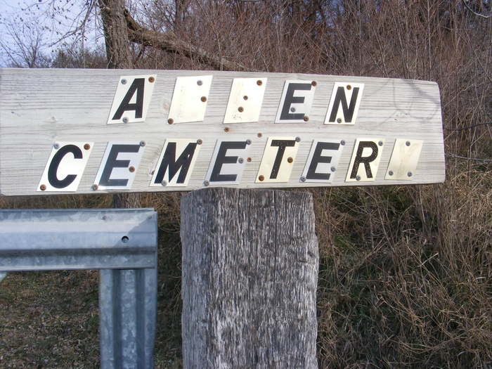
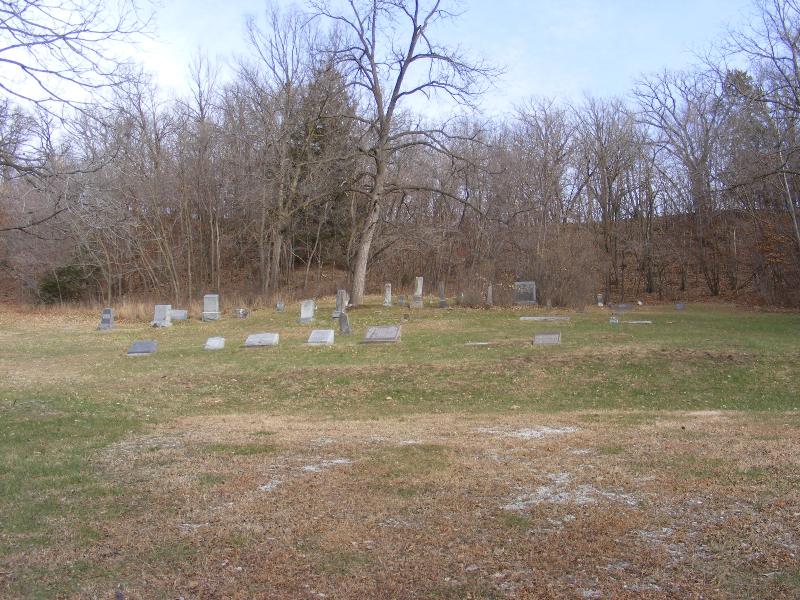
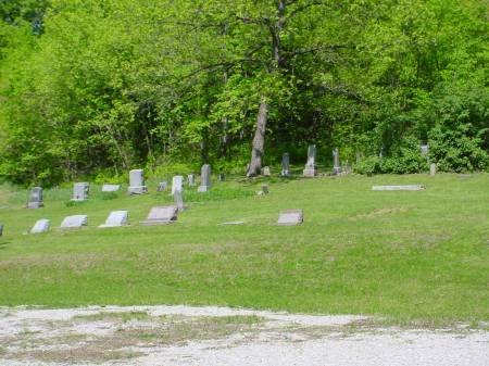
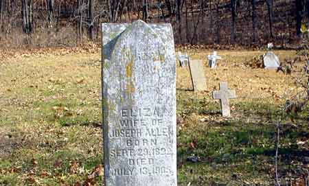
| Description | : | Allen Cemetery does not appear in the 1885 Atlas of Pottawattamie County, but by the burial dates for Joseph and Eliza Allen's children -- 1858, 1865 and 1868, it was in existence early on as probably a private cemetery. The land around the cemetery, in 1885, was owned by Joseph Allen, E. Allen, Agnes Allen and Jas. Allen. To get to Allen Cemetery, from Crescent, go north on Highway 183 (Old Lincoln Highway) to Sumac Road. Turn right on Sumac to 170th Street. At 170th St. turn left and go approximately 1/4 to 1/2 mile. The cemetery is on a... Read More |
frequently asked questions (FAQ):
-
Where is Allen Cemetery?
Allen Cemetery is located at Pottawattamie County ,Iowa ,USA.
-
Allen Cemetery cemetery's updated grave count on graveviews.com?
16 memorials
-
Where are the coordinates of the Allen Cemetery?
Latitude: 41.4427986
Longitude: -95.8550034

Nearby Cemetories:
1. Crook Cemetery
Honey Creek, Pottawattamie County, USA
Coordinate: 41.4581330, -95.8737000
2. Reels Cemetery
Crescent, Pottawattamie County, USA
Coordinate: 41.4234100, -95.8321700
3. Saint Bridgets Cemetery
Honey Creek, Pottawattamie County, USA
Coordinate: 41.4664001, -95.8289032
4. William C McIntosh Cemetery
Crescent, Pottawattamie County, USA
Coordinate: 41.4088745, -95.8477097
5. Grange Cemetery
Honey Creek, Pottawattamie County, USA
Coordinate: 41.4446678, -95.8034668
6. Branson Cemetery
Loveland, Pottawattamie County, USA
Coordinate: 41.4846992, -95.8606033
7. Saint Pauls Lutheran Cemetery
Neola, Pottawattamie County, USA
Coordinate: 41.4337000, -95.7607000
8. Oak Grove Cemetery
Missouri Valley, Harrison County, USA
Coordinate: 41.5167007, -95.8649979
9. Crescent Cemetery
Crescent, Pottawattamie County, USA
Coordinate: 41.3664894, -95.8566208
10. Hazel Dell Cemetery
Council Bluffs, Pottawattamie County, USA
Coordinate: 41.3489723, -95.7939911
11. Shipley Cemetery
Washington County, USA
Coordinate: 41.3932991, -95.9828033
12. Evans Cemetery
Crescent, Pottawattamie County, USA
Coordinate: 41.3255997, -95.8368988
13. Gregg Cemetery
Weston, Pottawattamie County, USA
Coordinate: 41.3330000, -95.7931000
14. Rose Hill Memorial Gardens
Missouri Valley, Harrison County, USA
Coordinate: 41.5656000, -95.8897000
15. Mount Carmel Cemetery
Missouri Valley, Harrison County, USA
Coordinate: 41.5675011, -95.8897018
16. Hurleys Evergreen Cemetery
Harrison County, USA
Coordinate: 41.5700989, -95.8618698
17. Castor Cemetery
Underwood, Pottawattamie County, USA
Coordinate: 41.4127040, -95.6887490
18. Saint Columbanus Cemetery
Weston, Pottawattamie County, USA
Coordinate: 41.3429440, -95.7435260
19. Fort Calhoun Cemetery
Fort Calhoun, Washington County, USA
Coordinate: 41.4581375, -96.0352020
20. Mormon Pioneer Cemetery
Omaha, Douglas County, USA
Coordinate: 41.3348450, -95.9663720
21. Champan Frazier Cemetery
Harrison County, USA
Coordinate: 41.5773500, -95.8933500
22. H G Fisher Cemetery
Underwood, Pottawattamie County, USA
Coordinate: 41.3838997, -95.6889038
23. Linnwood Cemetery
Harrison County, USA
Coordinate: 41.5589200, -95.7502100
24. Downsville Cemetery
Pottawattamie County, USA
Coordinate: 41.3502998, -95.7039032