
| Memorials | : | 1 |
| Location | : | Crescent, Pottawattamie County, USA |
| Coordinate | : | 41.4234100, -95.8321700 |
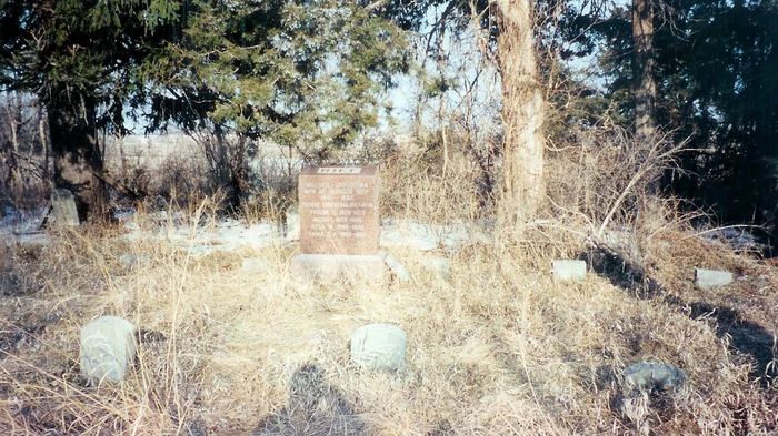
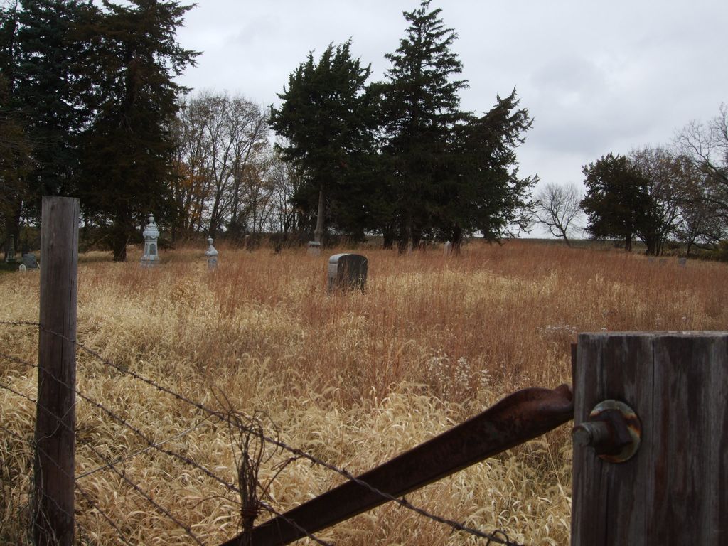
| Description | : | Reel Cemetery, remotely located some 7 miles (mostly south) of Missouri Valley, IA, and a few miles east of Honey Creek, IA. Land is owned by Dan Hanson, a farmer. Access can be granted by asking him at 1st farm south of the REEL CEMETERY sign or @ 712-545-3467. GPS ~ N41.42335 W095.83241 ~ Elev 1172' |
frequently asked questions (FAQ):
-
Where is Reels Cemetery?
Reels Cemetery is located at Crescent, Pottawattamie County ,Iowa ,USA.
-
Reels Cemetery cemetery's updated grave count on graveviews.com?
1 memorials
-
Where are the coordinates of the Reels Cemetery?
Latitude: 41.4234100
Longitude: -95.8321700


Nearby Cemetories:
1. William C McIntosh Cemetery
Crescent, Pottawattamie County, USA
Coordinate: 41.4088745, -95.8477097
2. Allen Cemetery
Pottawattamie County, USA
Coordinate: 41.4427986, -95.8550034
3. Grange Cemetery
Honey Creek, Pottawattamie County, USA
Coordinate: 41.4446678, -95.8034668
4. Saint Bridgets Cemetery
Honey Creek, Pottawattamie County, USA
Coordinate: 41.4664001, -95.8289032
5. Crook Cemetery
Honey Creek, Pottawattamie County, USA
Coordinate: 41.4581330, -95.8737000
6. Saint Pauls Lutheran Cemetery
Neola, Pottawattamie County, USA
Coordinate: 41.4337000, -95.7607000
7. Crescent Cemetery
Crescent, Pottawattamie County, USA
Coordinate: 41.3664894, -95.8566208
8. Branson Cemetery
Loveland, Pottawattamie County, USA
Coordinate: 41.4846992, -95.8606033
9. Hazel Dell Cemetery
Council Bluffs, Pottawattamie County, USA
Coordinate: 41.3489723, -95.7939911
10. Gregg Cemetery
Weston, Pottawattamie County, USA
Coordinate: 41.3330000, -95.7931000
11. Oak Grove Cemetery
Missouri Valley, Harrison County, USA
Coordinate: 41.5167007, -95.8649979
12. Evans Cemetery
Crescent, Pottawattamie County, USA
Coordinate: 41.3255997, -95.8368988
13. Saint Columbanus Cemetery
Weston, Pottawattamie County, USA
Coordinate: 41.3429440, -95.7435260
14. Castor Cemetery
Underwood, Pottawattamie County, USA
Coordinate: 41.4127040, -95.6887490
15. H G Fisher Cemetery
Underwood, Pottawattamie County, USA
Coordinate: 41.3838997, -95.6889038
16. Shipley Cemetery
Washington County, USA
Coordinate: 41.3932991, -95.9828033
17. Downsville Cemetery
Pottawattamie County, USA
Coordinate: 41.3502998, -95.7039032
18. Garner Cemetery
Council Bluffs, Pottawattamie County, USA
Coordinate: 41.2956161, -95.8001709
19. Mormon Pioneer Cemetery
Omaha, Douglas County, USA
Coordinate: 41.3348450, -95.9663720
20. Hurleys Evergreen Cemetery
Harrison County, USA
Coordinate: 41.5700989, -95.8618698
21. Rose Hill Memorial Gardens
Missouri Valley, Harrison County, USA
Coordinate: 41.5656000, -95.8897000
22. Linnwood Cemetery
Harrison County, USA
Coordinate: 41.5589200, -95.7502100
23. Green Valley Cemetery
Council Bluffs, Pottawattamie County, USA
Coordinate: 41.2743988, -95.8225021
24. Forest Lawn Memorial Park
Omaha, Douglas County, USA
Coordinate: 41.3272018, -95.9847031