
| Memorials | : | 0 |
| Location | : | Honey Creek, Pottawattamie County, USA |
| Coordinate | : | 41.4581330, -95.8737000 |
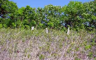
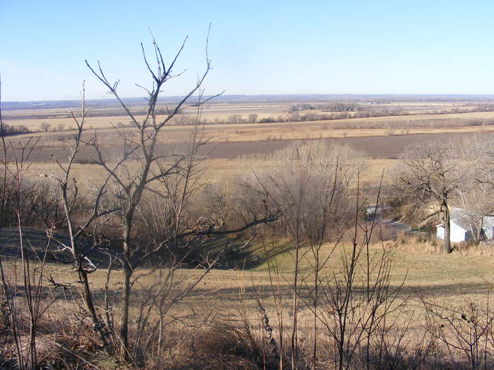
| Description | : | Crescent Township. It is an abandoned cemetery north of Honey Creek, Iowa on Spencer Mountain, on Old Lincoln Highway. |
frequently asked questions (FAQ):
-
Where is Crook Cemetery?
Crook Cemetery is located at Honey Creek, Pottawattamie County ,Iowa ,USA.
-
Crook Cemetery cemetery's updated grave count on graveviews.com?
0 memorials
-
Where are the coordinates of the Crook Cemetery?
Latitude: 41.4581330
Longitude: -95.8737000
Nearby Cemetories:
1. Allen Cemetery
Pottawattamie County, USA
Coordinate: 41.4427986, -95.8550034
2. Branson Cemetery
Loveland, Pottawattamie County, USA
Coordinate: 41.4846992, -95.8606033
3. Saint Bridgets Cemetery
Honey Creek, Pottawattamie County, USA
Coordinate: 41.4664001, -95.8289032
4. Reels Cemetery
Crescent, Pottawattamie County, USA
Coordinate: 41.4234100, -95.8321700
5. William C McIntosh Cemetery
Crescent, Pottawattamie County, USA
Coordinate: 41.4088745, -95.8477097
6. Grange Cemetery
Honey Creek, Pottawattamie County, USA
Coordinate: 41.4446678, -95.8034668
7. Oak Grove Cemetery
Missouri Valley, Harrison County, USA
Coordinate: 41.5167007, -95.8649979
8. Saint Pauls Lutheran Cemetery
Neola, Pottawattamie County, USA
Coordinate: 41.4337000, -95.7607000
9. Crescent Cemetery
Crescent, Pottawattamie County, USA
Coordinate: 41.3664894, -95.8566208
10. Shipley Cemetery
Washington County, USA
Coordinate: 41.3932991, -95.9828033
11. Rose Hill Memorial Gardens
Missouri Valley, Harrison County, USA
Coordinate: 41.5656000, -95.8897000
12. Mount Carmel Cemetery
Missouri Valley, Harrison County, USA
Coordinate: 41.5675011, -95.8897018
13. Hurleys Evergreen Cemetery
Harrison County, USA
Coordinate: 41.5700989, -95.8618698
14. Champan Frazier Cemetery
Harrison County, USA
Coordinate: 41.5773500, -95.8933500
15. Fort Calhoun Cemetery
Fort Calhoun, Washington County, USA
Coordinate: 41.4581375, -96.0352020
16. Hazel Dell Cemetery
Council Bluffs, Pottawattamie County, USA
Coordinate: 41.3489723, -95.7939911
17. Evans Cemetery
Crescent, Pottawattamie County, USA
Coordinate: 41.3255997, -95.8368988
18. Linnwood Cemetery
Harrison County, USA
Coordinate: 41.5589200, -95.7502100
19. Frazier Cemetery
Missouri Valley, Harrison County, USA
Coordinate: 41.5932999, -95.8375015
20. Gregg Cemetery
Weston, Pottawattamie County, USA
Coordinate: 41.3330000, -95.7931000
21. Mormon Pioneer Cemetery
Omaha, Douglas County, USA
Coordinate: 41.3348450, -95.9663720
22. Castor Cemetery
Underwood, Pottawattamie County, USA
Coordinate: 41.4127040, -95.6887490
23. Saint Columbanus Cemetery
Weston, Pottawattamie County, USA
Coordinate: 41.3429440, -95.7435260
24. Potter Field
Omaha, Douglas County, USA
Coordinate: 41.3320274, -95.9902878