


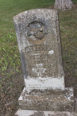
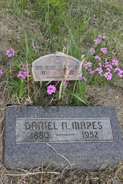
Daniel Mapes
| Birth | : | 1 Sep 1845 Illinois, USA |
| Death | : | 5 Feb 1904 Marshall County, Kansas, USA |
| Burial | : | Prairie City Cemetery, Prairie City, Grant County, USA |
| Coordinate | : | 44.4566994, -118.7027969 |
| Description | : | Mr. Mapes moved from IL to MO and escaped from Confederate raiders by being hid in a wagon load of apples. When Mr. Mapes was 18 he enlisted, Sept. 1862, in Company D, 12th Kansas Inf., serving 36 months. He enlisted at Paola, Kansas. This regiment was used to subdue the western and southwestern part of Missouri and they were on the march most of the time. They joined General Steele's Division from Little Rock and were at Camden, AR, March 1863 when attacked by the Confederates and again at Jenkins Ferry, AR on April... Read More |
frequently asked questions (FAQ):
-
Where is Daniel Mapes's memorial?
Daniel Mapes's memorial is located at: Prairie City Cemetery, Prairie City, Grant County, USA.
-
When did Daniel Mapes death?
Daniel Mapes death on 5 Feb 1904 in Marshall County, Kansas, USA
-
Where are the coordinates of the Daniel Mapes's memorial?
Latitude: 44.4566994
Longitude: -118.7027969
Family Members:
Parent
Spouse
Siblings

Children

Flowers:


Nearby Cemetories:
1. Prairie City Cemetery
Prairie City, Grant County, USA
Coordinate: 44.4566994, -118.7027969
2. McHaley Cemetery
Prairie City, Grant County, USA
Coordinate: 44.4618988, -118.7169037
3. Boot Hill Cemetery
Canyon City, Grant County, USA
Coordinate: 44.3927994, -118.9372025
4. Canyon City Cemetery
Canyon City, Grant County, USA
Coordinate: 44.3925018, -118.9403000
5. Saint Andrews Cemetery
Canyon City, Grant County, USA
Coordinate: 44.3913994, -118.9456024
6. Rest Lawn Cemetery
John Day, Grant County, USA
Coordinate: 44.4249992, -118.9617004
7. Galena Cemetery
Grant County, USA
Coordinate: 44.7083015, -118.8056030
8. Ingle Cemetery
Mount Vernon, Grant County, USA
Coordinate: 44.4091988, -119.0947037
9. Greenhorn Cemetery
Baker County, USA
Coordinate: 44.7071991, -118.4935989
10. Fletcher Cemetery
Mount Vernon, Grant County, USA
Coordinate: 44.4063988, -119.1085968
11. Hester A Lemons Grave
Mount Vernon, Grant County, USA
Coordinate: 44.4228060, -119.1501540
12. Unity Cemetery
Unity, Baker County, USA
Coordinate: 44.4592018, -118.2391968
13. Southworth Cemetery
Grant County, USA
Coordinate: 44.1885986, -118.9860992
14. Whitney Cemetery
Whitney, Baker County, USA
Coordinate: 44.6597000, -118.2810000
15. Fox Valley Cemetery
Grant County, USA
Coordinate: 44.6375008, -119.1513977
16. Long Creek Cemetery
Long Creek, Grant County, USA
Coordinate: 44.7172012, -119.0777969
17. Johnson Children Burials
Long Creek, Grant County, USA
Coordinate: 44.7131690, -119.1066030
18. Moon Creek Cemetery
Mount Vernon, Grant County, USA
Coordinate: 44.4291992, -119.2469025
19. Big Flat Cemetery
Baker County, USA
Coordinate: 44.5430984, -118.1624985
20. Granite Cemetery
Granite, Grant County, USA
Coordinate: 44.8108530, -118.4188440
21. Van Cleave Family Cemetery
Hereford, Baker County, USA
Coordinate: 44.4941700, -118.1021900
22. Kilbride Cemetery
Ritter, Grant County, USA
Coordinate: 44.8434200, -118.9918300
23. Fleetwood Cemetery
Baker County, USA
Coordinate: 44.5061700, -118.0714800
24. Cummings Cemetery
Mount Vernon, Grant County, USA
Coordinate: 44.4398000, -119.3452000