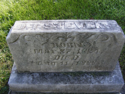
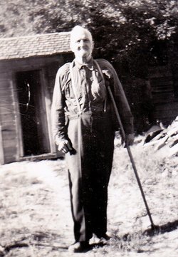
Delorma Theodore Stevens
| Birth | : | 27 Mar 1824 Brockville, Leeds and Grenville United Counties, Ontario, Canada |
| Death | : | 11 Aug 1888 Dayton, Columbia County, Washington, USA |
| Burial | : | Nobe Cemetery, Nobe, Calhoun County, USA |
| Coordinate | : | 38.9813000, -81.0380300 |
| Plot | : | BLK B, LOT 68, SEC 05 |
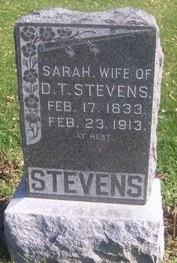
| Description | : | m: Sarah Anne Conger 30 May 1852 in Putnam Co, MO children: Eli Gafford, William Murry, Deltha Mae, Franklin Alexander and Rufus Miller Delorma Theodore Stevens went to Iowa from Canada to be with his brother Frederick in 1848. Delorma taught school at various times - South Exline in Iowa and later in Missouri. In the first few years in Iowa, before his marriage, he was doing well and in February 1851 advised those in Canada who did not own a farm not to purchase one there. "Farmers do not haft to work as hard here as they do... Read More |
frequently asked questions (FAQ):
-
Where is Delorma Theodore Stevens's memorial?
Delorma Theodore Stevens's memorial is located at: Nobe Cemetery, Nobe, Calhoun County, USA.
-
When did Delorma Theodore Stevens death?
Delorma Theodore Stevens death on 11 Aug 1888 in Dayton, Columbia County, Washington, USA
-
Where are the coordinates of the Delorma Theodore Stevens's memorial?
Latitude: 38.9813000
Longitude: -81.0380300
Family Members:
Parent
Spouse
Siblings
Children
Flowers:
Nearby Cemetories:
1. Nobe Cemetery
Nobe, Calhoun County, USA
Coordinate: 38.9813000, -81.0380300
2. Big Springs Cemetery
Big Springs, Calhoun County, USA
Coordinate: 38.9850006, -81.0708008
3. Trace Fork United Methodist Church Cemetery
Gilmer County, USA
Coordinate: 38.9743580, -81.0005560
4. Knight Cemetery
Big Springs, Calhoun County, USA
Coordinate: 38.9894000, -81.0800000
5. Pleasant Hill Cemetery
Grantsville, Calhoun County, USA
Coordinate: 38.9508018, -81.0627975
6. Broomstick Cemetery
Calhoun County, USA
Coordinate: 38.9668999, -81.0911026
7. Ayers Cemetery
Latonia, Gilmer County, USA
Coordinate: 38.9422222, -81.0058333
8. Fluharty Cemetery
Calhoun County, USA
Coordinate: 39.0147018, -81.0982971
9. Chestnut Grove Baptist Church Cemetery
Gilmer County, USA
Coordinate: 38.9340420, -80.9885860
10. Yoak Cemetery
Five Forks, Calhoun County, USA
Coordinate: 38.9703865, -81.1154938
11. Cloverleaf Cemetery
Calhoun County, USA
Coordinate: 39.0022011, -81.1121979
12. Gainer Cemetery
Calhoun County, USA
Coordinate: 39.0019900, -81.1126800
13. Fox Cemetery
Ritchie County, USA
Coordinate: 39.0271988, -81.0931015
14. Norman Ridge United Methodist Church Cemetery
Calhoun County, USA
Coordinate: 38.9687900, -81.1175100
15. Taylor Cemetery
Bigbend, Calhoun County, USA
Coordinate: 38.9801760, -81.1199320
16. Mount Liberty Cemetery
Tanner, Gilmer County, USA
Coordinate: 39.0086390, -80.9616440
17. Tanner Baptist Church Cemetery
Gilmer County, USA
Coordinate: 38.9814310, -80.9480630
18. Hunt Cemetery
Bigbend, Calhoun County, USA
Coordinate: 38.9573700, -81.1239100
19. Goff Cemetery
Burnt House, Ritchie County, USA
Coordinate: 39.0361530, -80.9774200
20. Good Shepherd Catholic Cemetery
Tanner, Gilmer County, USA
Coordinate: 38.9811830, -80.9447050
21. N.H. Frederick Cemetery
Burnt House, Ritchie County, USA
Coordinate: 39.0525520, -81.0169120
22. Three Poplar Cemetery
Glenville, Gilmer County, USA
Coordinate: 38.9628600, -80.9445500
23. Roseville Church Cemetery
Gilmer County, USA
Coordinate: 39.0207880, -80.9547600
24. Burnt House United Methodist Church Cemetery
Burnt House, Ritchie County, USA
Coordinate: 39.0487301, -80.9904470

