| Birth | : | 25 Dec 1886 Oostwold, Oldambt Municipality, Groningen, Netherlands |
| Death | : | 18 Jul 1973 Shell Rock, Butler County, Iowa, USA |
| Burial | : | Redhill Cemetery, Arnold, Nottingham Unitary Authority, England |
| Coordinate | : | 53.0066910, -1.1382950 |
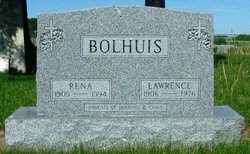
| Description | : | Mrs Fred Bolhuis, 86, Died Wednesday Funeral services were held on Saturday afternoon July 21st, at the Reformed Church of Stout with Rev. Peter Koenen of Aplington officiating. Interment was made in the Stout Cemetery under the direction of Engelkes Funeral Home of Parkersburg. Mrs Bernard Schnell was organist. Vocalist, Mrs Andy Nielsen, sang "What a Friend We Have In Jesus" and "God Will Take Care Of You." Casketbearers were Chris Bolhuis, Fred Bolhuis, Mervin Meyer, Garry Gersema, Fred Syhlman adn Eldon Myers. Mrs Dorothy Bolhuis, daughter of Jerry and Etta Nuis Boelman, was born on December 25, 1886 in the Netherlands.... Read More |
frequently asked questions (FAQ):
-
Where is Derktje “Dorothy” Boelman Bolhuis's memorial?
Derktje “Dorothy” Boelman Bolhuis's memorial is located at: Redhill Cemetery, Arnold, Nottingham Unitary Authority, England.
-
When did Derktje “Dorothy” Boelman Bolhuis death?
Derktje “Dorothy” Boelman Bolhuis death on 18 Jul 1973 in Shell Rock, Butler County, Iowa, USA
-
Where are the coordinates of the Derktje “Dorothy” Boelman Bolhuis's memorial?
Latitude: 53.0066910
Longitude: -1.1382950
Family Members:
Parent
Spouse
Siblings
Children
Flowers:
Nearby Cemetories:
1. Redhill Cemetery
Arnold, Nottingham Unitary Authority, England
Coordinate: 53.0066910, -1.1382950
2. St. John's Carrington Churchyard
Nottingham, Nottingham Unitary Authority, England
Coordinate: 52.9755350, -1.1506790
3. Basford Cemetery
Old Basford, Nottingham Unitary Authority, England
Coordinate: 52.9799700, -1.1725900
4. St. Leodegarius Churchyard
Old Basford, Nottingham Unitary Authority, England
Coordinate: 52.9794240, -1.1778650
5. Gedling Cemetery
Gedling, Gedling Borough, England
Coordinate: 52.9806930, -1.0870670
6. St. Paul's Churchyard
Nottingham Unitary Authority, England
Coordinate: 52.9667590, -1.1172140
7. Northern Cemetery
Bulwell, Nottingham Unitary Authority, England
Coordinate: 52.9979840, -1.2077900
8. Hucknall Cemetery
Hucknall, Ashfield District, England
Coordinate: 53.0293427, -1.1988190
9. Nottingham Church Cemetery
Nottingham, Nottingham Unitary Authority, England
Coordinate: 52.9649830, -1.1558070
10. All Hallows Churchyard
Gedling, Gedling Borough, England
Coordinate: 52.9769400, -1.0805130
11. Hardy Street Jewish Cemetery
Nottingham, Nottingham Unitary Authority, England
Coordinate: 52.9619500, -1.1665900
12. Carlton Cemetery
Nottingham, Nottingham Unitary Authority, England
Coordinate: 52.9682820, -1.0900230
13. St. Mary Rest Ground
Nottingham, Nottingham Unitary Authority, England
Coordinate: 52.9568310, -1.1406580
14. Nottingham General Cemetery
Nottingham, Nottingham Unitary Authority, England
Coordinate: 52.9575370, -1.1594236
15. Woodborough Cemetery
Woodborough, Gedling Borough, England
Coordinate: 53.0272840, -1.0600540
16. St. Mary Magdalene Churchyard
Hucknall, Ashfield District, England
Coordinate: 53.0390630, -1.2058330
17. General Cemetery
Nottingham, Nottingham Unitary Authority, England
Coordinate: 52.9561430, -1.1615420
18. St. Peter Churchyard Old Radford
Nottingham, Nottingham Unitary Authority, England
Coordinate: 52.9601830, -1.1789620
19. Cathedral Church of St. Barnabas
Nottingham, Nottingham Unitary Authority, England
Coordinate: 52.9546750, -1.1570460
20. National Ice Centre
Nottingham, Nottingham Unitary Authority, England
Coordinate: 52.9527790, -1.1394460
21. St Mary's Burial Grounds
Nottingham, Nottingham Unitary Authority, England
Coordinate: 52.9527860, -1.1419160
22. St Peters Church Yard
Nottingham, Nottingham Unitary Authority, England
Coordinate: 52.9522800, -1.1486940
23. National Justice Museum High Pavement Nottingham
Nottingham Unitary Authority, England
Coordinate: 52.9510680, -1.1443050
24. St Nicholas Churchyard
Nottingham, Nottingham Unitary Authority, England
Coordinate: 52.9504780, -1.1509220


