
| Birth | : | 5 Nov 1932 Milton-Freewater, Umatilla County, Oregon, USA |
| Death | : | 18 Nov 2012 |
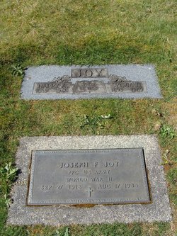
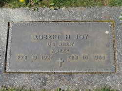
| Burial | : | Washington Lawn Cemetery, Centralia, Lewis County, USA |
| Coordinate | : | 46.7209320, -122.9606040 |
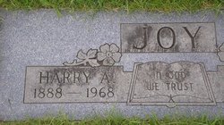
| Description | : | Donald Monroe Joy was born November 5, 1932, and died peacefully on November 18, 2012 at the home he shared with his youngest daughter, Angela, Josh and children. He was born, number 10 of 11 children and was raised with three brothers and five sisters. His parents followed the harvest, and he was born in Milton, Oregon. They later moved to Lowden, where he attended school for the 1st grade. He had walked to school from that home, and always thought it several miles away. Later, moving to Walla Walla, in 1966, he was very surprised to see the house... Read More |
frequently asked questions (FAQ):
-
Where is Donald Monroe Joy's memorial?
Donald Monroe Joy's memorial is located at: Washington Lawn Cemetery, Centralia, Lewis County, USA.
-
When did Donald Monroe Joy death?
Donald Monroe Joy death on 18 Nov 2012 in
-
Where are the coordinates of the Donald Monroe Joy's memorial?
Latitude: 46.7209320
Longitude: -122.9606040
Family Members:
Parent
Spouse

Siblings
Flowers:


Nearby Cemetories:
1. Washington Lawn Cemetery
Centralia, Lewis County, USA
Coordinate: 46.7209320, -122.9606040
2. Mountain View Cemetery
Centralia, Lewis County, USA
Coordinate: 46.7289009, -122.9843979
3. Pioneer Cemetery
Centralia, Lewis County, USA
Coordinate: 46.7290300, -122.9898100
4. Greenwood Memorial Park
Centralia, Lewis County, USA
Coordinate: 46.7372017, -122.9824982
5. Greenwood Cemetery
Chehalis, Lewis County, USA
Coordinate: 46.6511002, -122.9389038
6. Cogdil Family Cemetery
Thurston County, USA
Coordinate: 46.7747010, -122.8826590
7. Claquato Cemetery
Chehalis, Lewis County, USA
Coordinate: 46.6469002, -123.0216980
8. Fern Hill Cemetery
Chehalis, Lewis County, USA
Coordinate: 46.6366710, -122.9418560
9. Newaukum Hill Cemetery
Lewis County, USA
Coordinate: 46.6338980, -122.9768320
10. Grand Mound Cemetery
Rochester, Thurston County, USA
Coordinate: 46.8213997, -123.0199966
11. Forest Grove Cemetery
Tenino, Thurston County, USA
Coordinate: 46.8254580, -122.8497110
12. Lincoln Creek Cemetery
Galvin, Lewis County, USA
Coordinate: 46.7604700, -123.1446600
13. Pleasant Hill Cemetery
Bunker, Lewis County, USA
Coordinate: 46.6088840, -123.0863790
14. Napavine Cemetery
Napavine, Lewis County, USA
Coordinate: 46.5817000, -122.9039000
15. Deskins Family Cemetery
Chehalis, Lewis County, USA
Coordinate: 46.6878000, -122.7530000
16. Chehalis Tribal Cemetery
Thurston County, USA
Coordinate: 46.8068570, -123.1602260
17. Secena Cemetery
Oakville, Grays Harbor County, USA
Coordinate: 46.8061600, -123.1611900
18. Finn Hill Cemetery
Lewis County, USA
Coordinate: 46.7564011, -123.1919022
19. Mima Prairie Pioneer Cemetery
Mima, Thurston County, USA
Coordinate: 46.8724403, -123.0611649
20. Thurston County Poor Farm Cemetery
Littlerock, Thurston County, USA
Coordinate: 46.8861790, -123.0225100
21. Saint Urban Catholic Cemetery
Winlock, Lewis County, USA
Coordinate: 46.5177200, -122.8856500
22. Benn Cemetery
Oakville, Grays Harbor County, USA
Coordinate: 46.8303540, -123.2239950
23. Oakville Pioneer Cemetery
Oakville, Grays Harbor County, USA
Coordinate: 46.8318939, -123.2229996
24. Oakville Final Rest Memorial Cemetery
Oakville, Grays Harbor County, USA
Coordinate: 46.8323060, -123.2240030