
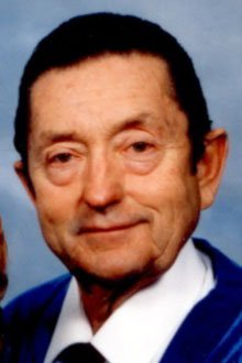

Donn Stanley Blackwell
| Birth | : | 2 Apr 1934 Chelan, Chelan County, Washington, USA |
| Death | : | 26 Oct 2011 Chelan, Chelan County, Washington, USA |
| Burial | : | Chelan Fraternal Cemetery, Chelan, Chelan County, USA |
| Coordinate | : | 47.8502998, -120.0081024 |
| Plot | : | South Fraternal Row 44 STBLK 44 LOT N6 |
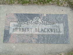
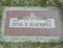
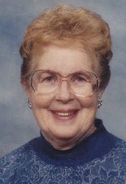
| Description | : | Donn Stanley Blackwell Chelan, WA Donn Stanley Blackwell, 77, a longtime resident of Chelan, WA, died October 26, 2011. He was born April 2, 1934, to Herb and Edna (Garrison) Blackwell of Chelan, WA. He attended schools and graduated from Chelan High School with the class of 1952. His interests included sports, excelling in baseball. He served with the U.S. Army from 1957 until 1959, stationed in Germany. Donn worked for Chelan County Highway Department for 25 years, in maintenance and snow plowing, retiring in 1989. He married Shirley Evans on February 2, 1980 in Manson, WA. He was a 45 year... Read More |
frequently asked questions (FAQ):
-
Where is Donn Stanley Blackwell's memorial?
Donn Stanley Blackwell's memorial is located at: Chelan Fraternal Cemetery, Chelan, Chelan County, USA.
-
When did Donn Stanley Blackwell death?
Donn Stanley Blackwell death on 26 Oct 2011 in Chelan, Chelan County, Washington, USA
-
Where are the coordinates of the Donn Stanley Blackwell's memorial?
Latitude: 47.8502998
Longitude: -120.0081024
Family Members:
Parent
Spouse

Flowers:


Nearby Cemetories:
1. Chelan Fraternal Cemetery
Chelan, Chelan County, USA
Coordinate: 47.8502998, -120.0081024
2. Mount Olivet Cemetery
Chelan, Chelan County, USA
Coordinate: 47.8451000, -119.9946000
3. Saint Andrews Episcopal Church
Chelan, Chelan County, USA
Coordinate: 47.8397460, -120.0183780
4. Riverview Cemetery
Chelan, Chelan County, USA
Coordinate: 47.8335991, -119.9944000
5. Manson Indian Cemetery
Manson, Chelan County, USA
Coordinate: 47.8800000, -120.1300000
6. Ballard Family Cemetery
Stayman, Chelan County, USA
Coordinate: 47.7811100, -120.1133300
7. Fletcher Cemetery
Douglas County, USA
Coordinate: 47.7430992, -119.9403000
8. Brays Landing Cemetery
Douglas County, USA
Coordinate: 47.7364120, -120.1704660
9. Kummer Cemetery
Waterville, Douglas County, USA
Coordinate: 47.6559000, -120.0332000
10. Packwood Memorial Cemetery
Dyer, Douglas County, USA
Coordinate: 48.0118305, -119.8178880
11. Dick Family Cemetery
Okanogan County, USA
Coordinate: 48.0502700, -119.9241700
12. Miller Family Cemetery
Okanogan County, USA
Coordinate: 48.0530300, -119.9288000
13. Pateros Cemetery
Pateros, Okanogan County, USA
Coordinate: 48.0516600, -119.9097300
14. Waterville Cemetery
Waterville, Douglas County, USA
Coordinate: 47.6418500, -120.0685940
15. Gate of Heaven Catholic Cemetery
Waterville, Douglas County, USA
Coordinate: 47.6382100, -120.0671690
16. Douglas Lutheran Cemetery
Douglas County, USA
Coordinate: 47.6189003, -119.9614029
17. Badger Mountain View Cemetery
Douglas County, USA
Coordinate: 47.6088000, -120.0476000
18. Mansfield Cemetery
Mansfield, Douglas County, USA
Coordinate: 47.8088880, -119.6508330
19. Orondo Community Cemetery
Orondo, Douglas County, USA
Coordinate: 47.6486015, -120.2136002
20. Buckingham Cemetery
Douglas County, USA
Coordinate: 47.8669014, -119.6286011
21. Happy Home Cemetery
Farmer, Douglas County, USA
Coordinate: 47.6268997, -119.8125000
22. Methow Cemetery
Methow, Okanogan County, USA
Coordinate: 48.1102982, -120.0124969
23. Entiat Cemetery
Entiat, Chelan County, USA
Coordinate: 47.6755981, -120.3043976
24. Bridgeport Cemetery
Bridgeport, Douglas County, USA
Coordinate: 48.0050000, -119.6738800