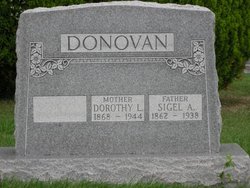
Dorothea Louise Muth Donovan
| Birth | : | 25 Mar 1868 Saint Marys, Auglaize County, Ohio, USA |
| Death | : | 27 Apr 1943 Lima, Allen County, Ohio, USA |
| Burial | : | Corbridge Cemetery, Corbridge, Northumberland Unitary Authority, England |
| Coordinate | : | 54.9693100, -2.0263500 |
| Description | : | According to her death certificate, Dorothea lived 75 years, 1 month and 2 days. Cause of death, diabetis millitus; contributory cause, hypertension cardimuscular, renal disease. Death notice in the Lima News, Lima, Ohio dated Wednesday, April 28, 1943 Mrs. Dorothea Louise Donovan, 75, died Tuesday afternoon at her home in Lima Route 4, after an illness of eight years. She had been a resident of Allen-co for 40 years and was a member of the Garden City Church. Surviving are three sons, Arthur, Melvin, and Carl, all of Lima Route 4; a daughter Mrs. Louetta Brunenhorst, at home; four grandchildren and six great... Read More |
frequently asked questions (FAQ):
-
Where is Dorothea Louise Muth Donovan's memorial?
Dorothea Louise Muth Donovan's memorial is located at: Corbridge Cemetery, Corbridge, Northumberland Unitary Authority, England.
-
When did Dorothea Louise Muth Donovan death?
Dorothea Louise Muth Donovan death on 27 Apr 1943 in Lima, Allen County, Ohio, USA
-
Where are the coordinates of the Dorothea Louise Muth Donovan's memorial?
Latitude: 54.9693100
Longitude: -2.0263500
Family Members:
Spouse
Children
Flowers:
Nearby Cemetories:
1. Corbridge Cemetery
Corbridge, Northumberland Unitary Authority, England
Coordinate: 54.9693100, -2.0263500
2. St Andrew's Churchyard
Corbridge, Northumberland Unitary Authority, England
Coordinate: 54.9745300, -2.0197400
3. Dilston Castle Chapelyard
Corbridge, Northumberland Unitary Authority, England
Coordinate: 54.9639270, -2.0393460
4. St Oswalds Churchyard
Halton, Northumberland Unitary Authority, England
Coordinate: 55.0050180, -2.0048830
5. Hexham Abbey
Hexham, Northumberland Unitary Authority, England
Coordinate: 54.9715940, -2.1026190
6. St Mary Roman Catholic Churchyard
Hexham, Northumberland Unitary Authority, England
Coordinate: 54.9697070, -2.1040520
7. St. John Lee of Beverley New Churchyard
Acomb, Northumberland Unitary Authority, England
Coordinate: 54.9861290, -2.1049280
8. St John Lee, St John of Beverley Old Churchyard
Hexham, Northumberland Unitary Authority, England
Coordinate: 54.9860620, -2.1056870
9. St John of Beverley Churchyard
Acomb, Northumberland Unitary Authority, England
Coordinate: 54.9859680, -2.1061560
10. St John's Churchyard
Healey, Northumberland Unitary Authority, England
Coordinate: 54.9200850, -1.9790940
11. Hexham Cemetery
Hexham, Northumberland Unitary Authority, England
Coordinate: 54.9788580, -2.1276740
12. St Andrew's Cemetery
Haydon Bridge, Northumberland Unitary Authority, England
Coordinate: 54.9788680, -2.1276850
13. St Andrew's Churchyard
Bywell, Northumberland Unitary Authority, England
Coordinate: 54.9482010, -1.9258340
14. St. Peter's Churchyard
Bywell, Northumberland Unitary Authority, England
Coordinate: 54.9476800, -1.9249700
15. Hindley and Broomley Churchyard
Broomley, Northumberland Unitary Authority, England
Coordinate: 54.9279100, -1.9339700
16. Holy Trinity Churchyard
Matfen, Northumberland Unitary Authority, England
Coordinate: 55.0403000, -1.9536100
17. St George's Churchyard
Mickley, Northumberland Unitary Authority, England
Coordinate: 54.9498300, -1.8831900
18. St Giles Churchyard
Chollerton, Northumberland Unitary Authority, England
Coordinate: 55.0414100, -2.1094900
19. St Peter's Churchyard
Humshaugh, Northumberland Unitary Authority, England
Coordinate: 55.0368780, -2.1264880
20. Saint Andrew’s Churchyard
Kiln Pit Hill, Northumberland Unitary Authority, England
Coordinate: 54.8916000, -1.9307000
21. Winnowshill Friends' Meeting House
Healey, Northumberland Unitary Authority, England
Coordinate: 54.8706180, -2.0084840
22. St. Mary's Roman Catholic Churchyard
Great Swinburne, Northumberland Unitary Authority, England
Coordinate: 55.0748020, -2.0998430
23. Church of Saint Mary
Blanchland, Northumberland Unitary Authority, England
Coordinate: 54.8484000, -2.0541000
24. St Bartholomew Churchyard
Kirkheaton, Northumberland Unitary Authority, England
Coordinate: 55.0902060, -1.9740250


