
| Memorials | : | 31 |
| Location | : | Blanchland, Northumberland Unitary Authority, England |
| Coordinate | : | 54.8484000, -2.0541000 |
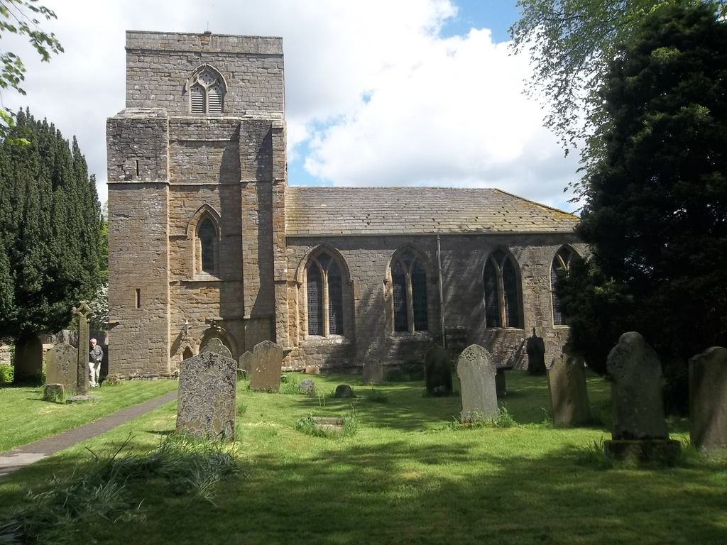
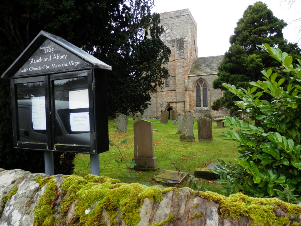
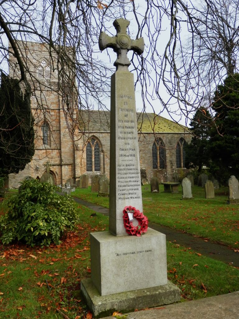
| Description | : | Also known as Blanchland Abbey or St Mary's Abbey, Blanchland. The church is usually open during daylight hours all year round, visitors are always welcome. Service times vary but there is usually one at 10.30am on the first and third Sundays of every month. The church is a grade 1 listed building containing a variety of remnants from the earlier abbey and from the 12th to the 19th centuries. |
frequently asked questions (FAQ):
-
Where is Church of Saint Mary?
Church of Saint Mary is located at Blanchland, Northumberland Unitary Authority ,Northumberland ,England.
-
Church of Saint Mary cemetery's updated grave count on graveviews.com?
31 memorials
-
Where are the coordinates of the Church of Saint Mary?
Latitude: 54.8484000
Longitude: -2.0541000
Nearby Cemetories:
1. St James Churchyard
Hunstanworth, Durham Unitary Authority, England
Coordinate: 54.8358650, -2.0807750
2. Winnowshill Friends' Meeting House
Healey, Northumberland Unitary Authority, England
Coordinate: 54.8706180, -2.0084840
3. St. Edmunds Churchyard
Edmundbyers, Durham Unitary Authority, England
Coordinate: 54.8440300, -1.9790400
4. All Saints Churchyard
Muggleswick, Durham Unitary Authority, England
Coordinate: 54.8442600, -1.9326700
5. Old Churchyard
Eastgate, Durham Unitary Authority, England
Coordinate: 54.7751710, -2.0933400
6. Rookhope Cemetery
Eastgate, Durham Unitary Authority, England
Coordinate: 54.7744000, -2.0916800
7. Saint Andrew’s Churchyard
Kiln Pit Hill, Northumberland Unitary Authority, England
Coordinate: 54.8916000, -1.9307000
8. St John's Churchyard
Healey, Northumberland Unitary Authority, England
Coordinate: 54.9200850, -1.9790940
9. St Matthew Churchyard
Consett, Durham Unitary Authority, England
Coordinate: 54.8040630, -1.9239040
10. Castleside Cemetery
Consett, Durham Unitary Authority, England
Coordinate: 54.8300800, -1.8834900
11. All Saints Churchyard
Eastgate, Durham Unitary Authority, England
Coordinate: 54.7445590, -2.0745270
12. Hindley and Broomley Churchyard
Broomley, Northumberland Unitary Authority, England
Coordinate: 54.9279100, -1.9339700
13. St Peter in the Forest
Allendale, Northumberland Unitary Authority, England
Coordinate: 54.8313100, -2.2350600
14. Moorside Cemetery
Consett, Durham Unitary Authority, England
Coordinate: 54.8409330, -1.8709330
15. Rowley Burial Ground
Consett, Durham Unitary Authority, England
Coordinate: 54.8262177, -1.8656499
16. Dilston Castle Chapelyard
Corbridge, Northumberland Unitary Authority, England
Coordinate: 54.9639270, -2.0393460
17. Blackhill Cemetery
Consett, Durham Unitary Authority, England
Coordinate: 54.8609100, -1.8451580
18. Corbridge Cemetery
Corbridge, Northumberland Unitary Authority, England
Coordinate: 54.9693100, -2.0263500
19. St. Peter's Churchyard
Bywell, Northumberland Unitary Authority, England
Coordinate: 54.9476800, -1.9249700
20. St Andrew's Churchyard
Bywell, Northumberland Unitary Authority, England
Coordinate: 54.9482010, -1.9258340
21. St Mary Roman Catholic Churchyard
Hexham, Northumberland Unitary Authority, England
Coordinate: 54.9697070, -2.1040520
22. St. Cuthbert's Churchyard
Allendale, Northumberland Unitary Authority, England
Coordinate: 54.8978260, -2.2545020
23. Hexham Abbey
Hexham, Northumberland Unitary Authority, England
Coordinate: 54.9715940, -2.1026190
24. Friends Meeting House
Allendale, Northumberland Unitary Authority, England
Coordinate: 54.8957750, -2.2598490