
| Birth | : | 23 Oct 1923 Versailles, Morgan County, Missouri, USA |
| Death | : | 11 Sep 1965 Kansas City, Platte County, Missouri, USA |
| Burial | : | East Slope Memorial Gardens, Riverside, Platte County, USA |
| Coordinate | : | 39.1859320, -94.6124980 |
| Inscription | : | Sergeant US Army World War II |
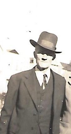
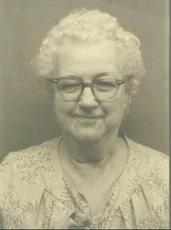
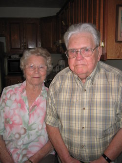
| Description | : | Dorsey E. Troutman was born October 23, 1923 in Versailles, Missouri to Grace (Bales) and Charles Troutman. He married Mabel (Fulmer) Teddleton on June 6, 1953. He was a truckdriver for Builders Steel in North Kansas City. He was a member of the Parkville Rough Riders. He was a World War II veteran. Survivors include his wife, Mabel Troutman; two sons, Dorsey Troutman and Randall Troutman; two daughters, Deborah Troutman and Lisa Troutman and a stepdaughter, Janice Teddleton, all of the home; a stepson, A. L. Teddleton (Bonnie) Platte City, MO; stepgranddaughter, Denice; two brothers, Francis... Read More |
frequently asked questions (FAQ):
-
Where is Dorsey E Troutman's memorial?
Dorsey E Troutman's memorial is located at: East Slope Memorial Gardens, Riverside, Platte County, USA.
-
When did Dorsey E Troutman death?
Dorsey E Troutman death on 11 Sep 1965 in Kansas City, Platte County, Missouri, USA
-
Where are the coordinates of the Dorsey E Troutman's memorial?
Latitude: 39.1859320
Longitude: -94.6124980
Family Members:
Parent
Spouse
Siblings
Children

Flowers:


Nearby Cemetories:
1. East Slope Memorial Gardens
Riverside, Platte County, USA
Coordinate: 39.1859320, -94.6124980
2. Saint Matthew's Cemetery
Riverside, Platte County, USA
Coordinate: 39.1861153, -94.6130142
3. John and Elizabeth Brenner Memorial Cemetery
Riverside, Platte County, USA
Coordinate: 39.1819801, -94.6135178
4. Old German Cemetery
Kansas City, Clay County, USA
Coordinate: 39.1885300, -94.6010100
5. Deister Cemetery
Kansas City, Platte County, USA
Coordinate: 39.1959400, -94.6439300
6. North Cross Methodist Church Memorial Garden
Kansas City, Clay County, USA
Coordinate: 39.1806410, -94.5635200
7. Antioch Community Church Columbarium
Kansas City, Clay County, USA
Coordinate: 39.1813695, -94.5483659
8. Line Creek Cemetery
Platte Woods, Platte County, USA
Coordinate: 39.2225990, -94.6584015
9. Church of the Redeemer
Kansas City, Platte County, USA
Coordinate: 39.2248800, -94.6603600
10. Faubion Cemetery
Gladstone, Clay County, USA
Coordinate: 39.2246017, -94.5617981
11. Walnut Grove Cemetery
Parkville, Platte County, USA
Coordinate: 39.2022018, -94.6815033
12. Church of the Good Shepherd Episcopal Columbarium
Kansas City, Clay County, USA
Coordinate: 39.1852600, -94.5399800
13. Old Parkville Cemetery
Parkville, Platte County, USA
Coordinate: 39.2004900, -94.6828000
14. Ricketts Cemetery
Kansas City, Clay County, USA
Coordinate: 39.1638718, -94.5430145
15. Starks Cemetery
Clay County, USA
Coordinate: 39.2150210, -94.5464510
16. Barry Cemetery
Barry, Clay County, USA
Coordinate: 39.2444000, -94.5963974
17. White Chapel Memorial Gardens
Gladstone, Clay County, USA
Coordinate: 39.2111015, -94.5372009
18. Gash Cemetery
Gashland, Clay County, USA
Coordinate: 39.2467613, -94.5848846
19. New Stark Cemetery
Gladstone, Clay County, USA
Coordinate: 39.2056007, -94.5291977
20. Big Shoal Cemetery
Gladstone, Clay County, USA
Coordinate: 39.2098503, -94.5307312
21. Wilsons Cemetery
Barry, Clay County, USA
Coordinate: 39.2528800, -94.5982800
22. Old Hoy Cemetery
Kansas City, Platte County, USA
Coordinate: 39.2210800, -94.6901600
23. Fountain Waller Cemetery
Gladstone, Clay County, USA
Coordinate: 39.2078700, -94.5258500
24. Craig Cemetery
Clay County, USA
Coordinate: 39.2477112, -94.5638733