
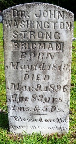
Dr John Washington Strong Brigman
| Birth | : | 14 May 1813 South Carolina, USA |
| Death | : | 9 Mar 1896 |
| Burial | : | Runnymede Memorial, Englefield Green, Runnymede Borough, England |
| Coordinate | : | 51.4378433, -0.5649990 |
frequently asked questions (FAQ):
-
Where is Dr John Washington Strong Brigman's memorial?
Dr John Washington Strong Brigman's memorial is located at: Runnymede Memorial, Englefield Green, Runnymede Borough, England.
-
When did Dr John Washington Strong Brigman death?
Dr John Washington Strong Brigman death on 9 Mar 1896 in
-
Where are the coordinates of the Dr John Washington Strong Brigman's memorial?
Latitude: 51.4378433
Longitude: -0.5649990
Family Members:
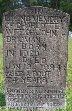
Spouse
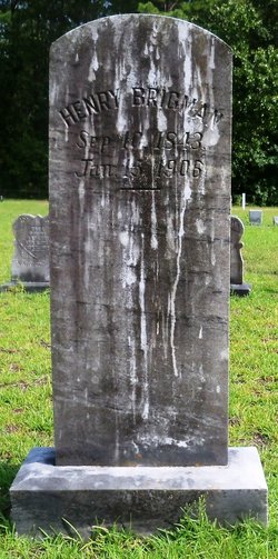
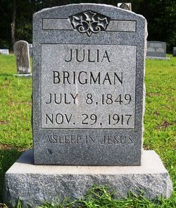
Children


Nearby Cemetories:
1. Runnymede Memorial
Englefield Green, Runnymede Borough, England
Coordinate: 51.4378433, -0.5649990
2. Englefield Green Cemetery
Englefield Green, Runnymede Borough, England
Coordinate: 51.4273640, -0.5730490
3. St. John the Baptist Churchyard
Egham, Runnymede Borough, England
Coordinate: 51.4327120, -0.5443380
4. Saint Andrew's Churchyard
Wraysbury, Windsor and Maidenhead Royal Borough, England
Coordinate: 51.4558200, -0.5600900
5. St. Peter and St. Andrew Churchyard
Old Windsor, Windsor and Maidenhead Royal Borough, England
Coordinate: 51.4621120, -0.5727310
6. Church Road Cemetery
Old Windsor, Windsor and Maidenhead Royal Borough, England
Coordinate: 51.4622500, -0.5805900
7. St. Mary's Churchyard
Staines, Spelthorne Borough, England
Coordinate: 51.4365400, -0.5191540
8. Christ Church Churchyard
Virginia Water, Runnymede Borough, England
Coordinate: 51.4073160, -0.5796440
9. St Marys Churchyard
Thorpe, Runnymede Borough, England
Coordinate: 51.4075720, -0.5293820
10. St Michael's Churchyard
Horton, Aylesbury Vale District, England
Coordinate: 51.4725400, -0.5402620
11. St Michael Churchyard
Horton, Windsor and Maidenhead Royal Borough, England
Coordinate: 51.4728500, -0.5403800
12. Royal Burial Ground
Windsor, Windsor and Maidenhead Royal Borough, England
Coordinate: 51.4740562, -0.5986640
13. Adelaide Cottage
Windsor, Windsor and Maidenhead Royal Borough, England
Coordinate: 51.4790700, -0.5903400
14. Datchet Parish Council Cemetery
Datchet, Windsor and Maidenhead Royal Borough, England
Coordinate: 51.4836530, -0.5657230
15. St. Mary the Virgin Churchyard
Datchet, Windsor and Maidenhead Royal Borough, England
Coordinate: 51.4843260, -0.5782760
16. London Road Cemetery
Staines, Spelthorne Borough, England
Coordinate: 51.4380000, -0.4889100
17. Windsor Cemetery
Windsor, Windsor and Maidenhead Royal Borough, England
Coordinate: 51.4703170, -0.6231090
18. Slopes of Windsor
Windsor, Windsor and Maidenhead Royal Borough, England
Coordinate: 51.4850000, -0.5950000
19. St John the Baptist Churchyard
Windsor, Windsor and Maidenhead Royal Borough, England
Coordinate: 51.4786250, -0.6136450
20. Stanwell Cemetery
Stanwell, Spelthorne Borough, England
Coordinate: 51.4523640, -0.4840770
21. Albert Memorial Chapel
Windsor, Windsor and Maidenhead Royal Borough, England
Coordinate: 51.4837180, -0.6061340
22. St. George's Chapel
Windsor, Windsor and Maidenhead Royal Borough, England
Coordinate: 51.4835910, -0.6068820
23. Saint Thomas Churchyard
Colnbrook, Slough Borough, England
Coordinate: 51.4845890, -0.5219910
24. All Saints Churchyard
Laleham, Spelthorne Borough, England
Coordinate: 51.4091880, -0.4898680