
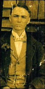
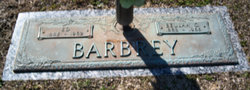
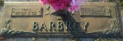
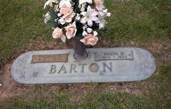
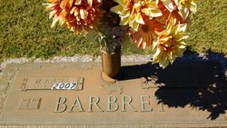
Ed Barbrey
| Birth | : | 12 Sep 1885 Simpsonville, Greenville County, South Carolina, USA |
| Death | : | 23 Jan 1962 Fountain Inn, Greenville County, South Carolina, USA |
| Burial | : | Radcliffe Cemetery, Radcliffe, Metropolitan Borough of Bury, England |
| Coordinate | : | 53.5706240, -2.3294860 |
frequently asked questions (FAQ):
-
Where is Ed Barbrey's memorial?
Ed Barbrey's memorial is located at: Radcliffe Cemetery, Radcliffe, Metropolitan Borough of Bury, England.
-
When did Ed Barbrey death?
Ed Barbrey death on 23 Jan 1962 in Fountain Inn, Greenville County, South Carolina, USA
-
Where are the coordinates of the Ed Barbrey's memorial?
Latitude: 53.5706240
Longitude: -2.3294860
Family Members:
Parent

Spouse
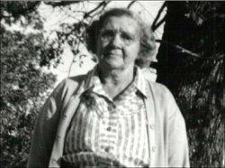
Siblings
Children
Flowers:


Nearby Cemetories:
1. Radcliffe Cemetery
Radcliffe, Metropolitan Borough of Bury, England
Coordinate: 53.5706240, -2.3294860
2. East Lancashire Crematorium
Radcliffe, Metropolitan Borough of Bury, England
Coordinate: 53.5726893, -2.3273050
3. St. Andrew's Churchyard
Radcliffe, Metropolitan Borough of Bury, England
Coordinate: 53.5740731, -2.3377989
4. St. Thomas & St. John with St. Philip Churchyard
Radcliffe, Metropolitan Borough of Bury, England
Coordinate: 53.5625140, -2.3266770
5. St. Mary's Churchyard
Radcliffe, Metropolitan Borough of Bury, England
Coordinate: 53.5644410, -2.3081470
6. St. John Parish Churchyard
Radcliffe, Metropolitan Borough of Bury, England
Coordinate: 53.5571400, -2.3206700
7. New Jerusalem Church Burial
Radcliffe, Metropolitan Borough of Bury, England
Coordinate: 53.5542680, -2.3174070
8. Wellington Barracks Memorial Garden
Bury, Metropolitan Borough of Bury, England
Coordinate: 53.5882208, -2.3210890
9. Stand United Reformed Church Burial Ground
Radcliffe, Metropolitan Borough of Bury, England
Coordinate: 53.5512300, -2.3140600
10. St Paul Churchyard
Bury, Metropolitan Borough of Bury, England
Coordinate: 53.5789815, -2.2925926
11. Christ Church Churchyard
Ainsworth, Metropolitan Borough of Bury, England
Coordinate: 53.5875690, -2.3589540
12. Bury Cemetery
Bury, Metropolitan Borough of Bury, England
Coordinate: 53.5794850, -2.2904870
13. Ainsworth Unitarian Chapel Cemetery
Metropolitan Borough of Bury, England
Coordinate: 53.5882700, -2.3590390
14. Christ Church Churchyard
Little Lever, Metropolitan Borough of Bolton, England
Coordinate: 53.5598101, -2.3692188
15. Ainsworth Methodist Churchyard
Ainsworth, Metropolitan Borough of Bury, England
Coordinate: 53.5877390, -2.3623810
16. King's Church Chapelyard
Little Lever, Metropolitan Borough of Bolton, England
Coordinate: 53.5625122, -2.3716833
17. St. Matthew Churchyard
Little Lever, Metropolitan Borough of Bolton, England
Coordinate: 53.5626144, -2.3732190
18. All Saints Churchyard Stand
Whitefield, Metropolitan Borough of Bury, England
Coordinate: 53.5501180, -2.2985570
19. All Saints Churchyard
Elton, Metropolitan Borough of Bury, England
Coordinate: 53.5965000, -2.3118000
20. St. James Churchyard
Bury, Metropolitan Borough of Bury, England
Coordinate: 53.5996770, -2.3214600
21. St Saviour churchyard
Ringley, Metropolitan Borough of Bolton, England
Coordinate: 53.5439030, -2.3576830
22. St Georges Churchyard
Unsworth, Metropolitan Borough of Bury, England
Coordinate: 53.5668741, -2.2745340
23. Unsworth Weslyan Methodist Churchyard
Bury, Metropolitan Borough of Bury, England
Coordinate: 53.5667900, -2.2745100
24. St John's Churchyard
Bury, Metropolitan Borough of Bury, England
Coordinate: 53.5954900, -2.2910100