
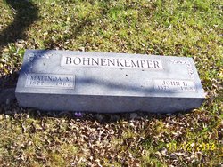
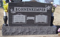
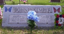
| Birth | : | 27 Oct 1905 Kansas, USA |
| Death | : | 8 Oct 1914 Brown County, Kansas, USA |
| Burial | : | All Saints Churchyard, Moulton, South Holland District, England |
| Coordinate | : | 52.7990056, -0.0629691 |
| Description | : | Edna's death, sadly, resulted from complications after she was kicked in the head by a horse. April 15, 1910 Census. BOHNEUKEMPER Mission Twp., Brown Co., KS. J. H., Head, 37, b.IN, parents b.Germany. Maliada, Wife, 32, b.IN, parents b.Germany. Edna, Dau, 4, b.KS, Lebla, Dau, 2, b.KS, Mable, Dau, 0, b.KS. |
frequently asked questions (FAQ):
-
Where is Edna C. Bohnenkemper's memorial?
Edna C. Bohnenkemper's memorial is located at: All Saints Churchyard, Moulton, South Holland District, England.
-
When did Edna C. Bohnenkemper death?
Edna C. Bohnenkemper death on 8 Oct 1914 in Brown County, Kansas, USA
-
Where are the coordinates of the Edna C. Bohnenkemper's memorial?
Latitude: 52.7990056
Longitude: -0.0629691
Family Members:
Parent

Siblings


Flowers:


Nearby Cemetories:
1. All Saints Churchyard
Moulton, South Holland District, England
Coordinate: 52.7990056, -0.0629691
2. Moulton Cemetery
Moulton, South Holland District, England
Coordinate: 52.8017000, -0.0632400
3. St. Mary's Cemetery
Weston, South Holland District, England
Coordinate: 52.8078662, -0.0809039
4. St. Mary's Churchyard
Whaplode, South Holland District, England
Coordinate: 52.7974840, -0.0385520
5. Whaplode Cemetery
Whaplode, South Holland District, England
Coordinate: 52.8016190, -0.0281347
6. St Paul's Churchyard
Spalding, South Holland District, England
Coordinate: 52.7969559, -0.1305557
7. All Saints Churchyard
Holbeach, South Holland District, England
Coordinate: 52.8036140, 0.0142530
8. Holbeach Cemetery
Holbeach, South Holland District, England
Coordinate: 52.8062100, 0.0171500
9. Spalding Cemetery
Spalding, South Holland District, England
Coordinate: 52.7954960, -0.1519390
10. St. Mary's Churchyard
Pinchbeck, South Holland District, England
Coordinate: 52.8135340, -0.1589220
11. Surfleet Cemetery
Surfleet, South Holland District, England
Coordinate: 52.8391670, -0.1383330
12. St. Laurence Churchyard
Surfleet, South Holland District, England
Coordinate: 52.8369500, -0.1436110
13. St. John's Churchyard
Holbeach, South Holland District, England
Coordinate: 52.7457510, -0.0024000
14. South Lincolnshire Crematorium
Surfleet, South Holland District, England
Coordinate: 52.8451100, -0.1475110
15. St. Mary Magdalene Churchyard
Fleet, South Holland District, England
Coordinate: 52.7928490, 0.0582900
16. St. Luke's Churchyard
Holbeach Hurn, South Holland District, England
Coordinate: 52.8231700, 0.0653600
17. Fosdyke Village Cemetery
Fosdyke, Boston Borough, England
Coordinate: 52.8808330, -0.0447220
18. All Saints Churchyard
Fosdyke, Boston Borough, England
Coordinate: 52.8811100, -0.0469440
19. Gosberton Baptist Church
Gosberton, South Holland District, England
Coordinate: 52.8651820, -0.1533940
20. St Mary Magdalene Churchyard
Gedney, South Holland District, England
Coordinate: 52.7984900, 0.0791600
21. Gosberton Cemetery
Gosberton, South Holland District, England
Coordinate: 52.8659400, -0.1623000
22. St. Peter and St. Paul Churchyard
Gosberton, South Holland District, England
Coordinate: 52.8690870, -0.1629740
23. St. John the Baptist Churchyard
Whaplode Drove, South Holland District, England
Coordinate: 52.7034435, -0.0476688
24. St Bartholomew's Church West Pinchbeck
Pinchbeck, South Holland District, England
Coordinate: 52.8080873, -0.2216285