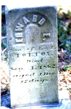
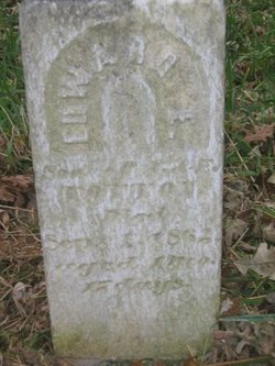
Edward E. Totton
| Birth | : | 15 Jul 1862 Mahaska County, Iowa, USA |
| Death | : | 1 Sep 1862 Mahaska County, Iowa, USA |
| Burial | : | Aramoho Cemetery, Whanganui, Whanganui District, New Zealand |
| Coordinate | : | -39.8926494, 175.0922441 |
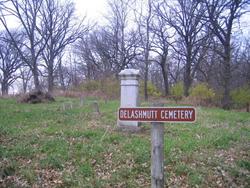
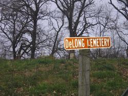
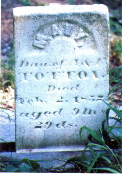
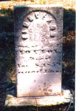
| Description | : | "Died age 1m 17d. Son of A and E Totton" Born in Scott Township, Mahaska Co., Iowa and buried in the DeLong-Delashmutt Pioneer Cemetery in Garfield Township, Mahaska County, Iowa were 3 Totton infants and their young paternal uncle: Mary (1856-1857), Georgeana/Georgeann (1859-1859), Edward E.(1862-1862), and Milton (1833-1858)-brother of the babies' father William Albert Totton. Elizabeth Bradford & William Albert Totton were married 22 June 1848 in Oxford, Butler Co., Ohio. In the 1850's they left for the unknown in Iowa and by 1870 they had moved on to Jasper County, Iowa and forever left behind these 4 loved ones. They were... Read More |
frequently asked questions (FAQ):
-
Where is Edward E. Totton's memorial?
Edward E. Totton's memorial is located at: Aramoho Cemetery, Whanganui, Whanganui District, New Zealand.
-
When did Edward E. Totton death?
Edward E. Totton death on 1 Sep 1862 in Mahaska County, Iowa, USA
-
Where are the coordinates of the Edward E. Totton's memorial?
Latitude: -39.8926494
Longitude: 175.0922441
Family Members:
Parent
Siblings
Flowers:
Nearby Cemetories:
1. Aramoho Cemetery
Whanganui, Whanganui District, New Zealand
Coordinate: -39.8926494, 175.0922441
2. St. Mary's Anglican Church Cemetery
Upokongaro, Whanganui District, New Zealand
Coordinate: -39.8656100, 175.1132820
3. Heads Road Cemetery
Whanganui, Whanganui District, New Zealand
Coordinate: -39.9393300, 175.0473400
4. Putiki Urupā
Whanganui District, New Zealand
Coordinate: -39.9466140, 175.0499350
5. Matarawa Presbyterian Cemetery
Whanganui, Whanganui District, New Zealand
Coordinate: -39.9461300, 175.1433100
6. Matarawa Cemetery
Fordell, Whanganui District, New Zealand
Coordinate: -39.9468100, 175.1452700
7. Brunswick Cemetery
Brunswick, Whanganui District, New Zealand
Coordinate: -39.8417750, 175.0216400
8. Papanui Urupā
Kai Iwi, Whanganui District, New Zealand
Coordinate: -39.8435190, 174.9216230
9. Kauangaroa Pa Cemetery
Kauangaroa, Whanganui District, New Zealand
Coordinate: -39.9231800, 175.2788000
10. Ratana Cemetery
Ratana, Rangitikei District, New Zealand
Coordinate: -40.0311470, 175.1771200
11. Turakina Cemetery
Turakina, Rangitikei District, New Zealand
Coordinate: -40.0461300, 175.2140160
12. Turakina Catholic Cemetery
Turakina, Rangitikei District, New Zealand
Coordinate: -40.0453000, 175.2239600
13. Te Mangungu Churchyard
Turakina, Rangitikei District, New Zealand
Coordinate: -40.0633110, 175.1818200
14. Maxwell Cemetery
Whanganui, Whanganui District, New Zealand
Coordinate: -39.8224020, 174.8530960
15. Grant Family Makirikiri Cemetery
Turakina, Rangitikei District, New Zealand
Coordinate: -40.0625400, 175.2258200
16. Pakaraka Māori Cemetery
Maxwell, Whanganui District, New Zealand
Coordinate: -39.8226300, 174.8460700
17. Marshall Family Cemetery
Matahiwi, Whanganui District, New Zealand
Coordinate: -39.6757200, 175.1595964
18. Bonny Glen Cemetery
Marton, Rangitikei District, New Zealand
Coordinate: -40.0496200, 175.3410200
19. Upper Tutaenui Cemetery
Marton, Rangitikei District, New Zealand
Coordinate: -40.0086900, 175.4093900
20. Marton Lutheran Cemetery Tutaenui
Marton, Rangitikei District, New Zealand
Coordinate: -40.0772400, 175.3692700
21. St Stephens Anglican Cemetery
Marton, Rangitikei District, New Zealand
Coordinate: -40.0618230, 175.4258020
22. Mount View Cemetery
Marton, Rangitikei District, New Zealand
Coordinate: -40.0631570, 175.4252250
23. St John's Anglican Church Cemetery
Marton, Rangitikei District, New Zealand
Coordinate: -40.0298860, 175.4759430
24. Jerusalem - Hiruhārama Urupā
Jerusalem, Whanganui District, New Zealand
Coordinate: -39.5521740, 175.0788340

