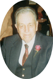
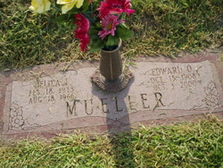
Edward Otto Mueller
| Birth | : | 15 Oct 1908 Platte County, Nebraska, USA |
| Death | : | 3 Oct 2000 Genoa, Nance County, Nebraska, USA |
| Burial | : | First Presbyterian Church of Lancaster Columbarium, Lancaster, Lancaster County, USA |
| Coordinate | : | 34.7278800, -80.7756800 |
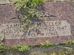
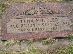
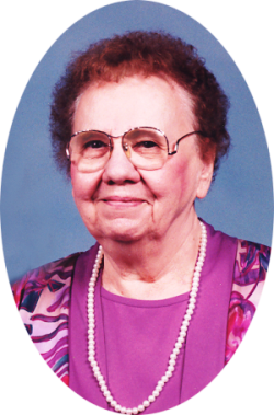
| Description | : | Son of Samuel T. & Lena (Egger) Mueller. He attended District 3 school. He married Delila Miller on August 16, 1933 in Columbus, Nebraska. Delila preceded him in death on August 18, 1966. Edward married Martha (Lutjelusche) Muhle on May 10, 1969 in Lincoln, Nebraska. Edward was a lifelong farmer in the Oconee area. He semi-retired in 1969 and moved to Columbus. He was a member of St. Luke's United Church of Christ and was a past president of the church council. He served on the Oconee District 25 School Board for 20 years and the Oconee Township Election Board. He... Read More |
frequently asked questions (FAQ):
-
Where is Edward Otto Mueller's memorial?
Edward Otto Mueller's memorial is located at: First Presbyterian Church of Lancaster Columbarium, Lancaster, Lancaster County, USA.
-
When did Edward Otto Mueller death?
Edward Otto Mueller death on 3 Oct 2000 in Genoa, Nance County, Nebraska, USA
-
Where are the coordinates of the Edward Otto Mueller's memorial?
Latitude: 34.7278800
Longitude: -80.7756800
Family Members:
Parent
Spouse
Siblings
Flowers:
Nearby Cemetories:
1. First Presbyterian Church of Lancaster Columbarium
Lancaster, Lancaster County, USA
Coordinate: 34.7278800, -80.7756800
2. Witherspoon Cemetery
Lancaster, Lancaster County, USA
Coordinate: 34.7229170, -80.7768560
3. West Side Cemetery
Lancaster, Lancaster County, USA
Coordinate: 34.7216988, -80.7774963
4. Clinton Memorial Cemetery
Lancaster, Lancaster County, USA
Coordinate: 34.7268982, -80.7671967
5. Saint Paul Methodist Cemetery
Lancaster, Lancaster County, USA
Coordinate: 34.7231800, -80.7654770
6. Olde Presbyterian Church Cemetery
Lancaster, Lancaster County, USA
Coordinate: 34.7168999, -80.7735977
7. Christ Episcopal Church Cemetery
Lancaster, Lancaster County, USA
Coordinate: 34.7245950, -80.7988530
8. Lancaster Memorial Park
Lancaster, Lancaster County, USA
Coordinate: 34.7016983, -80.7944031
9. Mahaffey Hill Baptist Church
Lancaster County, USA
Coordinate: 34.7108510, -80.8066430
10. County Home Cemetery
Lancaster, Lancaster County, USA
Coordinate: 34.7232400, -80.7258500
11. Saint John Baptist Church Cemetery
Lancaster, Lancaster County, USA
Coordinate: 34.7655400, -80.7978600
12. Taylors Grove Baptist Church
Lancaster, Lancaster County, USA
Coordinate: 34.7714340, -80.7880710
13. Centenniel A.M.E. Zion Church Cemetery
Lancaster, Lancaster County, USA
Coordinate: 34.7082970, -80.7257430
14. Fellowship Bible Church
Lancaster, Lancaster County, USA
Coordinate: 34.6914920, -80.7422720
15. Shiloh ARP Church Cemetery
Lancaster, Lancaster County, USA
Coordinate: 34.7745080, -80.7818700
16. Deliverance Church of God in Jesus Christ
Lancaster County, USA
Coordinate: 34.7754480, -80.7677200
17. Mount Tabor AME Zion Church Cemetery
Lancaster County, USA
Coordinate: 34.7772250, -80.7721730
18. Mount Nebo Baptist Church Cemetery
Grace, Lancaster County, USA
Coordinate: 34.7170460, -80.8385550
19. Zion United Methodist Church Cemetery
Lancaster, Lancaster County, USA
Coordinate: 34.7734060, -80.7377770
20. Gills Creek Cemetery
Lancaster County, USA
Coordinate: 34.7300000, -80.7047000
21. David Stand AME Zion Church Cemetery
Riverside, Lancaster County, USA
Coordinate: 34.7592850, -80.8430370
22. Red Hill Baptist Church Cemetery
Lancaster County, USA
Coordinate: 34.6727330, -80.8162540
23. Rose Memorial Cemetery
Lancaster County, USA
Coordinate: 34.6645570, -80.7989200
24. Mount Moriah AME Zion Church Cemetery
Lancaster County, USA
Coordinate: 34.6641930, -80.8030520

