
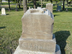
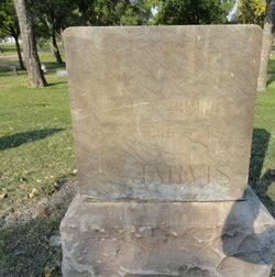
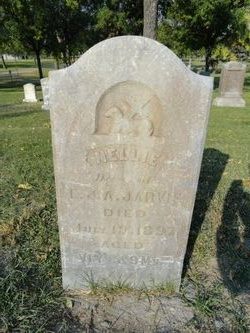
Elia Gervais Jarvis
| Birth | : | 22 May 1846 Canada |
| Death | : | 14 Aug 1905 Havre, Hill County, Montana, USA |
| Burial | : | Calvary Cemetery, Havre, Hill County, USA |
| Coordinate | : | 48.5457000, -109.6883000 |
| Plot | : | Lot 8 Block 10 |
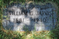
| Description | : | The Havre Herald (MT), 18 Aug 1905 Havre Pioneer Passes to Rest Eli Jarvis, one of the pioneers and landed proprietors of Havre died Monday night at his home on West First street after suffering an illness of several years. He had been bedridden for five months. Mr. Jarvis was 60 years old. Mr. Jarvis came to Havre in 1888, when the city was a hamlet. By careful and persistent industry, in partnership with his father, he acquired a goodly estate. His father died only a little over a year ago, having nearly reached the age... Read More |
frequently asked questions (FAQ):
-
Where is Elia Gervais Jarvis's memorial?
Elia Gervais Jarvis's memorial is located at: Calvary Cemetery, Havre, Hill County, USA.
-
When did Elia Gervais Jarvis death?
Elia Gervais Jarvis death on 14 Aug 1905 in Havre, Hill County, Montana, USA
-
Where are the coordinates of the Elia Gervais Jarvis's memorial?
Latitude: 48.5457000
Longitude: -109.6883000
Family Members:
Parent
Spouse
Children

Flowers:


Nearby Cemetories:
1. Calvary Cemetery
Havre, Hill County, USA
Coordinate: 48.5457000, -109.6883000
2. Highland Cemetery
Havre, Hill County, USA
Coordinate: 48.5463982, -109.6900024
3. Mount Hope Cemetery
Havre, Hill County, USA
Coordinate: 48.5540000, -109.7050000
4. Sunset Garden Park
Havre, Hill County, USA
Coordinate: 48.5531006, -109.8019028
5. North Havre Lutheran Church Graveyard (Defunct)
Havre, Hill County, USA
Coordinate: 48.6538903, -109.6815870
6. Grainbelt Cemetery
Hill County, USA
Coordinate: 48.6828003, -109.8657990
7. Andrew S. Lohman Grave Site
Lohman, Blaine County, USA
Coordinate: 48.5903520, -109.4073350
8. East End Colony Cemetery
East End Colony, Hill County, USA
Coordinate: 48.7485000, -109.5474000
9. Hilldale Hutterite Colony Cemetery
Hilldale Colony, Hill County, USA
Coordinate: 48.7997000, -109.7872000
10. Saint Johns Catholic Cemetery
Havre, Hill County, USA
Coordinate: 48.7625008, -109.9638977
11. Saint Gabriel Cemetery
Chinook, Blaine County, USA
Coordinate: 48.6065200, -109.2531200
12. Kuper Memorial Cemetery
Chinook, Blaine County, USA
Coordinate: 48.6083100, -109.2531200
13. Rocky Boy Cemetery
Rocky Boy, Hill County, USA
Coordinate: 48.2572410, -109.7923690
14. Box Elder Cemetery
Box Elder, Hill County, USA
Coordinate: 48.3274000, -110.0095000
15. Rocky Boy Gravel Cemetery
Rocky Boy, Hill County, USA
Coordinate: 48.2427720, -109.7596500
16. Cottonwood Lutheran Church Cemetery
Havre, Hill County, USA
Coordinate: 48.4545000, -110.1748000
17. Bear Paw Battlefield
Chinook, Blaine County, USA
Coordinate: 48.3780070, -109.2121290
18. Hungry Hollow Cemetery
Blaine County, USA
Coordinate: 48.2103004, -109.4677963
19. Milk River Valley Church Graveyard
Hill County, USA
Coordinate: 48.6787180, -110.2261080
20. Hollandville Cemetery
Chinook, Blaine County, USA
Coordinate: 48.6960310, -109.1557200
21. Gildford Hill County Cemetery
Gildford, Hill County, USA
Coordinate: 48.5778008, -110.2957993
22. Prairie Chapel United Brethren Cemetery
Chinook, Blaine County, USA
Coordinate: 48.8860000, -109.3414000
23. Mennonite Brethren Cemetery
Chinook, Blaine County, USA
Coordinate: 48.8012560, -109.1980620
24. Bethel Bruderthaler Mennonite Church Cemetery
Chinook, Blaine County, USA
Coordinate: 48.7552000, -109.1345000