
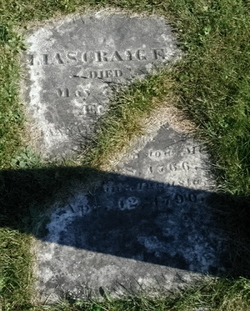
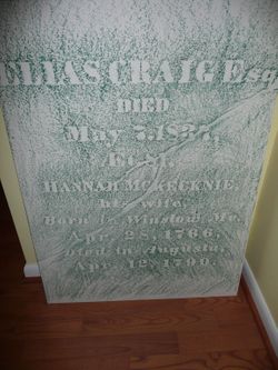
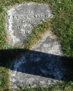
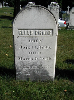
Elias Craig Sr.
| Birth | : | 27 Sep 1756 Wrentham, Norfolk County, Massachusetts, USA |
| Death | : | 7 May 1837 Fayette, Kennebec County, Maine, USA |
| Burial | : | Saint Margaret of Antioch Churchyard, Marton, West Lindsey District, England |
| Coordinate | : | 53.3260600, -0.7406500 |
| Description | : | Elias was the son of John Craig Sr. & Mary Skinner. He served in the Revoluntionary War at age 23. He was a hatter in Wrentham, Ma. when his shop took fire on Dec 1, 1785. The fire was the first known fire recorded in this settlement. The following year, Elias rebuilt his shop with the hlep of Henry Sewell, who assisted Elias on mason work of setting kettles. He was a respectable man and possessed the confidence of the settlers of Wrentham. He was a selectman of Hallowell, Maine. He married to Hannah McKecknie and they had a daugther.... Read More |
frequently asked questions (FAQ):
-
Where is Elias Craig Sr.'s memorial?
Elias Craig Sr.'s memorial is located at: Saint Margaret of Antioch Churchyard, Marton, West Lindsey District, England.
-
When did Elias Craig Sr. death?
Elias Craig Sr. death on 7 May 1837 in Fayette, Kennebec County, Maine, USA
-
Where are the coordinates of the Elias Craig Sr.'s memorial?
Latitude: 53.3260600
Longitude: -0.7406500
Family Members:
Parent
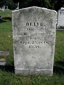
Spouse

Siblings
Children
Flowers:


Nearby Cemetories:
1. Saint Margaret of Antioch Churchyard
Marton, West Lindsey District, England
Coordinate: 53.3260600, -0.7406500
2. Marton Cemetery
Marton, West Lindsey District, England
Coordinate: 53.3251500, -0.7468200
3. St. Helen's Churchyard
Gate Burton, West Lindsey District, England
Coordinate: 53.3364060, -0.7420920
4. St. Nicholas Churchyard
Littleborough, Bassetlaw District, England
Coordinate: 53.3339600, -0.7632600
5. Holy Trinity Churchyard
Cottam, Bassetlaw District, England
Coordinate: 53.3112500, -0.7732600
6. St. Mary's Churchyard
Knaith, West Lindsey District, England
Coordinate: 53.3520400, -0.7577000
7. Stow Cemetery
Stow, West Lindsey District, England
Coordinate: 53.3252100, -0.6811100
8. Lea Fields Crematorium
Gainsborough, West Lindsey District, England
Coordinate: 53.3627763, -0.7528780
9. Sturton by Stow
Sturton-by-Stow, West Lindsey District, England
Coordinate: 53.3192800, -0.6677000
10. Saint Helens Churchyard
Lea, West Lindsey District, England
Coordinate: 53.3704000, -0.7528100
11. All Saints Churchyard
Rampton, Bassetlaw District, England
Coordinate: 53.2984394, -0.8019018
12. Sturton by Stow Quaker Cemetery
Sturton-by-Stow, West Lindsey District, England
Coordinate: 53.3173590, -0.6644260
13. St. Martin's North Leverton Churchyard
North Leverton with Habblesthorpe, Bassetlaw District, England
Coordinate: 53.3314800, -0.8195900
14. West Burton old church yard
West Burton, Bassetlaw District, England
Coordinate: 53.3569854, -0.8026078
15. St Peter & St Paul Churchyard
Sturton-le-Steeple, Bassetlaw District, England
Coordinate: 53.3500000, -0.8200000
16. Saint Peter And Saint Paul Churchyard
Kettlethorpe, West Lindsey District, England
Coordinate: 53.2714805, -0.7298717
17. St. John the Baptist Churchyard
Treswell, Bassetlaw District, England
Coordinate: 53.3057600, -0.8285600
18. St. Edith Churchyard
Coates-by-Stow, West Lindsey District, England
Coordinate: 53.3369700, -0.6377300
19. Saint Martin's Churchyard
Bole, Bassetlaw District, England
Coordinate: 53.3748200, -0.8093900
20. St. Peter's Churchyard
Newton on Trent, West Lindsey District, England
Coordinate: 53.2601290, -0.7528380
21. St. Peter's Churchyard
Stokeham, Bassetlaw District, England
Coordinate: 53.2835800, -0.8279800
22. All Saints Churchyard
Heapham, West Lindsey District, England
Coordinate: 53.3861890, -0.6817980
23. Saxilby Cemetery
Saxilby, West Lindsey District, England
Coordinate: 53.2755800, -0.6590400
24. St. Botolph Churchyard
Saxilby, West Lindsey District, England
Coordinate: 53.2747300, -0.6591000