
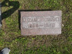
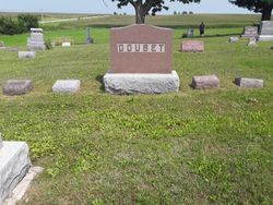
Elizabeth Sarah Brickey Doubet
| Birth | : | 21 Oct 1858 Fulton, Callaway County, Missouri, USA |
| Death | : | 15 Apr 1949 Clearfield, Taylor County, Iowa, USA |
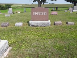
| Burial | : | Malvern Cemetery, Malvern, Mills County, USA |
| Coordinate | : | 40.9886017, -95.5785980 |
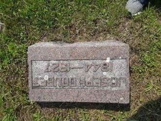
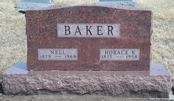
| Description | : | The Bedford Times Press April 28, 1949 page two CLEARFIELD Elizabeth Doubet Elizabeth Brickey was born in Callaway county, Missouri, October 21, 1949 (sic) and died at her home in Clearfield, April 15, 1949 aged 90 years, 5 months, 26 days. At the age of 12 the family came to Taylor county, locating near Bedford. It was there she received her education, fitting her for teaching. On October 2, 1879, she was married to Joseph Doubet and they located on a farm near Clearfield, where they lived until 1918 when they moved into Clearfield. To this union seven daughters were born: Nellie Baker, Beaconsfield;... Read More |
frequently asked questions (FAQ):
-
Where is Elizabeth Sarah Brickey Doubet's memorial?
Elizabeth Sarah Brickey Doubet's memorial is located at: Malvern Cemetery, Malvern, Mills County, USA.
-
When did Elizabeth Sarah Brickey Doubet death?
Elizabeth Sarah Brickey Doubet death on 15 Apr 1949 in Clearfield, Taylor County, Iowa, USA
-
Where are the coordinates of the Elizabeth Sarah Brickey Doubet's memorial?
Latitude: 40.9886017
Longitude: -95.5785980
Family Members:
Parent
Spouse
Siblings
Children

Flowers:


Nearby Cemetories:
1. Malvern Cemetery
Malvern, Mills County, USA
Coordinate: 40.9886017, -95.5785980
2. Parker Cemetery
White Cloud, Mills County, USA
Coordinate: 40.9737649, -95.5184363
3. Hillsdale Cemetery
Glenwood, Mills County, USA
Coordinate: 41.0097008, -95.6427994
4. Wearin Cemetery
Malvern, Mills County, USA
Coordinate: 41.0395000, -95.5313000
5. Hastings Cemetery
Hastings, Mills County, USA
Coordinate: 41.0097008, -95.4993973
6. South Grove Cemetery
Mills County, USA
Coordinate: 40.9775009, -95.4931030
7. East Liberty Cemetery
Malvern, Mills County, USA
Coordinate: 41.0592346, -95.6005020
8. Fairview Cemetery
Tabor, Mills County, USA
Coordinate: 40.9453011, -95.6716995
9. Mills County Farm Cemetery
Glenwood, Mills County, USA
Coordinate: 41.0417930, -95.6756530
10. North Grove Cemetery
Hastings, Mills County, USA
Coordinate: 41.0161018, -95.4618988
11. Bomar Family Cemetery
Mills County, USA
Coordinate: 41.0369400, -95.6941700
12. Cotten Cemetery
Mills County, USA
Coordinate: 41.0845000, -95.5167000
13. Estes Cemetery
Tabor, Mills County, USA
Coordinate: 40.9425011, -95.7080994
14. Randolph Cemetery
Randolph, Fremont County, USA
Coordinate: 40.8769493, -95.5695038
15. Tabor Cemetery
Tabor, Mills County, USA
Coordinate: 40.9035260, -95.6799460
16. Riverside Cemetery
Randolph, Fremont County, USA
Coordinate: 40.8806000, -95.5269012
17. Pottawattamie Chief Waubonsie Burial Site
Mills County, USA
Coordinate: 40.9236100, -95.7086100
18. Waubonsie Cemetery
Mills County, USA
Coordinate: 40.9451370, -95.7310791
19. Silver City Cemetery
Silver City, Mills County, USA
Coordinate: 41.1042442, -95.6380005
20. Glenwood Resource Center Cemetery
Glenwood, Mills County, USA
Coordinate: 41.0361720, -95.7338590
21. Wesley Chapel Cemetery
Henderson, Mills County, USA
Coordinate: 41.1019249, -95.4987793
22. Rhodes Cemetery
Tabor, Fremont County, USA
Coordinate: 40.9011002, -95.7097015
23. Saylers Farm Cemetery
Henderson, Mills County, USA
Coordinate: 41.1083300, -95.4919440
24. Emerson Cemetery
Emerson, Mills County, USA
Coordinate: 41.0325012, -95.4021988