
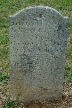
| Birth | : | 17 Sep 1824 Cleveland County, North Carolina, USA |
| Death | : | 7 Jun 1908 Union Mills, Rutherford County, North Carolina, USA |
| Burial | : | Pleasant Hills Memorial Park and Mortuary, Sebastopol, Sonoma County, USA |
| Coordinate | : | 38.3792000, -122.8350983 |
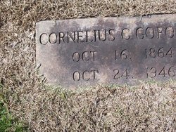
| Description | : | Here is the death record of their son Cornelius Jr. Cornelius Clements Goforth Gender: Male Race: White Age: 82 Birth Date: 16 Oct 1864 Birth Place: Rutherford, North Carolina, United States Death Date: 25 Oct 1946 Death Location: Camp Creek, Rutherford Father's Name: C C Goforth Mother's Name: Emeline Ware Residence: Rutherford, North Carolina |
frequently asked questions (FAQ):
-
Where is Emaline Ware Goforth's memorial?
Emaline Ware Goforth's memorial is located at: Pleasant Hills Memorial Park and Mortuary, Sebastopol, Sonoma County, USA.
-
When did Emaline Ware Goforth death?
Emaline Ware Goforth death on 7 Jun 1908 in Union Mills, Rutherford County, North Carolina, USA
-
Where are the coordinates of the Emaline Ware Goforth's memorial?
Latitude: 38.3792000
Longitude: -122.8350983
Family Members:
Parent
Spouse

Siblings
Children
Flowers:


Nearby Cemetories:
1. Pleasant Hills Memorial Park and Mortuary
Sebastopol, Sonoma County, USA
Coordinate: 38.3792000, -122.8350983
2. Sebastopol Memorial Lawn Cemetery
Sebastopol, Sonoma County, USA
Coordinate: 38.3981018, -122.8366013
3. Spring Hill Cemetery
Sebastopol, Sonoma County, USA
Coordinate: 38.3968010, -122.8637009
4. Canfield Cemetery
Sebastopol, Sonoma County, USA
Coordinate: 38.3512430, -122.8147040
5. Macedonia Methodist Episcopal Church Cemetery
Sebastopol, Sonoma County, USA
Coordinate: 38.3594860, -122.7727270
6. Jasper O'Farrell Ranch Cemetery
Freestone, Sonoma County, USA
Coordinate: 38.3758300, -122.9090300
7. Gilliam Cemetery
Graton, Sonoma County, USA
Coordinate: 38.4314995, -122.8816986
8. Bloomfield Cemetery
Bloomfield, Sonoma County, USA
Coordinate: 38.3135986, -122.8583984
9. Green Valley Cemetery
Sebastopol, Sonoma County, USA
Coordinate: 38.4424019, -122.8869019
10. Steele Family Cemetery
Santa Rosa, Sonoma County, USA
Coordinate: 38.4523730, -122.8065610
11. Druids Occidental Cemetery
Occidental, Sonoma County, USA
Coordinate: 38.4104996, -122.9419022
12. Forestview Cemetery
Forestville, Sonoma County, USA
Coordinate: 38.4677010, -122.8834000
13. Chapel of the Chimes Cemetery and Mausoleum
Santa Rosa, Sonoma County, USA
Coordinate: 38.4141998, -122.7137985
14. Luther Burbank Memorial Home and Gardens Cemetery
Santa Rosa, Sonoma County, USA
Coordinate: 38.4355810, -122.7118050
15. Saint Theresa of Avila Church Cemetery
Bodega, Sonoma County, USA
Coordinate: 38.3461342, -122.9723663
16. Calvary Cemetery
Bodega, Sonoma County, USA
Coordinate: 38.3414993, -122.9749985
17. Fulton Cemetery
Fulton, Sonoma County, USA
Coordinate: 38.4888000, -122.7786026
18. Beth Ami Cemetery
Santa Rosa, Sonoma County, USA
Coordinate: 38.4590920, -122.7086070
19. Santa Rosa Odd Fellows Cemetery
Santa Rosa, Sonoma County, USA
Coordinate: 38.4573690, -122.7066530
20. Shomrei Torah Cemetery
Santa Rosa, Sonoma County, USA
Coordinate: 38.4593760, -122.7086480
21. Santa Rosa Rural Cemetery
Santa Rosa, Sonoma County, USA
Coordinate: 38.4557991, -122.7039032
22. Santa Rosa Memorial Park
Santa Rosa, Sonoma County, USA
Coordinate: 38.4597015, -122.7071991
23. County of Sonoma Cemetery
Santa Rosa, Sonoma County, USA
Coordinate: 38.4552780, -122.7027780
24. Calvary Catholic Cemetery
Santa Rosa, Sonoma County, USA
Coordinate: 38.4314003, -122.6847000