
| Birth | : | 22 Feb 1875 Clayton County, Iowa, USA |
| Death | : | 13 May 1948 Highmore, Hyde County, South Dakota, USA |
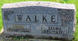
| Burial | : | Guttenberg Cemetery, Guttenberg, Clayton County, USA |
| Coordinate | : | 42.7691994, -91.1035995 |
| Description | : | Born on the 22nd of February 1875, Emil Schorg lived with his parents until 1900 when he moved to Highmore, South Dakota and engaged in farming. He retired in 1945 due to poor health and moved to Highmore where he remained until his death. He died on May 13, 1948 in Pierre, South Dakota at the age of 73 years, 2 months and 21 days. |
frequently asked questions (FAQ):
-
Where is Emil Schorg's memorial?
Emil Schorg's memorial is located at: Guttenberg Cemetery, Guttenberg, Clayton County, USA.
-
When did Emil Schorg death?
Emil Schorg death on 13 May 1948 in Highmore, Hyde County, South Dakota, USA
-
Where are the coordinates of the Emil Schorg's memorial?
Latitude: 42.7691994
Longitude: -91.1035995
Family Members:
Parent

Siblings
Flowers:


Nearby Cemetories:
1. Guttenberg Cemetery
Guttenberg, Clayton County, USA
Coordinate: 42.7691994, -91.1035995
2. Mount Olivet Cemetery
Guttenberg, Clayton County, USA
Coordinate: 42.7764840, -91.1083560
3. Saint Johns Cemetery
Jefferson Township, Clayton County, USA
Coordinate: 42.7497000, -91.1133000
4. Saint Marys Cemetery
Guttenberg, Clayton County, USA
Coordinate: 42.7691994, -91.1352997
5. Old Saint Marys Cemetery
Glen Haven, Grant County, USA
Coordinate: 42.8078100, -91.0675330
6. Bierer Cemetery
Millville, Clayton County, USA
Coordinate: 42.7230500, -91.0925166
7. Charlotte Cemetery
Glen Haven, Grant County, USA
Coordinate: 42.7933006, -91.0381012
8. Redman Cemetery
Millville, Clayton County, USA
Coordinate: 42.7166755, -91.0852901
9. Borcherding Cemetery
Jefferson Township, Clayton County, USA
Coordinate: 42.8182983, -91.1414032
10. Storck Cemetery
Guttenberg, Clayton County, USA
Coordinate: 42.7694335, -91.1834638
11. Friedlein Cemetery
Millville, Clayton County, USA
Coordinate: 42.7080994, -91.1108017
12. Lewis Cemetery
Osterdock, Clayton County, USA
Coordinate: 42.7416000, -91.1834000
13. Saint Michael Cemetery
Clayton County, USA
Coordinate: 42.8055992, -91.1802979
14. Duncan Cemetery
Glen Haven, Grant County, USA
Coordinate: 42.8325540, -91.0725940
15. Saint Paula Cemetery
Osterdock, Clayton County, USA
Coordinate: 42.7635994, -91.1992035
16. Gockel Cemetery
Glen Haven, Grant County, USA
Coordinate: 42.8224983, -91.0385971
17. Ramsey Cemetery
North Andover, Grant County, USA
Coordinate: 42.7817001, -90.9972000
18. Bethel Cemetery
Osterdock, Clayton County, USA
Coordinate: 42.7041702, -91.1688919
19. Pioneer Rock Cemetery
Ceres, Clayton County, USA
Coordinate: 42.8230591, -91.1863937
20. Goshen Cemetery
Millville, Clayton County, USA
Coordinate: 42.6905594, -91.0544434
21. Scott Cemetery
Glen Haven, Grant County, USA
Coordinate: 42.8368988, -91.0299988
22. Graham Cemetery
Millville, Clayton County, USA
Coordinate: 42.6833172, -91.1195685
23. Tangeman Family Cemetery
Garnavillo, Clayton County, USA
Coordinate: 42.8580000, -91.1420000
24. McClelland Cemetery
Garnavillo, Clayton County, USA
Coordinate: 42.8249879, -91.2084641