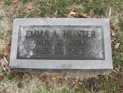
Emma Alphine Greer Hunter
| Birth | : | 2 Nov 1880 Houstonia, Pettis County, Missouri, USA |
| Death | : | 12 Feb 1967 Fayette, Howard County, Missouri, USA |
| Burial | : | Crown Hill Cemetery, Sedalia, Pettis County, USA |
| Coordinate | : | 38.7178001, -93.2149963 |
| Plot | : | Lot A Blk 3A GR 5 |
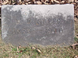
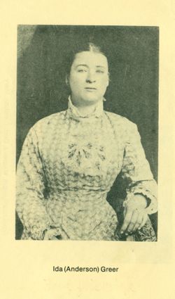
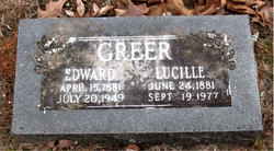
| Description | : | Mrs. Emma Hunter (Glasgow), 86, formerly of 2401 East 12th, who for the past three years has resided with her son. Theodore Hunter in Glasgow, died Sunday morning at the Keller Memorial Hospital, Fayette. She was the daughter of the late W. M. (William W) and Ida Anderson Greer and was married to C. T. (Charles Theodore) Greer who preceded her in death.... Sedalia Democrat February 13, 1967 (Submitted by Michele Matthews) |
frequently asked questions (FAQ):
-
Where is Emma Alphine Greer Hunter's memorial?
Emma Alphine Greer Hunter's memorial is located at: Crown Hill Cemetery, Sedalia, Pettis County, USA.
-
When did Emma Alphine Greer Hunter death?
Emma Alphine Greer Hunter death on 12 Feb 1967 in Fayette, Howard County, Missouri, USA
-
Where are the coordinates of the Emma Alphine Greer Hunter's memorial?
Latitude: 38.7178001
Longitude: -93.2149963
Family Members:
Parent
Spouse
Siblings
Children
Flowers:
Nearby Cemetories:
1. Crown Hill Cemetery
Sedalia, Pettis County, USA
Coordinate: 38.7178001, -93.2149963
2. Calvary Cemetery
Sedalia, Pettis County, USA
Coordinate: 38.7170100, -93.2131300
3. Glenwood Cemetery
Sedalia, Pettis County, USA
Coordinate: 38.7163000, -93.2171500
4. Calvary Episcopal Church Columbarium
Sedalia, Pettis County, USA
Coordinate: 38.7044800, -93.2282100
5. Hebrew Cemetery
Sedalia, Pettis County, USA
Coordinate: 38.6875000, -93.2371979
6. Highland Sacred Gardens
Sedalia, Pettis County, USA
Coordinate: 38.6831017, -93.1883011
7. Allcorn-Dumsday Cemetery
Sedalia, Pettis County, USA
Coordinate: 38.6772100, -93.2011800
8. Memorial Park Cemetery
Sedalia, Pettis County, USA
Coordinate: 38.6824989, -93.2542038
9. Georgetown Cemetery
Georgetown, Pettis County, USA
Coordinate: 38.7616770, -93.2398460
10. Mount Herman Cemetery
Cedar Township, Pettis County, USA
Coordinate: 38.7748700, -93.2198700
11. Salem Cemetery
Smithton, Pettis County, USA
Coordinate: 38.7352982, -93.1333008
12. Shobe Cemetery
Sedalia, Pettis County, USA
Coordinate: 38.6996994, -93.2968979
13. Abell Cemetery
Sedalia, Pettis County, USA
Coordinate: 38.6542015, -93.1774979
14. David Thomson Cemetery
Georgetown, Pettis County, USA
Coordinate: 38.7799500, -93.2723500
15. Olive Hill Amish Mennonite Cemetery
Beaman, Pettis County, USA
Coordinate: 38.7705600, -93.1413200
16. Forbes-Heard Cemetery
Hughesville, Pettis County, USA
Coordinate: 38.7937100, -93.2470200
17. Forbes-Bouldin Cemetery
Hughesville, Pettis County, USA
Coordinate: 38.7956200, -93.2589500
18. Olive Branch Cemetery
Beaman, Pettis County, USA
Coordinate: 38.7792015, -93.1355972
19. Pleasant Hill Cemetery
Sedalia, Pettis County, USA
Coordinate: 38.6341600, -93.1817000
20. Wheeler Family Cemetery
Beaman, Pettis County, USA
Coordinate: 38.7533600, -93.1045000
21. Bethlehem Baptist Church Cemetery
Pettis County, USA
Coordinate: 38.6250000, -93.2457962
22. Dresden Cemetery
Dresden, Pettis County, USA
Coordinate: 38.7468987, -93.3349991
23. North Dresden Cemetery
Dresden, Pettis County, USA
Coordinate: 38.7469600, -93.3352400
24. Hopewell Cemetery
Newland, Pettis County, USA
Coordinate: 38.8130989, -93.1660995

