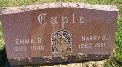
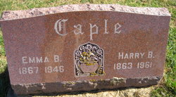
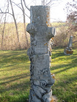
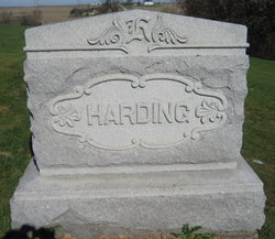
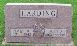
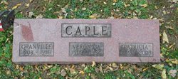
Emma Belle Harding Caple
| Birth | : | Mar 1867 Washington County, Iowa, USA |
| Death | : | 1946 Iowa, USA |
| Burial | : | High Ridge Cemetery, Stanberry, Gentry County, USA |
| Coordinate | : | 40.2267500, -94.5457500 |
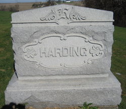
| Description | : | Emma Belle Harding, daughter of Frederick Wood Harding and Harriet Dye, married Harry Benton Caple, son of Hezekiah H. Caple and Sarah Jane Bush, on April 7, 1886, in Washington County, Iowa. The history of Oregon Township, Washington County, Iowa, has a bio of Emma's father, F. W. Harding, farmer and stock-raiser in section 10, where he owned 120 acres of land. |
frequently asked questions (FAQ):
-
Where is Emma Belle Harding Caple's memorial?
Emma Belle Harding Caple's memorial is located at: High Ridge Cemetery, Stanberry, Gentry County, USA.
-
When did Emma Belle Harding Caple death?
Emma Belle Harding Caple death on 1946 in Iowa, USA
-
Where are the coordinates of the Emma Belle Harding Caple's memorial?
Latitude: 40.2267500
Longitude: -94.5457500
Family Members:
Parent
Spouse
Siblings
Children
Flowers:
Nearby Cemetories:
1. High Ridge Cemetery
Stanberry, Gentry County, USA
Coordinate: 40.2267500, -94.5457500
2. Mount Calvary Cemetery
Stanberry, Gentry County, USA
Coordinate: 40.2273788, -94.5459137
3. Depriest Cemetery
Stanberry, Gentry County, USA
Coordinate: 40.2275200, -94.5146900
4. Hussey Cemetery
Gentry County, USA
Coordinate: 40.2200012, -94.4996567
5. Cooper Cemetery
Stanberry, Gentry County, USA
Coordinate: 40.1885986, -94.5492020
6. Mount Zion Cemetery-West
Cooper Township, Gentry County, USA
Coordinate: 40.1913650, -94.4872610
7. Hall Cemetery
Gentry County, USA
Coordinate: 40.2425003, -94.4717026
8. Liggett Cemetery
Gentry County, USA
Coordinate: 40.2892500, -94.5405900
9. Cranor Cemetery
Ford City, Gentry County, USA
Coordinate: 40.1543999, -94.5083008
10. Long Branch Cemetery
Gentry County, USA
Coordinate: 40.1881100, -94.4499100
11. Meeker Cemetery
Gentry County, USA
Coordinate: 40.1481018, -94.5969009
12. Jennings Cemetery
Alanthus Grove, Gentry County, USA
Coordinate: 40.3174240, -94.5246290
13. Hugginsville Cemetery
Hugginsville, Gentry County, USA
Coordinate: 40.2825203, -94.4491425
14. Carmack Cemetery
Carmack, Gentry County, USA
Coordinate: 40.2441559, -94.4265060
15. Lafayette Cemetery
Guilford, Nodaway County, USA
Coordinate: 40.1478806, -94.6112366
16. Mount Calvary Cemetery
Clyde, Nodaway County, USA
Coordinate: 40.2578468, -94.6635284
17. Dom Lukas Etlin Gravesite
Clyde, Nodaway County, USA
Coordinate: 40.2584100, -94.6668300
18. Saint Patrick Cemetery
Ford City, Gentry County, USA
Coordinate: 40.1481018, -94.4610977
19. Rouse Cemetery
Darlington, Gentry County, USA
Coordinate: 40.2030983, -94.4092026
20. Saint Columba Cemetery
Conception, Nodaway County, USA
Coordinate: 40.2431107, -94.6842957
21. Pleasant Hill Cemetery
Enyart, Gentry County, USA
Coordinate: 40.3343506, -94.5382233
22. Monroe Cemetery
Ravenwood, Nodaway County, USA
Coordinate: 40.3292007, -94.6055984
23. Finders Cemetery
Gentry County, USA
Coordinate: 40.3436012, -94.5616989
24. Greenridge Cemetery
Gentry County, USA
Coordinate: 40.3281200, -94.4529900

