

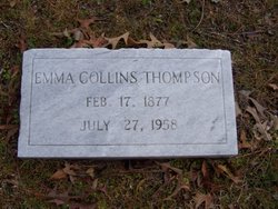
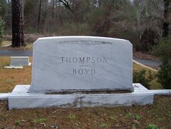
Emma Collins Thompson
| Birth | : | 17 Feb 1877 |
| Death | : | 27 Jul 1958 |
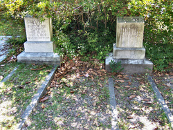
| Burial | : | Shady Grove Union Cemetery, Brandonville, Preston County, USA |
| Coordinate | : | 39.6739006, -79.5960999 |
frequently asked questions (FAQ):
-
Where is Emma Collins Thompson's memorial?
Emma Collins Thompson's memorial is located at: Shady Grove Union Cemetery, Brandonville, Preston County, USA.
-
When did Emma Collins Thompson death?
Emma Collins Thompson death on 27 Jul 1958 in
-
Where are the coordinates of the Emma Collins Thompson's memorial?
Latitude: 39.6739006
Longitude: -79.5960999
Family Members:
Parent
Spouse

Siblings
Children
Flowers:


Nearby Cemetories:
1. Shady Grove Union Cemetery
Brandonville, Preston County, USA
Coordinate: 39.6739006, -79.5960999
2. Brandonville Cemetery
Brandonville, Preston County, USA
Coordinate: 39.6667400, -79.6193100
3. Frankhouser Cemetery
Brandonville, Preston County, USA
Coordinate: 39.6545000, -79.5753000
4. Salem-Thomas Cemetery
Clifton Mills, Preston County, USA
Coordinate: 39.6972970, -79.5787720
5. Reverend John Boger Cemetery
Brandonville, Preston County, USA
Coordinate: 39.6623310, -79.5577120
6. Pleasant Grove Cemetery
Brandonville, Preston County, USA
Coordinate: 39.6941986, -79.5614014
7. Glover Cemetery
Glade Farms, Preston County, USA
Coordinate: 39.6943390, -79.5606420
8. Bruceton Mills Cemetery
Bruceton Mills, Preston County, USA
Coordinate: 39.6666100, -79.6402150
9. Sugar Valley Cemetery
Bruceton Mills, Preston County, USA
Coordinate: 39.6665993, -79.6404037
10. Mitchell Cemetery
Glade Farms, Preston County, USA
Coordinate: 39.6925470, -79.5294020
11. Jeffreys Cemetery
Hazelton, Preston County, USA
Coordinate: 39.6446160, -79.5351210
12. Ringer Cemetery
Bruceton Mills, Preston County, USA
Coordinate: 39.6175680, -79.6206020
13. Saint Peters Lutheran Cemetery
Clifton Mills, Preston County, USA
Coordinate: 39.7035860, -79.6691010
14. Cuppett - Teets Cemetery
Glade Farms, Preston County, USA
Coordinate: 39.7101700, -79.5225000
15. Danks Cemetery
Bruceton Mills, Preston County, USA
Coordinate: 39.6256110, -79.5290560
16. Centenary Cemetery
Cuzzart, Preston County, USA
Coordinate: 39.6000920, -79.6036560
17. Carroll Family Cemetery
Fayette County, USA
Coordinate: 39.7398300, -79.5435100
18. Maust Cemetery
Clifton Mills, Preston County, USA
Coordinate: 39.7202600, -79.6769710
19. Parnell Cemetery
Cuzzart, Preston County, USA
Coordinate: 39.5991900, -79.5687000
20. Webb Chapel Cemetery
Hazelton, Preston County, USA
Coordinate: 39.6648210, -79.4915600
21. Mountain Grove Church of the Brethren Cemetery
Laurel Run, Preston County, USA
Coordinate: 39.7003564, -79.6989387
22. Everly Cemetery
Laurel Run, Preston County, USA
Coordinate: 39.6725722, -79.7048876
23. Savage Cemetery
Hazelton, Preston County, USA
Coordinate: 39.6323470, -79.5003360
24. VanSickle Cemetery
Hazelton, Preston County, USA
Coordinate: 39.6800840, -79.4850690