Ena A. Harden Lieuwen
| Birth | : | 4 Aug 1906 Verdon, Richardson County, Nebraska, USA |
| Death | : | 23 Jan 2001 Mason City, Cerro Gordo County, Iowa, USA |
| Burial | : | Heddon on The Wall Churchyard, Heddon-on-the-Wall, Northumberland Unitary Authority, England |
| Coordinate | : | 54.9962960, -1.7923170 |
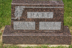
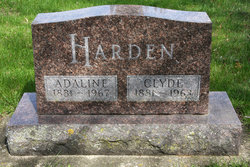
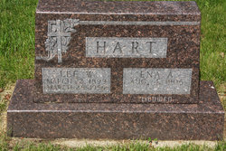
| Description | : | Ena was the daughter of Clyde & Adaline (Jenkins) Harden. On 5/23/1925 she was married to Lee W. Hart in Hiawatha, KS. They lived in Iowa Falls, IA for many years. Lee died in 1956. On 9/19/1959 she married Bert Lieuwen in Mason City, IA. Bert died there in 1981 and she remained there for the rest of her life. Ena loved music and was an accomplished organist and pianist. |
frequently asked questions (FAQ):
-
Where is Ena A. Harden Lieuwen's memorial?
Ena A. Harden Lieuwen's memorial is located at: Heddon on The Wall Churchyard, Heddon-on-the-Wall, Northumberland Unitary Authority, England.
-
When did Ena A. Harden Lieuwen death?
Ena A. Harden Lieuwen death on 23 Jan 2001 in Mason City, Cerro Gordo County, Iowa, USA
-
Where are the coordinates of the Ena A. Harden Lieuwen's memorial?
Latitude: 54.9962960
Longitude: -1.7923170
Family Members:
Parent
Spouse
Siblings
Children
Flowers:
Nearby Cemetories:
1. Heddon on The Wall Churchyard
Heddon-on-the-Wall, Northumberland Unitary Authority, England
Coordinate: 54.9962960, -1.7923170
2. Holy Cross Parish Churchyard
Ryton, Metropolitan Borough of Gateshead, England
Coordinate: 54.9774810, -1.7649850
3. Ryton and Crawcrook Cemetery
Ryton, Metropolitan Borough of Gateshead, England
Coordinate: 54.9703360, -1.7596530
4. St. Michael and All Angels Churchyard
Newburn, Metropolitan Borough of Newcastle upon Tyne, England
Coordinate: 54.9823080, -1.7410970
5. Greenside Cemetery
Greenside, Metropolitan Borough of Gateshead, England
Coordinate: 54.9591900, -1.7808900
6. St. John's Churchyard
Greenside, Metropolitan Borough of Gateshead, England
Coordinate: 54.9584780, -1.7818970
7. Lemington Cemetery
Lemington, Metropolitan Borough of Newcastle upon Tyne, England
Coordinate: 54.9830640, -1.7121210
8. Holy Trinity Churchyard
Dalton, Northumberland Unitary Authority, England
Coordinate: 55.0423380, -1.8266440
9. St Pauls Churchyard and Extension
Winlaton, Metropolitan Borough of Gateshead, England
Coordinate: 54.9513575, -1.7290585
10. Blaydon Cemetery
Blaydon, Metropolitan Borough of Gateshead, England
Coordinate: 54.9618300, -1.7079660
11. West Road Cemetery and Crematorium
Newcastle-upon-Tyne, Metropolitan Borough of Newcastle upon Tyne, England
Coordinate: 54.9835110, -1.6774750
12. St George's Churchyard
Mickley, Northumberland Unitary Authority, England
Coordinate: 54.9498300, -1.8831900
13. St John the Evangelist Churchyard
Chopwell, Metropolitan Borough of Gateshead, England
Coordinate: 54.9236780, -1.8093620
14. Holy Saviour Churchyard
Milbourne, Northumberland Unitary Authority, England
Coordinate: 55.0699360, -1.8177890
15. St Patricks Cemetery
High Spen, Metropolitan Borough of Gateshead, England
Coordinate: 54.9215030, -1.7744860
16. Hookergate Cemetery
Rowlands Gill, Metropolitan Borough of Gateshead, England
Coordinate: 54.9214632, -1.7744345
17. St James Churchyard
Benwell, Metropolitan Borough of Newcastle upon Tyne, England
Coordinate: 54.9710660, -1.6613400
18. Garden House Cemetery
Swalwell, Metropolitan Borough of Gateshead, England
Coordinate: 54.9511010, -1.6692210
19. St. Mary's Churchyard
Whickham, Metropolitan Borough of Gateshead, England
Coordinate: 54.9461090, -1.6738260
20. Saint Nicholas Cemetery
Newcastle-upon-Tyne, Metropolitan Borough of Newcastle upon Tyne, England
Coordinate: 54.9804950, -1.6449710
21. Elswick Cemetery
Newcastle-upon-Tyne, Metropolitan Borough of Newcastle upon Tyne, England
Coordinate: 54.9688000, -1.6490400
22. St. Matthew's Churchyard
Dinnington, Metropolitan Borough of Newcastle upon Tyne, England
Coordinate: 55.0533400, -1.6761000
23. St. Peter's Churchyard
Bywell, Northumberland Unitary Authority, England
Coordinate: 54.9476800, -1.9249700
24. St Andrew's Churchyard
Bywell, Northumberland Unitary Authority, England
Coordinate: 54.9482010, -1.9258340

