
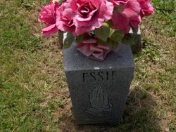
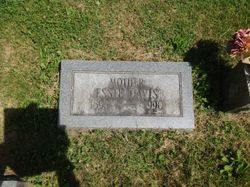
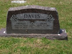
Essie Davis Davis
| Birth | : | 17 Oct 1898 Milton, Cabell County, West Virginia, USA |
| Death | : | 19 Jun 1990 Hurricane, Putnam County, West Virginia, USA |
| Burial | : | Holy Trinity Churchyard, Ardington, Vale of White Horse District, England |
| Coordinate | : | 51.5920530, -1.3784550 |
| Plot | : | Section G |
| Inscription | : | MOTHER ESSIE DAVIS 1898 - 1990 |
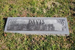
| Description | : | Daughter of Thomas Coleman Davis & Virginia Gibson. Married Robert Clifton Davis. |
frequently asked questions (FAQ):
-
Where is Essie Davis Davis's memorial?
Essie Davis Davis's memorial is located at: Holy Trinity Churchyard, Ardington, Vale of White Horse District, England.
-
When did Essie Davis Davis death?
Essie Davis Davis death on 19 Jun 1990 in Hurricane, Putnam County, West Virginia, USA
-
Where are the coordinates of the Essie Davis Davis's memorial?
Latitude: 51.5920530
Longitude: -1.3784550
Family Members:
Parent
Spouse
Siblings

Children
Flowers:


Nearby Cemetories:
1. Holy Trinity Churchyard
Ardington, Vale of White Horse District, England
Coordinate: 51.5920530, -1.3784550
2. All Saints Churchyard
Wantage, Vale of White Horse District, England
Coordinate: 51.5827496, -1.3822236
3. East Lockinge War Memorial
Wantage, Vale of White Horse District, England
Coordinate: 51.5844426, -1.3883416
4. East Lockinge All Souls Church Cemetery
Lockinge, Vale of White Horse District, England
Coordinate: 51.5846900, -1.3899900
5. Holy Trinity Churchyard
West Hendred, Vale of White Horse District, England
Coordinate: 51.5916030, -1.3556760
6. Cat Street Cemetery
East Hendred, Vale of White Horse District, England
Coordinate: 51.5964877, -1.3397450
7. St. Augustine of Canterbury Churchyard
East Hendred, Vale of White Horse District, England
Coordinate: 51.5944074, -1.3382489
8. St Mary Roman Catholic Churchyard
East Hendred, Vale of White Horse District, England
Coordinate: 51.5937960, -1.3363240
9. Chain Hill Cemetery
Wantage, Vale of White Horse District, England
Coordinate: 51.5843868, -1.4217107
10. Strict Baptist Chapel
Grove, Vale of White Horse District, England
Coordinate: 51.6051668, -1.4219236
11. Wantage Baptist Church
Wantage, Vale of White Horse District, England
Coordinate: 51.5892190, -1.4270540
12. St. Peter and Paul Churchyard
Wantage, Vale of White Horse District, England
Coordinate: 51.5886860, -1.4284970
13. St. John the Baptist Churchyard
Grove, Vale of White Horse District, England
Coordinate: 51.6112858, -1.4204966
14. Grove Cemetery
Grove, Vale of White Horse District, England
Coordinate: 51.6160002, -1.4299708
15. St Michaels and All Angels Churchyard
Steventon, Vale of White Horse District, England
Coordinate: 51.6196200, -1.3305500
16. Vicarage Hill Cemetery
East Challow, Vale of White Horse District, England
Coordinate: 51.5877810, -1.4512553
17. St. Nicholas Churchyard
East Challow, Vale of White Horse District, England
Coordinate: 51.5919480, -1.4518960
18. St. James The Great Churchyard
West Hanney, Vale of White Horse District, England
Coordinate: 51.6325030, -1.4144360
19. St. Andrew Churchyard
Letcombe Regis, Vale of White Horse District, England
Coordinate: 51.5758900, -1.4527800
20. St. James The Great Churchyard
Denchworth, Vale of White Horse District, England
Coordinate: 51.6229400, -1.4507800
21. Saint Matthews Churchyard
Harwell, Vale of White Horse District, England
Coordinate: 51.5983510, -1.2908880
22. Harwell Cemetery
Harwell, Vale of White Horse District, England
Coordinate: 51.5985200, -1.2885900
23. St. Laurence Churchyard
West Challow, Vale of White Horse District, England
Coordinate: 51.5920920, -1.4708930
24. All Saints Churchyard
Farnborough, West Berkshire Unitary Authority, England
Coordinate: 51.5346370, -1.3741600