| Birth | : | 12 Sep 1913 Vayland, Hand County, South Dakota, USA |
| Death | : | 30 Aug 2010 Butte, Silver Bow County, Montana, USA |
| Burial | : | Mountain View Cemetery, Butte, Silver Bow County, USA |
| Coordinate | : | 45.9622720, -112.5077200 |
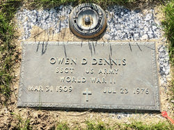
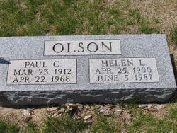
| Description | : | Our beloved and feisty mother, Esther P. Earle left us to be with the Lord and her beloved husband Bill upon her death August 30, 2010. Esther was born to Charles G. and Mattie (Fischer) Olson on Sept. 12, 1913, in Vayland, Hand Co., South Dakota. She attended schools in Vayland, Burdette, and graduated from Redfield High School in the class of 1931. Esther married Owen Doyle Dennis on May 13, 1934 in Miller, SD. They divorced in 1944. She married William E. Earle, Dec. 27, 1946, in Lewistown, MT, where they resided until 1956 when they moved to Great Falls.... Read More |
frequently asked questions (FAQ):
-
Where is Esther Pauline Olson Earle's memorial?
Esther Pauline Olson Earle's memorial is located at: Mountain View Cemetery, Butte, Silver Bow County, USA.
-
When did Esther Pauline Olson Earle death?
Esther Pauline Olson Earle death on 30 Aug 2010 in Butte, Silver Bow County, Montana, USA
-
Where are the coordinates of the Esther Pauline Olson Earle's memorial?
Latitude: 45.9622720
Longitude: -112.5077200
Family Members:
Parent
Spouse
Siblings
Flowers:
Nearby Cemetories:
1. Mountain View Cemetery
Butte, Silver Bow County, USA
Coordinate: 45.9622720, -112.5077200
2. Holy Cross Cemetery
Butte, Silver Bow County, USA
Coordinate: 45.9510994, -112.5036011
3. Saint Johns Columbarium
Butte, Silver Bow County, USA
Coordinate: 45.9923000, -112.5178000
4. Saint Patrick's Cemetery
Butte, Silver Bow County, USA
Coordinate: 45.9844017, -112.5406036
5. BNai Israel Cemetery
Butte, Silver Bow County, USA
Coordinate: 45.9865700, -112.5409000
6. Potters Field
Butte, Silver Bow County, USA
Coordinate: 45.9894470, -112.4773280
7. Mount Moriah Cemetery
Butte, Silver Bow County, USA
Coordinate: 45.9885500, -112.5423400
8. Highland Cemetery
Nine-mile, Silver Bow County, USA
Coordinate: 45.7992300, -112.4865100
9. Sunset Memorial Park
Gregson, Silver Bow County, USA
Coordinate: 46.0596000, -112.7754500
10. Norton Cemetery
Anaconda, Deer Lodge County, USA
Coordinate: 46.0619000, -112.8333000
11. Old Whitehall Cemetery
Whitehall, Jefferson County, USA
Coordinate: 45.9077988, -112.1038971
12. Anaconda Catholic Cemetery
Anaconda, Deer Lodge County, USA
Coordinate: 46.1165858, -112.8653042
13. Whitehall Cemetery
Whitehall, Jefferson County, USA
Coordinate: 45.8716050, -112.0875190
14. Fish Creek Cemetery
Whitehall, Jefferson County, USA
Coordinate: 45.7599983, -112.1772003
15. Warm Springs State Hospital Cemetery
Warm Springs, Deer Lodge County, USA
Coordinate: 46.1916580, -112.8032913
16. Silver Star Cemetery
Silver Star, Madison County, USA
Coordinate: 45.6907000, -112.2880000
17. Dewey Cemetery
Beaverhead County, USA
Coordinate: 45.7700005, -112.8613968
18. Iron Rod Cemetery
Madison County, USA
Coordinate: 45.6474380, -112.3131040
19. Melrose Cemetery
Melrose, Silver Bow County, USA
Coordinate: 45.6349983, -112.6722031
20. Rochester Cemetery
Madison County, USA
Coordinate: 45.6138992, -112.5100021
21. Lower Hill Cemetery
Anaconda, Deer Lodge County, USA
Coordinate: 46.1213440, -112.9572510
22. Upper Hill Cemetery
Anaconda, Deer Lodge County, USA
Coordinate: 46.1224440, -112.9588340
23. Mount Carmel Cemetery
Anaconda, Deer Lodge County, USA
Coordinate: 46.1237068, -112.9619827
24. Rainville Memorial Cemetery
Basin, Jefferson County, USA
Coordinate: 46.2736630, -112.2514180


