
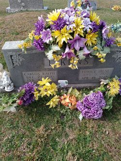
Eunice Irene Denton Watson
| Birth | : | 5 Jul 1927 Clay County, Tennessee, USA |
| Death | : | 19 Apr 2012 Livingston, Overton County, Tennessee, USA |
| Burial | : | Jonestown Cemetery, Clay County, USA |
| Coordinate | : | 36.5619011, -85.6921997 |
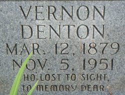
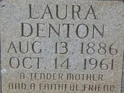
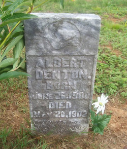
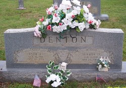
| Description | : | Mrs. Eunice Irene Watson Mrs. Eunice Irene Watson, Age 84 of Moss passed away Thursday, April 19, 2012 at the Livingston Regional Hospital. Eunice Irene Denton was born July 5, 1927 in Clay County, Tennessee to the late Mount Vernon and Laura Bell (Crabtree) Denton. Irene married Carlos Ralph Likens on November 29, 1946 he preceded her in death on February 16, 1973. She was a retired factory worker and a member of the Pine Hill Church of Christ In addition to her parents and husband she was preceded in death by her Grandson, James Kelly Asberry; Brothers, Normal Edwin, Albert, Estil... Read More |
frequently asked questions (FAQ):
-
Where is Eunice Irene Denton Watson's memorial?
Eunice Irene Denton Watson's memorial is located at: Jonestown Cemetery, Clay County, USA.
-
When did Eunice Irene Denton Watson death?
Eunice Irene Denton Watson death on 19 Apr 2012 in Livingston, Overton County, Tennessee, USA
-
Where are the coordinates of the Eunice Irene Denton Watson's memorial?
Latitude: 36.5619011
Longitude: -85.6921997
Family Members:
Parent
Spouse

Siblings

Flowers:


Nearby Cemetories:
1. Jonestown Cemetery
Clay County, USA
Coordinate: 36.5619011, -85.6921997
2. Cherry Denton Cemetery
Clay County, USA
Coordinate: 36.5512200, -85.6971200
3. Hinson Cemetery
Moss, Clay County, USA
Coordinate: 36.5756750, -85.7020010
4. Pricetown Cemetery
Clay County, USA
Coordinate: 36.5422500, -85.6750670
5. Smith Cemetery
Pine Hill, Clay County, USA
Coordinate: 36.5714930, -85.6568170
6. James H. Cherry Family Cemetery
Clay County, USA
Coordinate: 36.5453700, -85.7266000
7. Eads-Denton Cemetery
Pine Hill, Clay County, USA
Coordinate: 36.5644207, -85.6503187
8. Pitcock Cemetery
Clay County, USA
Coordinate: 36.5992012, -85.6911011
9. Cherry Cemetery #3
Oak Grove, Clay County, USA
Coordinate: 36.6015000, -85.7100300
10. Mount Vernon Cemetery
Miles Crossroads, Clay County, USA
Coordinate: 36.5435982, -85.7403030
11. Kendall Cemetery
Moss, Clay County, USA
Coordinate: 36.5672540, -85.6362650
12. Liberty Church Cemetery
Boles, Clay County, USA
Coordinate: 36.6010850, -85.6496830
13. Clementsville Cemetery
Clementsville, Clay County, USA
Coordinate: 36.6132300, -85.7146410
14. Browning Cemetery
Clay County, USA
Coordinate: 36.5578003, -85.7602997
15. Cherry Family Cemetery #02
Clay County, USA
Coordinate: 36.5071260, -85.6685290
16. Moore Cemetery #1
Moss, Clay County, USA
Coordinate: 36.6164920, -85.6636620
17. Moss Cemetery
Moss, Clay County, USA
Coordinate: 36.5911210, -85.6214460
18. Macedonia Cemetery
Moss, Clay County, USA
Coordinate: 36.5643997, -85.6110992
19. Moore Cemetery
Moss, Clay County, USA
Coordinate: 36.6113400, -85.6374980
20. Willhoite-Curtis Cemetery
Tompkinsville, Monroe County, USA
Coordinate: 36.6182208, -85.6442948
21. Hermitage Springs Cemetery
Hermitage Springs, Clay County, USA
Coordinate: 36.5823500, -85.7750900
22. Edna Lee Biblery
Bakerton, Clay County, USA
Coordinate: 36.5048730, -85.7420270
23. Beech Grove Cemetery
Harlan Crossroads, Monroe County, USA
Coordinate: 36.6319000, -85.6809000
24. Old Bowman Cemetery
Gamaliel, Monroe County, USA
Coordinate: 36.6289830, -85.7204190