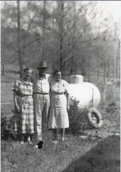
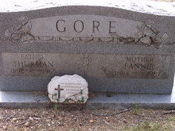
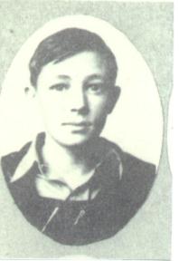
Fannie May Sides Gore
| Birth | : | 7 Sep 1894 Bowie County, Texas, USA |
| Death | : | 8 Aug 1987 De Queen, Sevier County, Arkansas, USA |
| Burial | : | Union Church Cemetery, Chesterfield, Henderson County, USA |
| Coordinate | : | 35.6336500, -88.2573400 |
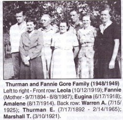
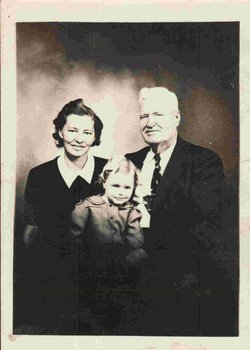
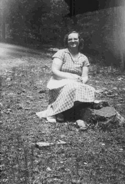
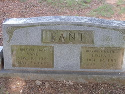
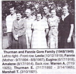
| Description | : | Fannie Mae (Sides) Gore aged 92 resident of De Queen, died Saturday August 8,1987 in community hospital of De Queen. Funeral were at 4 P.M. Monday August 10 in Wilkerson Funeral Home Chapel with Rev, Victor Gore officiating burial was in Millwee Cemetery.She was born September 7,1894 was the widow of Thurman Ernest Gore , and A member of Lone Oak Babtist Church. Survivors two sons Marshall Gore and Warren both of De Queen. three daughters Euginia Atwood of Moon Okla.; Amalene Burnett and Leola Fant both of De Queen; 16 Grandchildren, 35 Great-Grandchildren and five Great-Great- Grandchildren. |
frequently asked questions (FAQ):
-
Where is Fannie May Sides Gore's memorial?
Fannie May Sides Gore's memorial is located at: Union Church Cemetery, Chesterfield, Henderson County, USA.
-
When did Fannie May Sides Gore death?
Fannie May Sides Gore death on 8 Aug 1987 in De Queen, Sevier County, Arkansas, USA
-
Where are the coordinates of the Fannie May Sides Gore's memorial?
Latitude: 35.6336500
Longitude: -88.2573400
Family Members:
Spouse
Children
Flowers:
Nearby Cemetories:
1. Union Church Cemetery
Chesterfield, Henderson County, USA
Coordinate: 35.6336500, -88.2573400
2. Darden Cemetery
Darden, Henderson County, USA
Coordinate: 35.6388910, -88.2244260
3. Corinth Church Cemetery
Darden, Henderson County, USA
Coordinate: 35.6585850, -88.2381060
4. McCall Cemetery
Lexington, Henderson County, USA
Coordinate: 35.6481018, -88.2981033
5. Judson Cemetery
Middleburg, Henderson County, USA
Coordinate: 35.5947350, -88.2641960
6. Oak Grove Methodist Church Cemetery
Middleburg, Henderson County, USA
Coordinate: 35.5922290, -88.2527470
7. Central Grove Church Cemetery
Chesterfield, Henderson County, USA
Coordinate: 35.6705220, -88.2831450
8. Crowell Chapel Cemetery
Henderson County, USA
Coordinate: 35.5952860, -88.2318640
9. Wallace Cemetery
Henderson County, USA
Coordinate: 35.6514015, -88.3094025
10. Presley Cemetery
Darden, Henderson County, USA
Coordinate: 35.5928120, -88.2259270
11. Powers Cemetery
Scotts Hill, Henderson County, USA
Coordinate: 35.5830370, -88.2599740
12. Hayes Cemetery
Darden, Henderson County, USA
Coordinate: 35.6702050, -88.2136140
13. Rock Hill Cemetery
Lexington, Henderson County, USA
Coordinate: 35.6238020, -88.3201810
14. Dukes Cemetery
Darden, Henderson County, USA
Coordinate: 35.6435210, -88.1928930
15. Newsom Family Cemetery
Henderson County, USA
Coordinate: 35.5948410, -88.2104270
16. Duke Memorial Cemetery
Henderson County, USA
Coordinate: 35.6863590, -88.2364690
17. Hensley Cemetery
Henderson County, USA
Coordinate: 35.5861015, -88.2161026
18. Derryberry Cemetery
Darden, Henderson County, USA
Coordinate: 35.6898520, -88.2218400
19. Myracle Family Cemetery
Parsons, Decatur County, USA
Coordinate: 35.6234610, -88.1776630
20. Bible Grove Cemetery
Henderson County, USA
Coordinate: 35.7001620, -88.2704020
21. Oak Grove Cemetery
Lexington, Henderson County, USA
Coordinate: 35.6571999, -88.3352966
22. Smith Chapel Cemetery
Middleburg, Henderson County, USA
Coordinate: 35.5727500, -88.2203500
23. Pleasant Hill Cemetery
Pleasant Hill, Henderson County, USA
Coordinate: 35.6658430, -88.3323120
24. Keen Cemetery
Parsons, Decatur County, USA
Coordinate: 35.6459090, -88.1715020

