
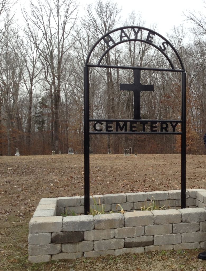
| Memorials | : | 0 |
| Location | : | Darden, Henderson County, USA |
| Coordinate | : | 35.6702050, -88.2136140 |
| Description | : | From the intersection of Darden Christian Chapel Rd. & US-412, at Darden, travel north following Darden Christian Chapel Rd. for 2.7 mi. to the cemetery on the west (left) side of the roadway. |
frequently asked questions (FAQ):
-
Where is Hayes Cemetery?
Hayes Cemetery is located at Darden Christian Chapel Road Darden, Henderson County ,Tennessee , 38328USA.
-
Hayes Cemetery cemetery's updated grave count on graveviews.com?
0 memorials
-
Where are the coordinates of the Hayes Cemetery?
Latitude: 35.6702050
Longitude: -88.2136140
Nearby Cemetories:
1. Derryberry Cemetery
Darden, Henderson County, USA
Coordinate: 35.6898520, -88.2218400
2. Mount Ararat Cemetery
Darden, Henderson County, USA
Coordinate: 35.6907997, -88.2031021
3. Corinth Church Cemetery
Darden, Henderson County, USA
Coordinate: 35.6585850, -88.2381060
4. Duke Memorial Cemetery
Henderson County, USA
Coordinate: 35.6863590, -88.2364690
5. Evans Cemetery
Henderson County, USA
Coordinate: 35.6977997, -88.2172012
6. Dukes Cemetery
Darden, Henderson County, USA
Coordinate: 35.6435210, -88.1928930
7. Darden Cemetery
Darden, Henderson County, USA
Coordinate: 35.6388910, -88.2244260
8. Keen Cemetery
Parsons, Decatur County, USA
Coordinate: 35.6459090, -88.1715020
9. Stephen Roberson Gravesite
Darden, Henderson County, USA
Coordinate: 35.7097750, -88.1919380
10. Moore Cemetery
Darden, Henderson County, USA
Coordinate: 35.7159150, -88.2280760
11. Box Cemetery
Decatur County, USA
Coordinate: 35.7069016, -88.1733017
12. Union Church Cemetery
Chesterfield, Henderson County, USA
Coordinate: 35.6336500, -88.2573400
13. Gabbard Cemetery
Parsons, Decatur County, USA
Coordinate: 35.6875340, -88.1507260
14. Bible Grove Cemetery
Henderson County, USA
Coordinate: 35.7001620, -88.2704020
15. Myracle Family Cemetery
Parsons, Decatur County, USA
Coordinate: 35.6234610, -88.1776630
16. Hill Cemetery
Parsons, Decatur County, USA
Coordinate: 35.6914190, -88.1505980
17. Hays Cemetery
Bible Hill, Decatur County, USA
Coordinate: 35.6914070, -88.1505910
18. Barnett Cemetery
Parsons, Decatur County, USA
Coordinate: 35.6377790, -88.1581500
19. Central Grove Church Cemetery
Chesterfield, Henderson County, USA
Coordinate: 35.6705220, -88.2831450
20. Hendrix Cemetery
Henderson County, USA
Coordinate: 35.7261009, -88.1996994
21. Bear Creek Church Cemetery
Parsons, Decatur County, USA
Coordinate: 35.6491130, -88.1481300
22. Hawkes Cemetery
Parsons, Decatur County, USA
Coordinate: 35.7190470, -88.1657000
23. Pleasant Grove Cemetery
Henderson County, USA
Coordinate: 35.7313995, -88.2347031
24. Lewis-Altom Cemetery
Wildersville, Henderson County, USA
Coordinate: 35.7240750, -88.2576840