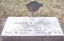
Floyd Robert Russell
| Birth | : | 18 May 1924 Barnard, Nodaway County, Missouri, USA |
| Death | : | 14 Apr 1972 Bureau County, Illinois, USA |
| Burial | : | Union Grove Baptist Church Cemetery, Seagrove, Randolph County, USA |
| Coordinate | : | 35.5137430, -79.7224430 |
| Description | : | April 15, 1972 - Carroll Daily Times - Floyd Robert Russell, 47, of Stanhope, formerly of Carroll, was killed in a two-truck collision on Interstate 80 about two miles east of Princeton, Illinois, Friday. He was a son-in-law of Mr. and Mrs. V.H. Christianson of Carroll. Russell, a trucker for Northrup Truck Lines of Stanhope, was reported to be enroute from Detroit, Mich., to Storm Lake with a load of hogs. Authorities said the truck driven by Russell hit the rear of another westbound truck. A passenger in Russell's truck, Benjamin Rooney, 15, of Evanston, Illinois, was also killed... Read More |
frequently asked questions (FAQ):
-
Where is Floyd Robert Russell's memorial?
Floyd Robert Russell's memorial is located at: Union Grove Baptist Church Cemetery, Seagrove, Randolph County, USA.
-
When did Floyd Robert Russell death?
Floyd Robert Russell death on 14 Apr 1972 in Bureau County, Illinois, USA
-
Where are the coordinates of the Floyd Robert Russell's memorial?
Latitude: 35.5137430
Longitude: -79.7224430
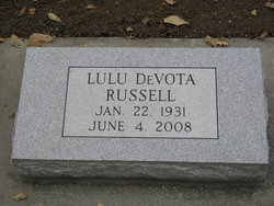
Family Members:
Spouse
Flowers:
Nearby Cemetories:
1. Union Grove Baptist Church Cemetery
Seagrove, Randolph County, USA
Coordinate: 35.5137430, -79.7224430
2. New Center Christian Church Cemetery
Seagrove, Randolph County, USA
Coordinate: 35.5335110, -79.7077100
3. Cagle Cemetery
Moore County, USA
Coordinate: 35.5007090, -79.7518280
4. Mount Zion Wesleyan Church Cemetery
Moore County, USA
Coordinate: 35.4838290, -79.7376190
5. Whynot Wesleyan Church Cemetery
Seagrove, Randolph County, USA
Coordinate: 35.5275090, -79.7586590
6. Fair Grove Methodist Church Cemetery
Seagrove, Randolph County, USA
Coordinate: 35.5308460, -79.7576500
7. Community Independent Baptist Church Cemetery
Seagrove, Randolph County, USA
Coordinate: 35.5187880, -79.6816070
8. Whynot Cemetery
Seagrove, Randolph County, USA
Coordinate: 35.5315800, -79.7589200
9. Spencer Family Cemetery
Seagrove, Randolph County, USA
Coordinate: 35.5528110, -79.7310880
10. Trinity Wesleyan Church Cemetery
Seagrove, Randolph County, USA
Coordinate: 35.5439660, -79.6777180
11. Seagrove Christian Church Cemetery
Seagrove, Randolph County, USA
Coordinate: 35.5389550, -79.7733010
12. Asbury Baptist Church Cemetery
Montgomery County, USA
Coordinate: 35.4904900, -79.7765990
13. Seagrove United Methodist Church Cemetery
Seagrove, Randolph County, USA
Coordinate: 35.5401900, -79.7804200
14. Little Oak Church of God Cemetery
Robbins, Moore County, USA
Coordinate: 35.4773960, -79.6720470
15. Allred Family Cemetery
Westmore, Moore County, USA
Coordinate: 35.4769500, -79.6687400
16. Maple Springs Baptist Church Cemetery
Seagrove, Randolph County, USA
Coordinate: 35.5310870, -79.7900260
17. Richard Graves Family Cemetery
Seagrove, Randolph County, USA
Coordinate: 35.5611100, -79.7679100
18. Shamburger Cemetery
Moore County, USA
Coordinate: 35.4533005, -79.7300034
19. Pleasant Hill United Methodist Church
Seagrove, Randolph County, USA
Coordinate: 35.5732574, -79.7067261
20. Mount Olivet United Methodist Church Cemetery
Coleridge, Randolph County, USA
Coordinate: 35.5527400, -79.6593200
21. King Family Cemetery
Seagrove, Randolph County, USA
Coordinate: 35.5465290, -79.7920060
22. Needham's Grove Baptist Church Cemetery
Robbins, Moore County, USA
Coordinate: 35.5069240, -79.6398630
23. Big Oak Church Of God Cemetery
Star, Montgomery County, USA
Coordinate: 35.5004050, -79.8062580
24. Boling Family Cemetery
Seagrove, Randolph County, USA
Coordinate: 35.5457340, -79.7999280


