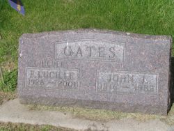
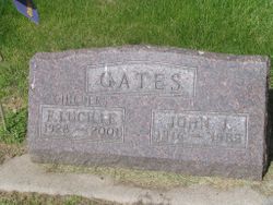
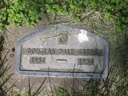
Frances Lucille Alexander Childers
| Birth | : | 18 Feb 1928 Redfield, Spink County, South Dakota, USA |
| Death | : | 11 May 2001 Casper, Natrona County, Wyoming, USA |
| Burial | : | Sittingbourne Cemetery, Sittingbourne, Swale Borough, England |
| Coordinate | : | 51.3345300, 0.7348000 |
| Plot | : | Division G, Block 053, Grave 003 |
| Description | : | Lucille, age 73, died at the Wyoming Medical Center in Casper. She was the daughter of Otto and Margaret (Kern) Alexander. She married John Gates on September 28, 1948, in Redfield. She married Russell C. Childers on April 21, 1984, in Riverton. Survivors include her second husband, her sons, Barry Gates and Byran Gates, and seven grandchildren. She was preceded in death by her first husband, her parents, her daughter, and her stillborn son. Funeral services were held at the United Methodist Church in Riverton. Another funeral service washeld at the First Congregational-United Church of Christ... Read More |
frequently asked questions (FAQ):
-
Where is Frances Lucille Alexander Childers's memorial?
Frances Lucille Alexander Childers's memorial is located at: Sittingbourne Cemetery, Sittingbourne, Swale Borough, England.
-
When did Frances Lucille Alexander Childers death?
Frances Lucille Alexander Childers death on 11 May 2001 in Casper, Natrona County, Wyoming, USA
-
Where are the coordinates of the Frances Lucille Alexander Childers's memorial?
Latitude: 51.3345300
Longitude: 0.7348000
Family Members:
Parent
Spouse
Children
Flowers:
Nearby Cemetories:
1. Holy Trinity Church
Sittingbourne, Swale Borough, England
Coordinate: 51.3416000, 0.7316000
2. Murston Cemetery
Sittingbourne, Swale Borough, England
Coordinate: 51.3424700, 0.7527100
3. St John the Baptist Churchyard
Tunstall, Swale Borough, England
Coordinate: 51.3246010, 0.7196400
4. St. Laurence's Churchyard
Bapchild, Swale Borough, England
Coordinate: 51.3330520, 0.7655020
5. St. Nicholas Churchyard
Rodmersham, Swale Borough, England
Coordinate: 51.3227780, 0.7627730
6. St Peter and St Paul Churchyard
Borden, Swale Borough, England
Coordinate: 51.3347350, 0.7008350
7. Holy Trinity Churchyard
Milton Regis, Swale Borough, England
Coordinate: 51.3556700, 0.7401300
8. St. Bartholomew's Churchyard
Bobbing, Swale Borough, England
Coordinate: 51.3537600, 0.7101420
9. St Giles Churchyard
Tonge, Swale Borough, England
Coordinate: 51.3424640, 0.7757790
10. Garden of England Crematorium
Bobbing, Swale Borough, England
Coordinate: 51.3595330, 0.7179190
11. St. John the Baptist Churchyard
Bredgar, Swale Borough, England
Coordinate: 51.3109210, 0.6960930
12. St Peter and St Paul New Churchyard
Lynsted, Swale Borough, England
Coordinate: 51.3150770, 0.7864080
13. St Peter and St Paul Churchyard
Lynsted, Swale Borough, England
Coordinate: 51.3138300, 0.7860890
14. St. Mary and the Holy Cross Churchyard
Milstead, Swale Borough, England
Coordinate: 51.2961020, 0.7288260
15. All Saints Churchyard
Iwade, Swale Borough, England
Coordinate: 51.3787920, 0.7306550
16. St Mary the Virgin Churchyard
Newington, Swale Borough, England
Coordinate: 51.3567080, 0.6733120
17. St Dunstan Churchyard
Frinsted, Maidstone Borough, England
Coordinate: 51.2843300, 0.7112270
18. St Mary Churchyard
Teynham, Swale Borough, England
Coordinate: 51.3377640, 0.8213570
19. Saint Mary Magdalene Churchyard
Stockbury, Maidstone Borough, England
Coordinate: 51.3247700, 0.6488800
20. St. Giles Churchyard
Wormshill, Maidstone Borough, England
Coordinate: 51.2850660, 0.6971740
21. St. James' Churchyard
Bicknor, Maidstone Borough, England
Coordinate: 51.2980836, 0.6674698
22. St Margaret of Antioch Churchyard
Lower Halstow, Swale Borough, England
Coordinate: 51.3752975, 0.6711660
23. The Beheading of St. John the Baptist Churchyard
Doddington, Swale Borough, England
Coordinate: 51.2843350, 0.7805830
24. St Mary Churchyard
Norton, Swale Borough, England
Coordinate: 51.3149750, 0.8221900

