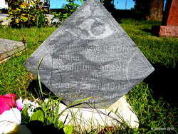
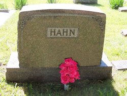
Frances Margretha Sophia Hahn
| Birth | : | 2 Feb 1903 Johnson County, Nebraska, USA |
| Death | : | 12 Sep 1903 Johnson County, Nebraska, USA |
| Burial | : | Lawn Woodville Cemetery, Woodville, Tararua District, New Zealand |
| Coordinate | : | -40.3390540, 175.8807710 |
| Description | : | Mr. and Mrs. Willie Hahn, of near Graf, lost their baby on September 12, 1903, and the remains were interred in the German Cemetery, (Zion), near Johnson on Sunday. The child was about 7 months old, and the bereaved parents have the sympathy of all in their misfortune. Frances died of Yellow Jaundice, a child of William L. and Minnie Hahn. |
frequently asked questions (FAQ):
-
Where is Frances Margretha Sophia Hahn's memorial?
Frances Margretha Sophia Hahn's memorial is located at: Lawn Woodville Cemetery, Woodville, Tararua District, New Zealand.
-
When did Frances Margretha Sophia Hahn death?
Frances Margretha Sophia Hahn death on 12 Sep 1903 in Johnson County, Nebraska, USA
-
Where are the coordinates of the Frances Margretha Sophia Hahn's memorial?
Latitude: -40.3390540
Longitude: 175.8807710
Family Members:
Parent
Siblings
Flowers:
Nearby Cemetories:
1. Lawn Woodville Cemetery
Woodville, Tararua District, New Zealand
Coordinate: -40.3390540, 175.8807710
2. RSA Woodville Cemetery
Woodville, Tararua District, New Zealand
Coordinate: -40.3362310, 175.8345210
3. Old Gorge Cemetery
Woodville, Tararua District, New Zealand
Coordinate: -40.3361206, 175.8332520
4. Mangatainoka Cemetery
Pahiatua, Tararua District, New Zealand
Coordinate: -40.4250620, 175.8597850
5. Ashhurst Cemetery
Ashhurst, Palmerston North City, New Zealand
Coordinate: -40.3013600, 175.7576040
6. Kumeroa Cemetery
Kumeroa, Tararua District, New Zealand
Coordinate: -40.3294480, 176.0238960
7. Mangahao Cemetery
Ballance, Tararua District, New Zealand
Coordinate: -40.4276820, 175.7890440
8. Kaitawa Cemetery
Kaitawa, Tararua District, New Zealand
Coordinate: -40.4939310, 175.8824710
9. Tahoraiti Urupā
Dannevirke, Tararua District, New Zealand
Coordinate: -40.2428680, 176.0574580
10. Kelvin Grove Cemetery
Palmerston North, Palmerston North City, New Zealand
Coordinate: -40.3239060, 175.6616870
11. Terrace End Cemetery
Palmerston North, Palmerston North City, New Zealand
Coordinate: -40.3427170, 175.6433160
12. Pohangina Cemetery
Pohangina, Manawatu District, New Zealand
Coordinate: -40.1682490, 175.7946660
13. St Peter's Anglican Church
Roslyn, Palmerston North City, New Zealand
Coordinate: -40.3468897, 175.6279770
14. Bunnythorpe Cemetery
Palmerston North, Palmerston North City, New Zealand
Coordinate: -40.2867770, 175.6272590
15. All Saint's Anglican Church
Palmerston North, Palmerston North City, New Zealand
Coordinate: -40.3581590, 175.6107926
16. Settlers Cemetery
Dannevirke, Tararua District, New Zealand
Coordinate: -40.2046600, 176.1107900
17. Mangatera Cemetery
Dannevirke, Tararua District, New Zealand
Coordinate: -40.1883520, 176.1180990
18. Aorangi Urupā
Manawatu District, New Zealand
Coordinate: -40.2443660, 175.5870110
19. St Agnes Anglican Churchyard
Kiwitea, Manawatu District, New Zealand
Coordinate: -40.1058087, 175.7196222
20. Calleson Family Cemetery
Palmerston North, Palmerston North City, New Zealand
Coordinate: -40.3814600, 175.5157840
21. Matamau Cemetery
Matamau, Tararua District, New Zealand
Coordinate: -40.1483730, 176.1531760
22. Feilding Cemetery
Feilding, Manawatu District, New Zealand
Coordinate: -40.1892990, 175.5543140
23. Maunga Tauari Urupa
Awahuri, Manawatu District, New Zealand
Coordinate: -40.2619750, 175.5081430
24. Newman Cemetery
Eketahuna, Tararua District, New Zealand
Coordinate: -40.6154770, 175.7134490

