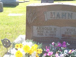
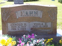
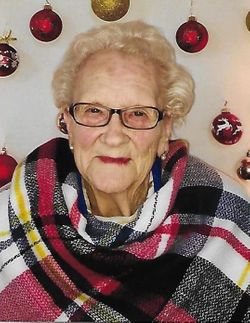
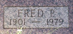
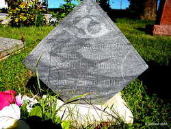
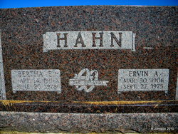
Arnold Herman Hahn
| Birth | : | 2 Nov 1917 Johnson County, Nebraska, USA |
| Death | : | 1 Feb 1989 Omaha, Douglas County, Nebraska, USA |
| Burial | : | Wise Cemetery, Winchester, Jefferson County, USA |
| Coordinate | : | 39.3107986, -95.2485962 |
| Description | : | Arnold's parents were, William L. Hahn and Bertha M.W.(Walkenhorst) Hahn. He was baptized jan. 20, 1918, Zion Lutheran Church, Johnson, Ne. and confirmed in sthe smae church. He graduated from Johnson high school with the class of 1936. and became a farmer, He served nearly 4 years in the Army being overseas two and one half years in Alaska and the European area. He married. Oct. 11, 1946 at Zion Lutheran Church, Johnson, Ne. to Viola Elizabeth Sophia Goering. b. Oct. 11, 1923. Johnson, Ne. she was the daughter of Louie A. and Ida (Hahn) Goering. They resided near Johnson, Ne.... Read More |
frequently asked questions (FAQ):
-
Where is Arnold Herman Hahn's memorial?
Arnold Herman Hahn's memorial is located at: Wise Cemetery, Winchester, Jefferson County, USA.
-
When did Arnold Herman Hahn death?
Arnold Herman Hahn death on 1 Feb 1989 in Omaha, Douglas County, Nebraska, USA
-
Where are the coordinates of the Arnold Herman Hahn's memorial?
Latitude: 39.3107986
Longitude: -95.2485962
Family Members:
Parent
Spouse
Siblings
Children
Flowers:
Nearby Cemetories:
1. Wise Cemetery
Winchester, Jefferson County, USA
Coordinate: 39.3107986, -95.2485962
2. Reformed Presbyterian Church Cemetery
Winchester, Jefferson County, USA
Coordinate: 39.3258100, -95.2680400
3. Wright Family Cemetery
Winchester, Jefferson County, USA
Coordinate: 39.2817200, -95.2519200
4. Plum Grove Cemetery
Winchester, Jefferson County, USA
Coordinate: 39.2672005, -95.2794037
5. Hull Grove Cemetery
Winchester, Jefferson County, USA
Coordinate: 39.3630981, -95.2435989
6. Lamar-Rogers Cemetery
Jefferson County, USA
Coordinate: 39.3867400, -95.2604900
7. Spring Grove Cemetery
Winchester, Jefferson County, USA
Coordinate: 39.3272018, -95.3471985
8. Corpus Christi Cemetery
Winchester, Jefferson County, USA
Coordinate: 39.3908005, -95.2394028
9. County Poor Farm Cemetery
Jefferson County, USA
Coordinate: 39.2343050, -95.2842700
10. Langley Cemetery
Easton, Leavenworth County, USA
Coordinate: 39.3616982, -95.1611023
11. Fowler Cemetery
McLouth, Jefferson County, USA
Coordinate: 39.2383003, -95.1911011
12. Sparks Cemetery
Easton, Leavenworth County, USA
Coordinate: 39.2958336, -95.1355591
13. Springdale Cemetery
Springdale, Leavenworth County, USA
Coordinate: 39.2672200, -95.1413900
14. Saint Lawrence Cemetery
Easton, Leavenworth County, USA
Coordinate: 39.3443985, -95.1335983
15. Easton Cemetery
Easton, Leavenworth County, USA
Coordinate: 39.3395882, -95.1237793
16. Fairview Cemetery
Dunavant, Jefferson County, USA
Coordinate: 39.2672005, -95.3672028
17. Hart Cemetery
Boyle, Jefferson County, USA
Coordinate: 39.3770485, -95.3482819
18. Pleasant View Cemetery
Oskaloosa, Jefferson County, USA
Coordinate: 39.2224998, -95.3167038
19. Ebenezer Amish Mennonite Church Cemetery
Oskaloosa, Jefferson County, USA
Coordinate: 39.2156400, -95.3218500
20. Saint Thomas Cemetery
Springdale, Leavenworth County, USA
Coordinate: 39.2597008, -95.1192017
21. Friends Church Cemetery
Springdale, Leavenworth County, USA
Coordinate: 39.2532800, -95.1237100
22. Stranger Creek Cemetery
Easton, Leavenworth County, USA
Coordinate: 39.3211100, -95.1016700
23. Evergreen Cemetery
Millwood, Leavenworth County, USA
Coordinate: 39.3833008, -95.1333008
24. Old Methodist Cemetery
Oskaloosa, Jefferson County, USA
Coordinate: 39.2093700, -95.3251400

