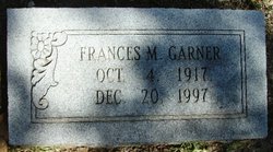
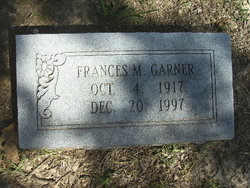
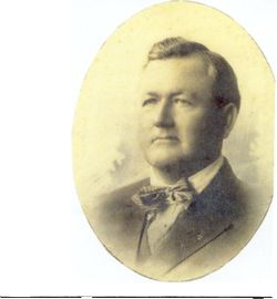
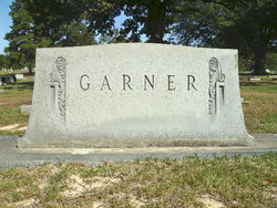
Frances Page Mays Garner
| Birth | : | 4 Oct 1917 Arkansas, USA |
| Death | : | 20 Dec 1997 Pulaski County, Arkansas, USA |
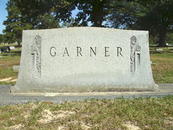
| Burial | : | East Side Cemetery, Estherville, Emmet County, USA |
| Coordinate | : | 43.4068985, -94.8264008 |
| Description | : | PINE BLUFF COMMERCIAL MONDAY, DECEMBER 22, 1997 LITTLE ROCK-- Frances M. Garner, 80, of Fordyce, died December 20, 1997, at St. Vincent Infirmary Medical Center. Born October 4, 1917, she was a daughter of Robert W. Mays and Louise Haygood Walthall. She was a homemaker and a member of First Methodist Church of Fordyce. Survivors include her husband, Clyde F. Garner, two daughters, Nancy G. Wood of Little Rock and Jean G. Estes of Dumas; two brothers, George Mays of Pine Bluff and... Read More |
frequently asked questions (FAQ):
-
Where is Frances Page Mays Garner's memorial?
Frances Page Mays Garner's memorial is located at: East Side Cemetery, Estherville, Emmet County, USA.
-
When did Frances Page Mays Garner death?
Frances Page Mays Garner death on 20 Dec 1997 in Pulaski County, Arkansas, USA
-
Where are the coordinates of the Frances Page Mays Garner's memorial?
Latitude: 43.4068985
Longitude: -94.8264008
Family Members:
Parent
Spouse
Siblings
Flowers:
Nearby Cemetories:
1. East Side Cemetery
Estherville, Emmet County, USA
Coordinate: 43.4068985, -94.8264008
2. East Side Memorial Cemetery
Estherville, Emmet County, USA
Coordinate: 43.4267750, -94.8265600
3. Oak Hill Cemetery
Estherville, Emmet County, USA
Coordinate: 43.3986015, -94.8518982
4. Norwegian Cemetery
Estherville, Emmet County, USA
Coordinate: 43.4291992, -94.8261032
5. Saint Patricks Cemetery
Estherville, Emmet County, USA
Coordinate: 43.3843994, -94.8283005
6. Estherville Lutheran Cemetery
Estherville, Emmet County, USA
Coordinate: 43.4298000, -94.8263000
7. Prosser Cemetery
Estherville, Emmet County, USA
Coordinate: 43.4422000, -94.7783000
8. Superior Township Cemetery
Superior, Dickinson County, USA
Coordinate: 43.4399986, -94.9533005
9. Wallingford Lutheran Cemetery
Wallingford, Emmet County, USA
Coordinate: 43.3128014, -94.7731018
10. Union State Line Cemetery
Dickinson County, USA
Coordinate: 43.4928017, -94.9156036
11. Center Township Cemetery
Emmet County, USA
Coordinate: 43.3608000, -94.6790000
12. Ellsworth Cemetery
Emmet County, USA
Coordinate: 43.5005989, -94.7249985
13. Richland Township Cemetery
Terril, Dickinson County, USA
Coordinate: 43.3565323, -94.9927821
14. Petersburg Cemetery
Jackson County, USA
Coordinate: 43.5224991, -94.9182968
15. Fairview Cemetery
Terril, Dickinson County, USA
Coordinate: 43.2977982, -94.9349976
16. Swan Lake Township Cemetery
Maple Hill, Emmet County, USA
Coordinate: 43.3850746, -94.6381378
17. High Lake Jack Creek Cemetery
Wallingford, Emmet County, USA
Coordinate: 43.3006500, -94.7000620
18. Saint Johns Lutheran Cemetery
Petersburg, Jackson County, USA
Coordinate: 43.5442009, -94.8780975
19. Lincoln Township Cemetery
Dolliver, Emmet County, USA
Coordinate: 43.4441986, -94.6204987
20. Graettinger City Cemetery
Graettinger, Palo Alto County, USA
Coordinate: 43.2550011, -94.7722015
21. Palestine Cemetery
Dolliver, Emmet County, USA
Coordinate: 43.4880000, -94.6408000
22. Saint Jacobs Cemetery
Graettinger, Palo Alto County, USA
Coordinate: 43.2546997, -94.7705994
23. Lake Fremont Cemetery
Dunnell, Martin County, USA
Coordinate: 43.5691986, -94.7746964
24. Lake Belt Cemetery
Ceylon, Martin County, USA
Coordinate: 43.5353012, -94.6742020

