
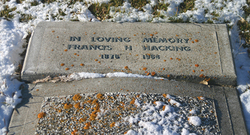
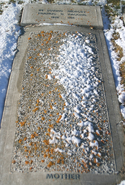


Francis Harriett Briggs Hacking
| Birth | : | 10 Jul 1878 Lehi, Utah County, Utah, USA |
| Death | : | 2 Apr 1964 Glenwood, Claresholm Census Division, Alberta, Canada |
| Burial | : | St Andrew Churchyard, Slaidburn, Ribble Valley Borough, England |
| Coordinate | : | 53.9641600, -2.4437090 |
| Plot | : | Block 01, Lot 34, Grave 15 |
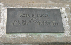
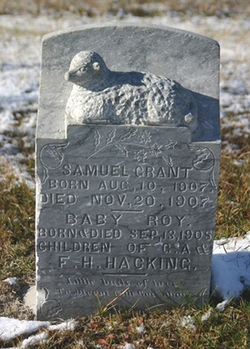
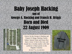
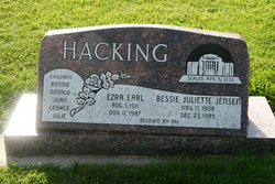
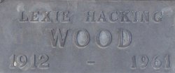
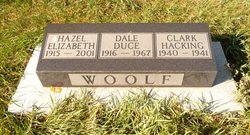
| Description | : | Frances Harriett was born to Samuel and Emma (Thomas) Briggs in Lehi, Utah, Utah, USA. On 16 Jun 1900, she married George Albert or Alfred Hacking in the same town. Their first child, Edith, was born in Utah, but the rest of their children were born in Canada, starting with George Reed Hacking in November of 1903, the same year of their arrival in the Magrath area. Children: Edith Hacking Sheffield George Reed Hacking Samuel Grant Hacking Ernest Roy Hacking Joseph Hacking Ezra Earl Hacking Lexie Hacking Wood Wayne Briggs Hacking Hazel Elizabeth "Beth" Hacking Woolf Dorothy Hacking Smith |
frequently asked questions (FAQ):
-
Where is Francis Harriett Briggs Hacking's memorial?
Francis Harriett Briggs Hacking's memorial is located at: St Andrew Churchyard, Slaidburn, Ribble Valley Borough, England.
-
When did Francis Harriett Briggs Hacking death?
Francis Harriett Briggs Hacking death on 2 Apr 1964 in Glenwood, Claresholm Census Division, Alberta, Canada
-
Where are the coordinates of the Francis Harriett Briggs Hacking's memorial?
Latitude: 53.9641600
Longitude: -2.4437090
Family Members:
Parent
Spouse
Siblings
Children

Flowers:


Nearby Cemetories:
1. St James Churchyard
Tosside, Ribble Valley Borough, England
Coordinate: 53.9940290, -2.4029690
2. St Hubert Roman Catholic Churchyard
Dunsop Bridge, Ribble Valley Borough, England
Coordinate: 53.9460100, -2.5246900
3. Holden Chapel
Bolton-by-Bowland, Ribble Valley Borough, England
Coordinate: 53.9420850, -2.3500060
4. Mount Sion Independent Chapelyard
Tosside, Ribble Valley Borough, England
Coordinate: 53.9982500, -2.3578200
5. St Bartholomew Churchyard
Tosside, Ribble Valley Borough, England
Coordinate: 54.0002500, -2.3536700
6. St. Michael's Churchyard
Whitewell, Ribble Valley Borough, England
Coordinate: 53.9167560, -2.5209540
7. Grindleton Methodist Cemetery
Grindleton, Ribble Valley Borough, England
Coordinate: 53.9080420, -2.3684420
8. St Peter and St Paul Churchyard
Bolton-by-Bowland, Ribble Valley Borough, England
Coordinate: 53.9399800, -2.3270300
9. St Ambrose Churchyard
Grindleton, Ribble Valley Borough, England
Coordinate: 53.9061710, -2.3633270
10. St Helen Churchyard
Waddington, Ribble Valley Borough, England
Coordinate: 53.8898700, -2.4143900
11. Sawley Abbey
Sawley, Ribble Valley Borough, England
Coordinate: 53.9131920, -2.3417080
12. Christ Churchyard
Chatburn, Ribble Valley Borough, England
Coordinate: 53.8940690, -2.3515030
13. Clitheroe Cemetery
Clitheroe, Ribble Valley Borough, England
Coordinate: 53.8779250, -2.3984550
14. St. Joseph's Roman Catholic Cemetery
Clitheroe, Ribble Valley Borough, England
Coordinate: 53.8770700, -2.3960000
15. St Mary Magdalene Churchyard
Clitheroe, Ribble Valley Borough, England
Coordinate: 53.8740980, -2.3903420
16. St. Leonard's Churchyard
Downham, Ribble Valley Borough, England
Coordinate: 53.8944340, -2.3294250
17. Trinity Methodist Churchyard
Clitheroe, Ribble Valley Borough, England
Coordinate: 53.8709060, -2.3954550
18. St James Churchyard
Clitheroe, Ribble Valley Borough, England
Coordinate: 53.8659600, -2.3922700
19. Brocklands Woodland Burial Site
Rathmell, Craven District, England
Coordinate: 54.0275720, -2.2998880
20. Holy Trinity Churchyard
Rathmell, Craven District, England
Coordinate: 54.0351000, -2.3002300
21. St. Bartholomew Churchyard
Chipping, Ribble Valley Borough, England
Coordinate: 53.8846800, -2.5764100
22. St. Mary the Virgin Churchyard
Gisburn, Ribble Valley Borough, England
Coordinate: 53.9356080, -2.2605210
23. Chipping Congregational Churchyard
Chipping, Ribble Valley Borough, England
Coordinate: 53.8836000, -2.5777700
24. Salem Congregational Chapel Martin Top
Rimington, Ribble Valley Borough, England
Coordinate: 53.9072484, -2.2740463