| Birth | : | 8 Dec 1884 Farmington, Van Buren County, Iowa, USA |
| Death | : | 15 Jul 1980 Donnellson, Lee County, Iowa, USA |
| Burial | : | Springwell Cemetery, Omaha, Douglas County, USA |
| Coordinate | : | 41.3114014, -96.0096970 |
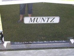
| Description | : | FARMINGTON – A funeral for Frank E. Muntz, 95, of Farmington, who died today at Donnellson Manor Care Center, will be at 10 a.m., Thursday in the United Methodist Church at Farmington with Robert Hambright officiating. Burial will be in Thompson Cemetery near Bonaparte. Friends may call at Hofbauer Funeral Home at Farmington at 7:30 p.m., Wednesday. He was born Dec. 8, 1884, at Bonaparte, the son of Jacob and Josephine Simmons Muntz. He married Elsie McElroy in 1907. She preceded him in death. He married ZoeFtta Swift in 1915. He was a lifelong resident of Farmington and a retired... Read More |
frequently asked questions (FAQ):
-
Where is Frank Edmund Muntz's memorial?
Frank Edmund Muntz's memorial is located at: Springwell Cemetery, Omaha, Douglas County, USA.
-
When did Frank Edmund Muntz death?
Frank Edmund Muntz death on 15 Jul 1980 in Donnellson, Lee County, Iowa, USA
-
Where are the coordinates of the Frank Edmund Muntz's memorial?
Latitude: 41.3114014
Longitude: -96.0096970
Family Members:
Parent
Spouse
Siblings
Children
Flowers:
Nearby Cemetories:
1. Springwell Cemetery
Omaha, Douglas County, USA
Coordinate: 41.3114014, -96.0096970
2. Servants of Mary Cemetery
Omaha, Douglas County, USA
Coordinate: 41.3017170, -96.0258260
3. Mount Sinai Cemetery
Omaha, Douglas County, USA
Coordinate: 41.3116989, -96.0314026
4. Mount Hope Cemetery
Omaha, Douglas County, USA
Coordinate: 41.3041992, -96.0310974
5. Forest Lawn Memorial Park
Omaha, Douglas County, USA
Coordinate: 41.3272018, -95.9847031
6. Potter Field
Omaha, Douglas County, USA
Coordinate: 41.3320274, -95.9902878
7. Pleasant Hill Jewish Cemetery
Omaha, Douglas County, USA
Coordinate: 41.3185997, -95.9766998
8. Golden Hill Cemetery
Omaha, Douglas County, USA
Coordinate: 41.3050003, -95.9744034
9. Mormon Pioneer Cemetery
Omaha, Douglas County, USA
Coordinate: 41.3348450, -95.9663720
10. All Saints Episcopal Church Columbarium
Omaha, Douglas County, USA
Coordinate: 41.2785000, -96.0579000
11. Prospect Hill Cemetery
Omaha, Douglas County, USA
Coordinate: 41.2780991, -95.9593964
12. Nash Chapel Crypt
Omaha, Douglas County, USA
Coordinate: 41.2665090, -95.9721790
13. Union Memorial Cemetery
Omaha, Douglas County, USA
Coordinate: 41.3512611, -96.0620193
14. Holy Sepulchre Cemetery
Omaha, Douglas County, USA
Coordinate: 41.2543983, -95.9875031
15. First Central Congregational Columbarium
Omaha, Douglas County, USA
Coordinate: 41.2563456, -95.9658365
16. Saint Andrews Episcopal Church Columbarium
Omaha, Douglas County, USA
Coordinate: 41.2492500, -96.0427500
17. Countryside Community Church Columbarium
Omaha, Douglas County, USA
Coordinate: 41.2483660, -96.0500270
18. Ak-Sar-Ben Racetrack Grounds
Omaha, Douglas County, USA
Coordinate: 41.2414703, -96.0159607
19. Douglas County Poor Farm Cemetery
Omaha, Douglas County, USA
Coordinate: 41.2437240, -95.9723480
20. Bohemian Cemetery
Omaha, Douglas County, USA
Coordinate: 41.2388992, -95.9955978
21. Trinity Cathedral Columbarium
Omaha, Douglas County, USA
Coordinate: 41.2603900, -95.9393660
22. Evergreen Memorial Park Cemetery
Omaha, Douglas County, USA
Coordinate: 41.2393990, -96.0355988
23. Calvary Cemetery
Omaha, Douglas County, USA
Coordinate: 41.2364006, -96.0294037
24. Westlawn-Hillcrest Memorial Park
Omaha, Douglas County, USA
Coordinate: 41.2346992, -95.9966965


