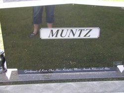
| Birth | : | 16 Jun 1917 Farmington, Van Buren County, Iowa, USA |
| Death | : | 29 Aug 1929 |
| Burial | : | Springwell Cemetery, Omaha, Douglas County, USA |
| Coordinate | : | 41.3114014, -96.0096970 |
| Description | : | She died of appendicitis. The source of this information is "Seed of Simon - Ancestors and Descendants of John and Susannah Simmons" compiled by Dolores Simmons Redding. Published by Mitchell Printing, Lakeland, Florida. From Find a Grave contributor46629045: Josephine Muntz dead Miss Josephine Muntz, twelve year old daughter of Mr. & Mrs. Frank Muntz of near Farmington died at Kirksville, Mo., at the hospital, Thursday morning August 29. She underwent an operation Wednesday for appendcitis, from whish she failed to recover. She leaves to mourn their loss her father and mother and three brothers, Elwin, Herald, and Keith and a half brother... Read More |
frequently asked questions (FAQ):
-
Where is Loretta Josephine Muntz's memorial?
Loretta Josephine Muntz's memorial is located at: Springwell Cemetery, Omaha, Douglas County, USA.
-
When did Loretta Josephine Muntz death?
Loretta Josephine Muntz death on 29 Aug 1929 in
-
Where are the coordinates of the Loretta Josephine Muntz's memorial?
Latitude: 41.3114014
Longitude: -96.0096970
Family Members:
Parent
Siblings
Flowers:
Nearby Cemetories:
1. Springwell Cemetery
Omaha, Douglas County, USA
Coordinate: 41.3114014, -96.0096970
2. Servants of Mary Cemetery
Omaha, Douglas County, USA
Coordinate: 41.3017170, -96.0258260
3. Mount Sinai Cemetery
Omaha, Douglas County, USA
Coordinate: 41.3116989, -96.0314026
4. Mount Hope Cemetery
Omaha, Douglas County, USA
Coordinate: 41.3041992, -96.0310974
5. Forest Lawn Memorial Park
Omaha, Douglas County, USA
Coordinate: 41.3272018, -95.9847031
6. Potter Field
Omaha, Douglas County, USA
Coordinate: 41.3320274, -95.9902878
7. Pleasant Hill Jewish Cemetery
Omaha, Douglas County, USA
Coordinate: 41.3185997, -95.9766998
8. Golden Hill Cemetery
Omaha, Douglas County, USA
Coordinate: 41.3050003, -95.9744034
9. Mormon Pioneer Cemetery
Omaha, Douglas County, USA
Coordinate: 41.3348450, -95.9663720
10. All Saints Episcopal Church Columbarium
Omaha, Douglas County, USA
Coordinate: 41.2785000, -96.0579000
11. Prospect Hill Cemetery
Omaha, Douglas County, USA
Coordinate: 41.2780991, -95.9593964
12. Nash Chapel Crypt
Omaha, Douglas County, USA
Coordinate: 41.2665090, -95.9721790
13. Union Memorial Cemetery
Omaha, Douglas County, USA
Coordinate: 41.3512611, -96.0620193
14. Holy Sepulchre Cemetery
Omaha, Douglas County, USA
Coordinate: 41.2543983, -95.9875031
15. First Central Congregational Columbarium
Omaha, Douglas County, USA
Coordinate: 41.2563456, -95.9658365
16. Saint Andrews Episcopal Church Columbarium
Omaha, Douglas County, USA
Coordinate: 41.2492500, -96.0427500
17. Countryside Community Church Columbarium
Omaha, Douglas County, USA
Coordinate: 41.2483660, -96.0500270
18. Ak-Sar-Ben Racetrack Grounds
Omaha, Douglas County, USA
Coordinate: 41.2414703, -96.0159607
19. Douglas County Poor Farm Cemetery
Omaha, Douglas County, USA
Coordinate: 41.2437240, -95.9723480
20. Bohemian Cemetery
Omaha, Douglas County, USA
Coordinate: 41.2388992, -95.9955978
21. Trinity Cathedral Columbarium
Omaha, Douglas County, USA
Coordinate: 41.2603900, -95.9393660
22. Evergreen Memorial Park Cemetery
Omaha, Douglas County, USA
Coordinate: 41.2393990, -96.0355988
23. Calvary Cemetery
Omaha, Douglas County, USA
Coordinate: 41.2364006, -96.0294037
24. Westlawn-Hillcrest Memorial Park
Omaha, Douglas County, USA
Coordinate: 41.2346992, -95.9966965


