
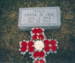
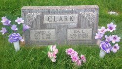
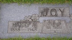
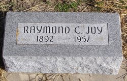
Frank Myron Joy Sr.
| Birth | : | 2 Jun 1853 Calhoun County, Michigan, USA |
| Death | : | 23 Jan 1946 Gothenburg, Dawson County, Nebraska, USA |
| Burial | : | Saint Thomas Cemetery, Coeur d'Alene, Kootenai County, USA |
| Coordinate | : | 47.6727982, -116.7536011 |
frequently asked questions (FAQ):
-
Where is Frank Myron Joy Sr.'s memorial?
Frank Myron Joy Sr.'s memorial is located at: Saint Thomas Cemetery, Coeur d'Alene, Kootenai County, USA.
-
When did Frank Myron Joy Sr. death?
Frank Myron Joy Sr. death on 23 Jan 1946 in Gothenburg, Dawson County, Nebraska, USA
-
Where are the coordinates of the Frank Myron Joy Sr.'s memorial?
Latitude: 47.6727982
Longitude: -116.7536011
Family Members:
Parent

Spouse
Siblings
Children
Flowers:


Nearby Cemetories:
1. Saint Thomas Cemetery
Coeur d'Alene, Kootenai County, USA
Coordinate: 47.6727982, -116.7536011
2. Saint Lukes Columbarium
Coeur d'Alene, Kootenai County, USA
Coordinate: 47.6767400, -116.7794800
3. Forest Cemetery
Coeur d'Alene, Kootenai County, USA
Coordinate: 47.6833600, -116.7888700
4. Riverview Cemetery
Coeur d'Alene, Kootenai County, USA
Coordinate: 47.6852798, -116.7916718
5. Bestland Cemetery
Coeur d'Alene, Kootenai County, USA
Coordinate: 47.7033005, -116.7727966
6. Saint Pius Parish Cemetery
Coeur d'Alene, Kootenai County, USA
Coordinate: 47.7038050, -116.7771900
7. Coeur d'Alene Memorial Gardens
Coeur d'Alene, Kootenai County, USA
Coordinate: 47.7380250, -116.7879720
8. Prairie View Cemetery
Coeur d'Alene, Kootenai County, USA
Coordinate: 47.7369385, -116.8083267
9. Kootenai County Cemetery
Post Falls, Kootenai County, USA
Coordinate: 47.7052803, -116.8627777
10. Saint John The Baptist Antiochian Orthodox Church
Post Falls, Kootenai County, USA
Coordinate: 47.7255000, -116.8842000
11. Post Falls 7th Day Adventist
Kootenai County, USA
Coordinate: 47.7309600, -116.9044010
12. Loffs Bay Cemetery
Coeur d'Alene, Kootenai County, USA
Coordinate: 47.5663900, -116.8258470
13. Evergreen Cemetery
Post Falls, Kootenai County, USA
Coordinate: 47.7358017, -116.9464035
14. Ford Family Graveyard
Harrison, Kootenai County, USA
Coordinate: 47.5281200, -116.7994400
15. Rimrock Cemetery
Garwood, Kootenai County, USA
Coordinate: 47.8246994, -116.7632980
16. Pine Grove Cemetery
Rathdrum, Kootenai County, USA
Coordinate: 47.8183100, -116.8736200
17. Pleasant View Cemetery
Post Falls, Kootenai County, USA
Coordinate: 47.6961000, -117.0111000
18. Mount Calvary Cemetery
Rathdrum, Kootenai County, USA
Coordinate: 47.8109055, -116.9901505
19. Medimont Cemetery
Medimont, Kootenai County, USA
Coordinate: 47.4780579, -116.6044464
20. Lane Cemetery
Kootenai County, USA
Coordinate: 47.5074997, -116.5369034
21. Harrison Cemetery
Harrison, Kootenai County, USA
Coordinate: 47.4495500, -116.7730800
22. Harrison
Harrison, Kootenai County, USA
Coordinate: 47.4492428, -116.7722339
23. Rose Lake Cemetery
Rose Lake, Kootenai County, USA
Coordinate: 47.5580559, -116.4497223
24. Mica Peak Cemetery
Saxby, Spokane County, USA
Coordinate: 47.5078011, -117.0764008