
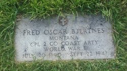
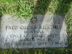
Fritjof Oscar “Fred” Bjertnes
| Birth | : | 20 Jul 1890 Underwood, Otter Tail County, Minnesota, USA |
| Death | : | 22 Sep 1947 Havre, Hill County, Montana, USA |
| Burial | : | Highland Cemetery, Havre, Hill County, USA |
| Coordinate | : | 48.5463982, -109.6900024 |
| Plot | : | Space A, Lot 31, Block 20 |
| Description | : | Billings Gazette (MT), 24 Sept 1947 Searchers Recover Body of Drowned Havre Carpenter Havre, Sept. 23--The body of Fred Bjertness, 57, Havre carpenter, who accidentally fell into the Milk river here and drowned Monday night, was recovered by searchers Tuesday. Bjertness was making his way homeward when he apparently slipped off the bank and plunged into the river. His shouts were heard by Elmer Croff and Fred Cyr, whose efforts to reach him failed in the dark. Bjertness came to Hill County in 1910. He was unmarried, and is survived by his mother and four sisters. |
frequently asked questions (FAQ):
-
Where is Fritjof Oscar “Fred” Bjertnes's memorial?
Fritjof Oscar “Fred” Bjertnes's memorial is located at: Highland Cemetery, Havre, Hill County, USA.
-
When did Fritjof Oscar “Fred” Bjertnes death?
Fritjof Oscar “Fred” Bjertnes death on 22 Sep 1947 in Havre, Hill County, Montana, USA
-
Where are the coordinates of the Fritjof Oscar “Fred” Bjertnes's memorial?
Latitude: 48.5463982
Longitude: -109.6900024
Family Members:
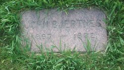
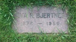
Parent
Siblings

Flowers:


Nearby Cemetories:
1. Highland Cemetery
Havre, Hill County, USA
Coordinate: 48.5463982, -109.6900024
2. Calvary Cemetery
Havre, Hill County, USA
Coordinate: 48.5457000, -109.6883000
3. Mount Hope Cemetery
Havre, Hill County, USA
Coordinate: 48.5540000, -109.7050000
4. Sunset Garden Park
Havre, Hill County, USA
Coordinate: 48.5531006, -109.8019028
5. North Havre Lutheran Church Graveyard (Defunct)
Havre, Hill County, USA
Coordinate: 48.6538903, -109.6815870
6. Grainbelt Cemetery
Hill County, USA
Coordinate: 48.6828003, -109.8657990
7. Andrew S. Lohman Grave Site
Lohman, Blaine County, USA
Coordinate: 48.5903520, -109.4073350
8. East End Colony Cemetery
East End Colony, Hill County, USA
Coordinate: 48.7485000, -109.5474000
9. Hilldale Hutterite Colony Cemetery
Hilldale Colony, Hill County, USA
Coordinate: 48.7997000, -109.7872000
10. Saint Johns Catholic Cemetery
Havre, Hill County, USA
Coordinate: 48.7625008, -109.9638977
11. Saint Gabriel Cemetery
Chinook, Blaine County, USA
Coordinate: 48.6065200, -109.2531200
12. Kuper Memorial Cemetery
Chinook, Blaine County, USA
Coordinate: 48.6083100, -109.2531200
13. Rocky Boy Cemetery
Rocky Boy, Hill County, USA
Coordinate: 48.2572410, -109.7923690
14. Box Elder Cemetery
Box Elder, Hill County, USA
Coordinate: 48.3274000, -110.0095000
15. Rocky Boy Gravel Cemetery
Rocky Boy, Hill County, USA
Coordinate: 48.2427720, -109.7596500
16. Cottonwood Lutheran Church Cemetery
Havre, Hill County, USA
Coordinate: 48.4545000, -110.1748000
17. Bear Paw Battlefield
Chinook, Blaine County, USA
Coordinate: 48.3780070, -109.2121290
18. Hungry Hollow Cemetery
Blaine County, USA
Coordinate: 48.2103004, -109.4677963
19. Milk River Valley Church Graveyard
Hill County, USA
Coordinate: 48.6787180, -110.2261080
20. Hollandville Cemetery
Chinook, Blaine County, USA
Coordinate: 48.6960310, -109.1557200
21. Gildford Hill County Cemetery
Gildford, Hill County, USA
Coordinate: 48.5778008, -110.2957993
22. Prairie Chapel United Brethren Cemetery
Chinook, Blaine County, USA
Coordinate: 48.8860000, -109.3414000
23. Mennonite Brethren Cemetery
Chinook, Blaine County, USA
Coordinate: 48.8012560, -109.1980620
24. Bethel Bruderthaler Mennonite Church Cemetery
Chinook, Blaine County, USA
Coordinate: 48.7552000, -109.1345000