George Bemis Woodbury
| Birth | : | 20 Feb 1876 Castleton, Rutland County, Vermont, USA |
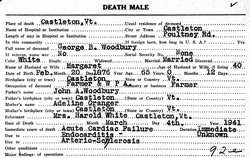
| Death | : | 4 Mar 1941 Castleton, Rutland County, Vermont, USA |
| Burial | : | Oak Grove Cemetery, Oak Grove, Chester County, USA |
| Coordinate | : | 35.4025002, -88.5858002 |
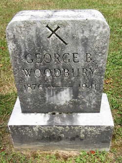
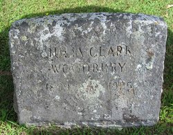
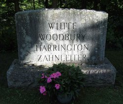
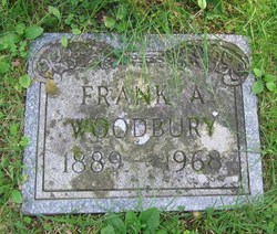
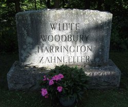
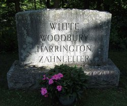
| Inscription | : | GEORGE B. WOODBURY 1876 - 1941 |
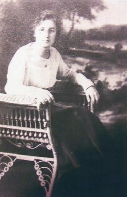
| Description | : | Son of John A. Woodbury and Adeline L. Granger. . Husband of: . 1) Julia Demaris Clark, whom he married in Castleton, Rutland, VT, on May 24, 1900; . 2) Marjorie Baker, whom he married on January 1, 1929, in Castleton, Rutland, VT. . |
frequently asked questions (FAQ):
-
Where is George Bemis Woodbury's memorial?
George Bemis Woodbury's memorial is located at: Oak Grove Cemetery, Oak Grove, Chester County, USA.
-
When did George Bemis Woodbury death?
George Bemis Woodbury death on 4 Mar 1941 in Castleton, Rutland County, Vermont, USA
-
Where are the coordinates of the George Bemis Woodbury's memorial?
Latitude: 35.4025002
Longitude: -88.5858002
Family Members:
Parent
Spouse
Siblings
Children
Flowers:
Nearby Cemetories:
1. Oak Grove Cemetery
Oak Grove, Chester County, USA
Coordinate: 35.4025002, -88.5858002
2. Robinson Cemetery
Chester County, USA
Coordinate: 35.4011002, -88.5642014
3. Robertson Cemetery
Henderson, Chester County, USA
Coordinate: 35.4013460, -88.5639870
4. Old Oak Grove Cemetery
Henderson, Chester County, USA
Coordinate: 35.3879000, -88.5727200
5. Faith Baptist Church Cemetery
Henderson, Chester County, USA
Coordinate: 35.4155970, -88.5666890
6. Trice's Chapel Cemetery
Jacks Creek, Chester County, USA
Coordinate: 35.4284800, -88.5915870
7. Ross Cemetery
Henderson, Chester County, USA
Coordinate: 35.4252000, -88.6088000
8. Brummer Cemetery
Henderson, Chester County, USA
Coordinate: 35.4262740, -88.6114100
9. Tillman's Chapel Cemetery
Henderson, Chester County, USA
Coordinate: 35.3894610, -88.6225830
10. Harmony Cemetery
Chester County, USA
Coordinate: 35.3960991, -88.6311035
11. Kerby Family Cemetery
Finger, McNairy County, USA
Coordinate: 35.3656810, -88.5971940
12. White Plains Cemetery
Finger, McNairy County, USA
Coordinate: 35.3731670, -88.5516960
13. Anderson Slave Cemetery
Finger, McNairy County, USA
Coordinate: 35.3598000, -88.5659000
14. Chester County Memory Gardens
Henderson, Chester County, USA
Coordinate: 35.4100760, -88.6411590
15. Estes Church of Christ Cemetery
Henderson, Chester County, USA
Coordinate: 35.3858370, -88.6398660
16. Malone Cemetery
Finger, McNairy County, USA
Coordinate: 35.3602440, -88.5572960
17. Finger Church Cemetery
Finger, McNairy County, USA
Coordinate: 35.3581900, -88.6107260
18. Old Estes Cemetery
Henderson, Chester County, USA
Coordinate: 35.3859790, -88.6462870
19. Finger Christian Fellowship Cemetery
Finger, McNairy County, USA
Coordinate: 35.3576110, -88.6189170
20. Sweetlips Cemetery
Sweet Lips, Chester County, USA
Coordinate: 35.3992004, -88.5205994
21. Massengill Cemetery
Jacks Creek, Chester County, USA
Coordinate: 35.4299500, -88.5287180
22. Smith Cemetery
Henderson, Chester County, USA
Coordinate: 35.4502983, -88.6207962
23. Hopewell Church Cemetery
Finger, McNairy County, USA
Coordinate: 35.3758011, -88.5203018
24. Hart Cemetery
Chester County, USA
Coordinate: 35.4575005, -88.5552979

