
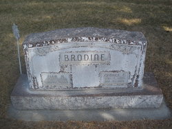

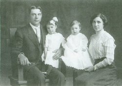
George Ervin Brodine
| Birth | : | 1 Sep 1885 Elm Creek, Buffalo County, Nebraska, USA |
| Death | : | 15 Jan 1961 Omaha, Douglas County, Nebraska, USA |
| Burial | : | All Saints Churchyard, Dickleburgh and Rushall, South Norfolk District, England |
| Coordinate | : | 52.3968580, 1.1848010 |
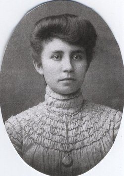
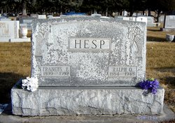
| Description | : | Husband of Ella H.Brodine and Frances E.Hesp Brodine |
frequently asked questions (FAQ):
-
Where is George Ervin Brodine's memorial?
George Ervin Brodine's memorial is located at: All Saints Churchyard, Dickleburgh and Rushall, South Norfolk District, England.
-
When did George Ervin Brodine death?
George Ervin Brodine death on 15 Jan 1961 in Omaha, Douglas County, Nebraska, USA
-
Where are the coordinates of the George Ervin Brodine's memorial?
Latitude: 52.3968580
Longitude: 1.1848010
Family Members:
Parent

Spouse
Siblings
Children
Flowers:


Nearby Cemetories:
1. All Saints Churchyard
Dickleburgh and Rushall, South Norfolk District, England
Coordinate: 52.3968580, 1.1848010
2. St. George's Churchyard
Shimpling, Babergh District, England
Coordinate: 52.3994010, 1.1680910
3. Saint George Churchyard
Shimpling, South Norfolk District, England
Coordinate: 52.3993000, 1.1680000
4. St Mary Churchyard
Dickleburgh and Rushall, South Norfolk District, England
Coordinate: 52.3978750, 1.2290680
5. Saint Mary the Virgin Churchyard
Burston, South Norfolk District, England
Coordinate: 52.4049300, 1.1402600
6. St Leonard Churchyard
Billingford, South Norfolk District, England
Coordinate: 52.3666290, 1.1834260
7. Saint Mary Churchyard
Gissing, South Norfolk District, England
Coordinate: 52.4235630, 1.1548260
8. Saint Andrew Churchyard
Scole, South Norfolk District, England
Coordinate: 52.3671670, 1.1579150
9. St Andrew's Frenze Church
Scole, South Norfolk District, England
Coordinate: 52.3802000, 1.1361000
10. St. Peter and St. Paul Churchyard
Brockdish, South Norfolk District, England
Coordinate: 52.3705240, 1.2366100
11. Pulham Market Cemetery
Pulham Market, South Norfolk District, England
Coordinate: 52.4281900, 1.2297700
12. Saint Mary Magdalene Churchyard
Pulham Market, South Norfolk District, England
Coordinate: 52.4285200, 1.2301100
13. St. Margaret's Churchyard
Syleham, Mid Suffolk District, England
Coordinate: 52.3641870, 1.2372060
14. Saint Peter and St. Paul Churchyard
Hoxne, Mid Suffolk District, England
Coordinate: 52.3522270, 1.2016300
15. St. Nicholas Churchyard
Oakley, Mid Suffolk District, England
Coordinate: 52.3518380, 1.1662190
16. Diss Cemetery
Diss, South Norfolk District, England
Coordinate: 52.3839060, 1.1115880
17. St Mary the Virgin Churchyard
Pulham St Mary, South Norfolk District, England
Coordinate: 52.4205290, 1.2520380
18. Saint Mary Churchyard
Diss, South Norfolk District, England
Coordinate: 52.3772370, 1.1097880
19. Diss War Memorial
Diss, South Norfolk District, England
Coordinate: 52.3773380, 1.1088530
20. All Saints Churchyard
Stuston, Mid Suffolk District, England
Coordinate: 52.3571980, 1.1332590
21. Croft Lane Baptist Church Burial Ground
Diss, South Norfolk District, England
Coordinate: 52.3771070, 1.1025490
22. Unitarian Chapel Cemetery
Palgrave, Mid Suffolk District, England
Coordinate: 52.3693130, 1.1086820
23. All Saints Churchyard
Shelfanger, South Norfolk District, England
Coordinate: 52.4104780, 1.0969230
24. St Peter Churchyard
Needham, South Norfolk District, England
Coordinate: 52.3896320, 1.2773700