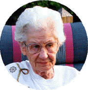
Georgia Irene Johnson Parks
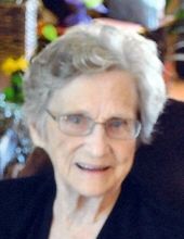
| Birth | : | 23 Oct 1917 Petersburg, Boone County, Nebraska, USA |
| Death | : | 28 May 2001 Columbus, Platte County, Nebraska, USA |
| Burial | : | St Mary Churchyard, Greenhow Hill, Harrogate Borough, England |
| Coordinate | : | 54.0734500, -1.8298000 |
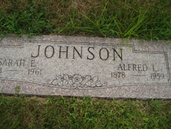
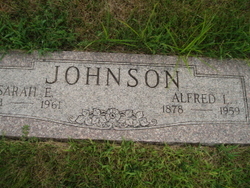
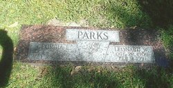
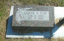
| Description | : | Daughter of Alfred & Sarah (Louden) Johnson. The family moved to Columbus in 1927. She graduated from Columbus High School. On August 8, 1947 she married Leonard Parks in North Platte, Nebraska. She was a homemaker. Georgia was a member of Trinity Lutheran Church and a charter member of the Eagles Auxiliary. She enjoyed gardening, crossword puzzles, and going to the horse races. She especially enjoyed her time with her grandchildren and great-grandchildren. Memorials may be directed to the Higgins Memorial Project. Georgia is survived by: Daughter - Connie Fyfe - Columbus, NE Daughter - Judy Sacosky - Portland, OR Daughter -... Read More |
frequently asked questions (FAQ):
-
Where is Georgia Irene Johnson Parks's memorial?
Georgia Irene Johnson Parks's memorial is located at: St Mary Churchyard, Greenhow Hill, Harrogate Borough, England.
-
When did Georgia Irene Johnson Parks death?
Georgia Irene Johnson Parks death on 28 May 2001 in Columbus, Platte County, Nebraska, USA
-
Where are the coordinates of the Georgia Irene Johnson Parks's memorial?
Latitude: 54.0734500
Longitude: -1.8298000
Family Members:
Parent
Spouse
Siblings
Children
Flowers:
Nearby Cemetories:
1. St Mary Churchyard
Greenhow Hill, Harrogate Borough, England
Coordinate: 54.0734500, -1.8298000
2. St. Cuthbert's Churchyard
Pateley Bridge, Harrogate Borough, England
Coordinate: 54.0878310, -1.7584560
3. Pateley Bridge Cemetery
Pateley Bridge, Harrogate Borough, England
Coordinate: 54.0843510, -1.7536700
4. St. Mary The Virgin Churchyard
Pateley Bridge, Harrogate Borough, England
Coordinate: 54.0853430, -1.7519550
5. St. Mary the Virgin Churchyard
Ramsgill, Harrogate Borough, England
Coordinate: 54.1340320, -1.8189890
6. Holy Trinity Cemetery
Thruscross, Harrogate Borough, England
Coordinate: 54.0259440, -1.7646110
7. St Saviour Churchyard
Thornthwaite, Harrogate Borough, England
Coordinate: 54.0288750, -1.7372950
8. Friends Burial Ground
Dacre, Harrogate Borough, England
Coordinate: 54.0412270, -1.7161800
9. St Wilfrid Churchyard
Burnsall, Craven District, England
Coordinate: 54.0495000, -1.9520690
10. Providence United Reformed Churchyard
Dacre, Harrogate Borough, England
Coordinate: 54.0437240, -1.7074570
11. St Peter Churchyard
Hebden, Craven District, England
Coordinate: 54.0626500, -1.9618960
12. Holy Trinity Churchyard
Dacre, Harrogate Borough, England
Coordinate: 54.0563270, -1.6996410
13. St Chad Churchyard
Middlesmoor, Harrogate Borough, England
Coordinate: 54.1630080, -1.8597240
14. St Andrew Churchyard
Blubberhouses, Harrogate Borough, England
Coordinate: 53.9932200, -1.7455200
15. St Jude Churchyard
Hartwith-cum-Winsley, Harrogate Borough, England
Coordinate: 54.0506810, -1.6713070
16. St. Michael and All Angels Churchyard
Linton, Craven District, England
Coordinate: 54.0647950, -1.9933070
17. St. Mary and St. Cuthbert Priory Churchyard
Bolton Abbey, Craven District, England
Coordinate: 53.9825000, -1.8872220
18. Grassington Congregational Churchyard
Grassington, Craven District, England
Coordinate: 54.0723570, -1.9963100
19. St Peter Churchyard
Laverton, Harrogate Borough, England
Coordinate: 54.1418330, -1.7034960
20. Fewston Cemetery
Blubberhouses, Harrogate Borough, England
Coordinate: 53.9950600, -1.7176000
21. Quaker Burial Ground Hardcastle Garth
Hartwith-cum-Winsley, Harrogate Borough, England
Coordinate: 54.0390740, -1.6563110
22. St Michael and St Lawrence Churchyard
Fewston, Harrogate Borough, England
Coordinate: 53.9827830, -1.7040760
23. Chapel of Resurrection
Laverton, Harrogate Borough, England
Coordinate: 54.1469500, -1.6713100
24. St James Churchyard
Birstwith, Harrogate Borough, England
Coordinate: 54.0307600, -1.6367800

