

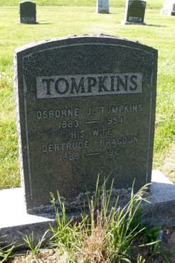
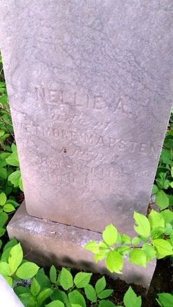
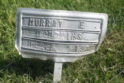
Gertrude Bragdon Tompkins
| Birth | : | 24 Nov 1888 Hartfield, York County, New Brunswick, Canada |
| Death | : | 21 Nov 1961 Southampton, York County, New Brunswick, Canada |
| Burial | : | Mount Olive Cemetery, Burnt House, Ritchie County, USA |
| Coordinate | : | 39.0531006, -80.9257965 |
frequently asked questions (FAQ):
-
Where is Gertrude Bragdon Tompkins's memorial?
Gertrude Bragdon Tompkins's memorial is located at: Mount Olive Cemetery, Burnt House, Ritchie County, USA.
-
When did Gertrude Bragdon Tompkins death?
Gertrude Bragdon Tompkins death on 21 Nov 1961 in Southampton, York County, New Brunswick, Canada
-
Where are the coordinates of the Gertrude Bragdon Tompkins's memorial?
Latitude: 39.0531006
Longitude: -80.9257965
Family Members:
Parent
Spouse
Siblings

Children
Flowers:


Nearby Cemetories:
1. Mount Olive Cemetery
Burnt House, Ritchie County, USA
Coordinate: 39.0531006, -80.9257965
2. New Mount Olive Cemetery
Burnt House, Ritchie County, USA
Coordinate: 39.0446100, -80.9340200
3. Newberne Cemetery
Gilmer County, USA
Coordinate: 39.0465510, -80.8910940
4. Spruce Creek Cemetery
Auburn, Ritchie County, USA
Coordinate: 39.0807300, -80.9083700
5. Roseville Church Cemetery
Gilmer County, USA
Coordinate: 39.0207880, -80.9547600
6. Goff Cemetery
Burnt House, Ritchie County, USA
Coordinate: 39.0361530, -80.9774200
7. Cooper Family Cemetery
Tanner, Gilmer County, USA
Coordinate: 39.0083050, -80.9255920
8. Abraham Bush Cemetery
Lucerne, Gilmer County, USA
Coordinate: 39.0184000, -80.8856806
9. Cooper Chapel Cemetery
Tanner, Gilmer County, USA
Coordinate: 39.0057800, -80.9161500
10. Horn Creek Baptist Church Cemetery
Gilmer County, USA
Coordinate: 39.0605700, -80.8633500
11. Bush Cemetery
Gilmer County, USA
Coordinate: 39.0203018, -80.8783035
12. Union Baptist Church Cemetery
Lucerne, Gilmer County, USA
Coordinate: 39.0200800, -80.8779200
13. Burnt House United Methodist Church Cemetery
Burnt House, Ritchie County, USA
Coordinate: 39.0487301, -80.9904470
14. Mount Liberty Cemetery
Tanner, Gilmer County, USA
Coordinate: 39.0086390, -80.9616440
15. Matthews Cemetery
Lucerne, Gilmer County, USA
Coordinate: 39.0112200, -80.8839100
16. Pine Low Gap Cemetery
Burnt House, Ritchie County, USA
Coordinate: 39.1006400, -80.9562200
17. Britton Cemetery
Hazelgreen, Ritchie County, USA
Coordinate: 39.0841500, -80.9894000
18. Fisher Cemetery
Troy, Gilmer County, USA
Coordinate: 39.0480500, -80.8400000
19. Hazelgreen Cemetery
Ritchie County, USA
Coordinate: 39.0853004, -81.0021973
20. N.H. Frederick Cemetery
Burnt House, Ritchie County, USA
Coordinate: 39.0525520, -81.0169120
21. Auburn Community Cemetery
Auburn, Ritchie County, USA
Coordinate: 39.0960999, -80.8533020
22. Pleasant Hill Cemetery
Berea, Ritchie County, USA
Coordinate: 39.1162100, -80.9682300
23. Good Shepherd Catholic Cemetery
Tanner, Gilmer County, USA
Coordinate: 38.9811830, -80.9447050
24. Auburn Baptist Church Cemetery
Auburn, Ritchie County, USA
Coordinate: 39.0819200, -80.8384600