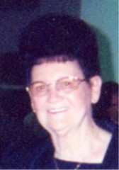
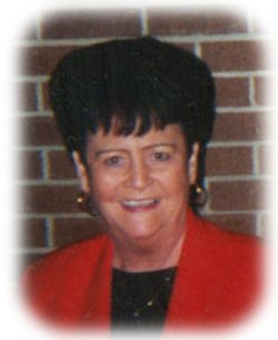
Gertrude “Gert” Evers Borchers
| Birth | : | 14 Jun 1925 Ackley, Hardin County, Iowa, USA |
| Death | : | 20 Feb 2007 Waterloo, Black Hawk County, Iowa, USA |
| Burial | : | St. Mary the Virgin Churchyard, Banham, Breckland Borough, England |
| Coordinate | : | 52.4529230, 1.0353120 |
| Plot | : | OC- 78-W4 |
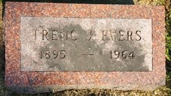
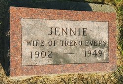
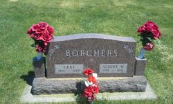
| Description | : | *** IN LOVING MEMORY OF *** Gertrude (Evers) Borchers was born on Sunday; June 14, 1925 in Ackley; Hardin County, Iowa. Gertrude was the daughter of Treno and Jennie (Hinders) Evers. She was united in marriage to Albert Borchers on September 9, 1970 at the First Presbyterian Church in Waterloo. Gert had helped her husband on the farm and was a member of the East Friesland Presbyterian Church at Ackley. Gertrude (Evers) Borchers, 81, of Ackley, passed away on Tuesday; February 20, 2007 at Allen Hospital in Waterloo; Black Hawk County, Iowa. Those left to mourn her passing... Read More |
frequently asked questions (FAQ):
-
Where is Gertrude “Gert” Evers Borchers's memorial?
Gertrude “Gert” Evers Borchers's memorial is located at: St. Mary the Virgin Churchyard, Banham, Breckland Borough, England.
-
When did Gertrude “Gert” Evers Borchers death?
Gertrude “Gert” Evers Borchers death on 20 Feb 2007 in Waterloo, Black Hawk County, Iowa, USA
-
Where are the coordinates of the Gertrude “Gert” Evers Borchers's memorial?
Latitude: 52.4529230
Longitude: 1.0353120
Family Members:
Spouse
Siblings
Flowers:
Nearby Cemetories:
1. St. Mary the Virgin Churchyard
Banham, Breckland Borough, England
Coordinate: 52.4529230, 1.0353120
2. St Mary's Churchyard Extension
Banham, Breckland Borough, England
Coordinate: 52.4549400, 1.0274400
3. Theddingworth Congregational Church yard
Theddingworth, Harborough District, England
Coordinate: 52.4644400, 1.0211700
4. Carmelite Monastery Cemetery
Quideham, Breckland Borough, England
Coordinate: 52.4498000, 0.9894000
5. Saint Mary Churchyard
Kenninghall, Breckland Borough, England
Coordinate: 52.4336980, 1.0010730
6. All Saints Churchyard
Old Buckenham, Breckland Borough, England
Coordinate: 52.4816260, 1.0433160
7. The Chapel Graveyard
Kenninghall, Breckland Borough, England
Coordinate: 52.4359530, 0.9961130
8. St. Martin's Churchyard
New Buckenham, Breckland Borough, England
Coordinate: 52.4728860, 1.0728380
9. St Andrews Churchyard
Quideham, Breckland Borough, England
Coordinate: 52.4493470, 0.9835550
10. Buckenham Priory
Buckenham, Broadland District, England
Coordinate: 52.4911000, 1.0497000
11. St. Mary the Virgin Churchyard
Eccles, Breckland Borough, England
Coordinate: 52.4649373, 0.9707904
12. All Saints Churchyard Hargham
Quideham, Breckland Borough, England
Coordinate: 52.4826470, 0.9732300
13. St Andrew Churchyard
Fersfield, South Norfolk District, England
Coordinate: 52.4043450, 1.0351310
14. Methodist Churchyard
North Lopham, Breckland Borough, England
Coordinate: 52.4053630, 0.9920680
15. St Nicholas Churchyard
North Lopham, Breckland Borough, England
Coordinate: 52.4029430, 0.9920510
16. All Saints Churchyard
Shelfanger, South Norfolk District, England
Coordinate: 52.4104780, 1.0969230
17. All Saints Churchyard
Carleton Rode, South Norfolk District, England
Coordinate: 52.4892230, 1.1133590
18. St Andrew Churchyard
South Lopham, Breckland Borough, England
Coordinate: 52.3957830, 0.9969650
19. East Harling Cemetery
East Harling, Breckland Borough, England
Coordinate: 52.4336498, 0.9346589
20. Parkside Garden
Attleborough, Breckland Borough, England
Coordinate: 52.5167420, 1.0209100
21. Carleton Rode Baptist Churchyard
Carleton Rode, South Norfolk District, England
Coordinate: 52.4937320, 1.1185210
22. St Peter & St Paul Church
Norwich, City of Norwich, England
Coordinate: 52.4408990, 0.9299175
23. St Peter and St Paul Churchyard
East Harling, Breckland Borough, England
Coordinate: 52.4373860, 0.9304050
24. Blessed Virgin Mary Churchyard
Attleborough, Breckland Borough, England
Coordinate: 52.5178950, 1.0181880

