
| Birth | : | 19 Mar 1945 |
| Death | : | 27 Oct 2007 |
| Burial | : | Camperdown Cemetery, Newtown, City of Sydney, Australia |
| Coordinate | : | -33.8942220, 151.1804900 |
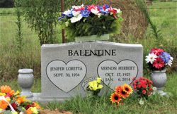
| Description | : | Glendle Gammill March 19, 1945 - October 27, 2007 Mountain View , AR Glendle Gammill, 62, Onia died October 27, 2007 in Mountain View. He was born March 19, 1945 in Timbo to V.O. and Verdia (Goodman) Gammill. He was of the Baptist faith and was a farmer. Survivors include three sisters, Loretta Balentine and husband Herbert of Harrison; Gennetta Wilcox of Mountain View and Geneva Cummings of Onia; one brother, V.J. Gammill and wife Roenea of Onia and a host of relatives and friends. He was preceded in death by his parents; his twin brother, Lendle Gammill. Visitation is 5 - 8 p.m., Monday,... Read More |
frequently asked questions (FAQ):
-
Where is Glendle Gammill's memorial?
Glendle Gammill's memorial is located at: Camperdown Cemetery, Newtown, City of Sydney, Australia.
-
When did Glendle Gammill death?
Glendle Gammill death on 27 Oct 2007 in
-
Where are the coordinates of the Glendle Gammill's memorial?
Latitude: -33.8942220
Longitude: 151.1804900
Family Members:
Parent

Siblings


Nearby Cemetories:
1. Camperdown Cemetery
Newtown, City of Sydney, Australia
Coordinate: -33.8942220, 151.1804900
2. St Luke's Anglican Church
Enmore, Inner West Council, Australia
Coordinate: -33.8989218, 151.1700724
3. St. Peters Cooks River Cemetery
Saint Peters, Inner West Council, Australia
Coordinate: -33.9139390, 151.1775670
4. Devonshire Street Cemetery (Defunct)
Sydney, City of Sydney, Australia
Coordinate: -33.8828080, 151.2066180
5. Pioneers Memorial Park
Leichhardt, Inner West Council, Australia
Coordinate: -33.8780800, 151.1575000
6. St Thomas Becket Churchyard
Lewisham, Inner West Council, Australia
Coordinate: -33.8928760, 151.1480490
7. Balmain Catholic Cemetery (Defunct)
Leichhardt, Inner West Council, Australia
Coordinate: -33.8797270, 151.1523730
8. Old Sydney Burial Ground
Sydney, City of Sydney, Australia
Coordinate: -33.8731750, 151.2063850
9. Parish Church of Saint James
Sydney, City of Sydney, Australia
Coordinate: -33.8693760, 151.2111540
10. Saint Mary's Cathedral
Sydney, City of Sydney, Australia
Coordinate: -33.8708540, 151.2135820
11. St David’s Presbyterian Cemetery
Haberfield, Inner West Council, Australia
Coordinate: -33.8823220, 151.1378500
12. Royal Botanic Gardens
Sydney, City of Sydney, Australia
Coordinate: -33.8647440, 151.2170610
13. St. John's Anglican Church Cemetery
Ashfield, Inner West Council, Australia
Coordinate: -33.8817160, 151.1278730
14. St. Paul's Anglican Church Cemetery
Canterbury, Canterbury-Bankstown Council, Australia
Coordinate: -33.9081600, 151.1236000
15. Botany Wesleyan Cemetery (Defunct)
Botany Bay, Bayside Council, Australia
Coordinate: -33.9421070, 151.1961480
16. Garden Island
Potts Point, City of Sydney, Australia
Coordinate: -33.8613635, 151.2280308
17. Saint Jude's Cemetery
Randwick, Randwick City, Australia
Coordinate: -33.9115460, 151.2417130
18. Holy Trinity Church
Kingsford, Randwick City, Australia
Coordinate: -33.9267060, 151.2321180
19. Mary MacKillop Memorial Chapel
North Sydney, North Sydney Council, Australia
Coordinate: -33.8388250, 151.2049160
20. St Paul's Anglican Church
Burwood, Burwood Municipality, Australia
Coordinate: -33.8816114, 151.1027492
21. St Aidan's Anglican Church
Longueville, Lane Cove Municipality, Australia
Coordinate: -33.8281510, 151.1709560
22. St. Luke's Anglican Church Columbarium
Concord, Canada Bay City, Australia
Coordinate: -33.8678417, 151.1068448
23. Gladesville Asylum Cemetery
Gladesville, Hunter's Hill Municipality, Australia
Coordinate: -33.8393010, 151.1342490
24. Rockdale Uniting Church Cemetery
Rockdale, Bayside Council, Australia
Coordinate: -33.9533350, 151.1381840