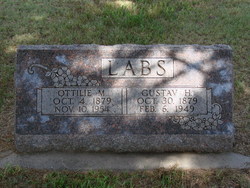
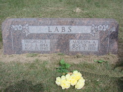
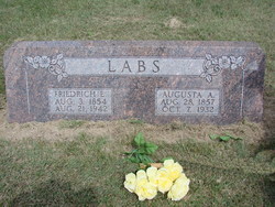
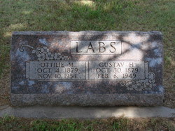
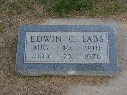
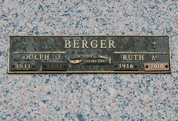
Gustav Herman Carl Labs
| Birth | : | 30 Oct 1879 Johnson County, Nebraska, USA |
| Death | : | 6 Feb 1949 Buffalo County, Nebraska, USA |
| Burial | : | Aramoho Cemetery, Whanganui, Whanganui District, New Zealand |
| Coordinate | : | -39.8926494, 175.0922441 |
| Description | : | Gustav was baptized at St. Peter's Lutheran Church in Johnson County. Both Gustav and Ottilie were confirmed at Immanuel Lutheran Church, rural Amherst, on Palm Sunday, 18 March 1894. They were married 22 Nov 1903 at Immanuel. Witnesses at their marriage were: Carl Labs, Emma Czenkusch, Otto Hemmann, Magdalina Abels, Gottfried Hemmann, Luena Thiede, Emil Buehler, and Anna Labs. Gustav bought his house from Sears & Roebuck, and erected in Grant twp., north of Amherst. In recent years, the house was moved to a location north of Riverdale, Nebraska. |
frequently asked questions (FAQ):
-
Where is Gustav Herman Carl Labs's memorial?
Gustav Herman Carl Labs's memorial is located at: Aramoho Cemetery, Whanganui, Whanganui District, New Zealand.
-
When did Gustav Herman Carl Labs death?
Gustav Herman Carl Labs death on 6 Feb 1949 in Buffalo County, Nebraska, USA
-
Where are the coordinates of the Gustav Herman Carl Labs's memorial?
Latitude: -39.8926494
Longitude: 175.0922441
Family Members:
Parent
Spouse
Siblings
Children
Flowers:
Nearby Cemetories:
1. Aramoho Cemetery
Whanganui, Whanganui District, New Zealand
Coordinate: -39.8926494, 175.0922441
2. St. Mary's Anglican Church Cemetery
Upokongaro, Whanganui District, New Zealand
Coordinate: -39.8656100, 175.1132820
3. Heads Road Cemetery
Whanganui, Whanganui District, New Zealand
Coordinate: -39.9393300, 175.0473400
4. Putiki Urupā
Whanganui District, New Zealand
Coordinate: -39.9466140, 175.0499350
5. Matarawa Presbyterian Cemetery
Whanganui, Whanganui District, New Zealand
Coordinate: -39.9461300, 175.1433100
6. Matarawa Cemetery
Fordell, Whanganui District, New Zealand
Coordinate: -39.9468100, 175.1452700
7. Brunswick Cemetery
Brunswick, Whanganui District, New Zealand
Coordinate: -39.8417750, 175.0216400
8. Papanui Urupā
Kai Iwi, Whanganui District, New Zealand
Coordinate: -39.8435190, 174.9216230
9. Kauangaroa Pa Cemetery
Kauangaroa, Whanganui District, New Zealand
Coordinate: -39.9231800, 175.2788000
10. Ratana Cemetery
Ratana, Rangitikei District, New Zealand
Coordinate: -40.0311470, 175.1771200
11. Turakina Cemetery
Turakina, Rangitikei District, New Zealand
Coordinate: -40.0461300, 175.2140160
12. Turakina Catholic Cemetery
Turakina, Rangitikei District, New Zealand
Coordinate: -40.0453000, 175.2239600
13. Te Mangungu Churchyard
Turakina, Rangitikei District, New Zealand
Coordinate: -40.0633110, 175.1818200
14. Maxwell Cemetery
Whanganui, Whanganui District, New Zealand
Coordinate: -39.8224020, 174.8530960
15. Grant Family Makirikiri Cemetery
Turakina, Rangitikei District, New Zealand
Coordinate: -40.0625400, 175.2258200
16. Pakaraka Māori Cemetery
Maxwell, Whanganui District, New Zealand
Coordinate: -39.8226300, 174.8460700
17. Marshall Family Cemetery
Matahiwi, Whanganui District, New Zealand
Coordinate: -39.6757200, 175.1595964
18. Bonny Glen Cemetery
Marton, Rangitikei District, New Zealand
Coordinate: -40.0496200, 175.3410200
19. Upper Tutaenui Cemetery
Marton, Rangitikei District, New Zealand
Coordinate: -40.0086900, 175.4093900
20. Marton Lutheran Cemetery Tutaenui
Marton, Rangitikei District, New Zealand
Coordinate: -40.0772400, 175.3692700
21. St Stephens Anglican Cemetery
Marton, Rangitikei District, New Zealand
Coordinate: -40.0618230, 175.4258020
22. Mount View Cemetery
Marton, Rangitikei District, New Zealand
Coordinate: -40.0631570, 175.4252250
23. St John's Anglican Church Cemetery
Marton, Rangitikei District, New Zealand
Coordinate: -40.0298860, 175.4759430
24. Jerusalem - Hiruhārama Urupā
Jerusalem, Whanganui District, New Zealand
Coordinate: -39.5521740, 175.0788340

