
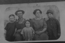
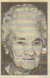
Hal Edward Arnold
| Birth | : | 9 Aug 1881 Warren County, Iowa, USA |
| Death | : | 12 Jul 1957 Osceola, Clarke County, Iowa, USA |
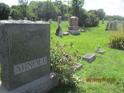
| Burial | : | Bacup Cemetery, Bacup, Rossendale Borough, England |
| Coordinate | : | 53.6906780, -2.2156640 |
| Plot | : | Row 04, Headstone 06 |
| Inscription | : | ARNOLD Hal Edward 1881 - 1957 |
| Description | : | Osceola Sentinel, Osceola, Iowa June 27, 1957, Page 12 Lucas County Line The sympathy of this neighborhood is extended to the families, friends and relatives of Hal Arnold and Ore Mason who passed away recently. Both men were former residents of this community. |
frequently asked questions (FAQ):
-
Where is Hal Edward Arnold's memorial?
Hal Edward Arnold's memorial is located at: Bacup Cemetery, Bacup, Rossendale Borough, England.
-
When did Hal Edward Arnold death?
Hal Edward Arnold death on 12 Jul 1957 in Osceola, Clarke County, Iowa, USA
-
Where are the coordinates of the Hal Edward Arnold's memorial?
Latitude: 53.6906780
Longitude: -2.2156640
Family Members:
Parent
Spouse
Siblings

Children

Flowers:


Nearby Cemetories:
1. Mount Pleasant Wesleyan Chapelyard
Bacup, Rossendale Borough, England
Coordinate: 53.6924900, -2.2228100
2. St John the Evangelist Churchyard
Bacup, Rossendale Borough, England
Coordinate: 53.7037300, -2.2019600
3. Ebenezer Particular Baptist Chapel Chapelyard
Bacup, Rossendale Borough, England
Coordinate: 53.7045700, -2.1997500
4. Newchurch Methodist Churchyard
Newchurch, Rossendale Borough, England
Coordinate: 53.6983460, -2.2501260
5. St. Nicholas Churchyard
Newchurch, Rossendale Borough, England
Coordinate: 53.6972220, -2.2524660
6. Bethlehem Chapel Graveyard
Newchurch, Rossendale Borough, England
Coordinate: 53.6976970, -2.2522620
7. Saint Anne's Churchyard Edgeside
Waterfoot, Rossendale Borough, England
Coordinate: 53.7031600, -2.2482700
8. Saint Michael on the Hill Churchyard
Lumb, Rossendale Borough, England
Coordinate: 53.7201000, -2.2479300
9. Lumb Baptist Church Cemetery
Waterfoot, Rossendale Borough, England
Coordinate: 53.7229340, -2.2455170
10. Whitworth Cemetery
Whitworth, Rossendale Borough, England
Coordinate: 53.6671650, -2.1674750
11. Friends Burial Ground
Rossendale, Rossendale Borough, England
Coordinate: 53.7091000, -2.2757160
12. Unitarian Chapel Burial Ground
Rossendale, Rossendale Borough, England
Coordinate: 53.7024380, -2.2856290
13. Longholme Methodist Cemetery
Rawtenstall, Rossendale Borough, England
Coordinate: 53.7009730, -2.2865000
14. Rawtenstall Cemetery
Rawtenstall, Rossendale Borough, England
Coordinate: 53.7060200, -2.2847500
15. St Bartholomew Churchyard
Whitworth, Rossendale Borough, England
Coordinate: 53.6553000, -2.1709700
16. Cloughfoot Independent Congregational Chapelyard
Todmorden, Metropolitan Borough of Calderdale, England
Coordinate: 53.7113850, -2.1379180
17. Broadleys Garden
Rawtenstall, Rossendale Borough, England
Coordinate: 53.7176321, -2.2904764
18. Burnley Road Cemetery, Reedsholme, Rossendale
Rossendale Borough, England
Coordinate: 53.7178398, -2.2904316
19. Crawshawbooth Quaker Burial Ground
Crawshawbooth, Rossendale Borough, England
Coordinate: 53.7242420, -2.2879400
20. Edenfield Parish Churchyard
Ramsbottom, Metropolitan Borough of Bury, England
Coordinate: 53.6742799, -2.3069304
21. St. Mary and All Saints Churchyard
Goodshaw, Rossendale Borough, England
Coordinate: 53.7315270, -2.2828940
22. Goodshaw Particular Baptist Chapel Graveyard
Goodshaw, Rossendale Borough, England
Coordinate: 53.7328210, -2.2815530
23. Christ Church Churchyard
Healey, Metropolitan Borough of Rochdale, England
Coordinate: 53.6378630, -2.1741198
24. Mount Zion Methodist Chapleyard
Cornholme, Metropolitan Borough of Calderdale, England
Coordinate: 53.7331400, -2.1457800