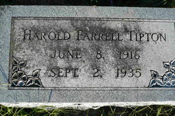
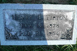
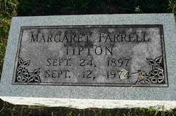
Harold Farrell Tipton
| Birth | : | 8 Jun 1916 Lancaster, Schuyler County, Missouri, USA |
| Death | : | 2 Sep 1935 Sargent, Custer County, Nebraska, USA |
| Burial | : | St. Martin's Churchyard, Kingsbury Episcopi, South Somerset District, England |
| Coordinate | : | 50.9863950, -2.8043130 |
| Description | : | From the Palmer (Nebraska) Journal, September 12, 1935, page 1, transcribed by Linda Berney: Former Palmer Boy Dies at Sargent: Harold Tipton, son of Mr. and Mrs. Henry E. Tipton who reside at the Doris Lake power plant near Sargent died Sunday, September 1, at Sargent. He had been ill about a week with what was called a strepticoccic sore throat. The Tipton's were Palmer residents some years ago at which time Mr. Tipton had charge of the Village Power plant. Harold was born at Lancaster Mo., but most of his life was spent at Palmer and Doris Lake. ... Read More |
frequently asked questions (FAQ):
-
Where is Harold Farrell Tipton's memorial?
Harold Farrell Tipton's memorial is located at: St. Martin's Churchyard, Kingsbury Episcopi, South Somerset District, England.
-
When did Harold Farrell Tipton death?
Harold Farrell Tipton death on 2 Sep 1935 in Sargent, Custer County, Nebraska, USA
-
Where are the coordinates of the Harold Farrell Tipton's memorial?
Latitude: 50.9863950
Longitude: -2.8043130
Family Members:
Parent
Flowers:
Nearby Cemetories:
1. St. Martin's Churchyard
Kingsbury Episcopi, South Somerset District, England
Coordinate: 50.9863950, -2.8043130
2. St James Churchyard
Kingsbury Episcopi, South Somerset District, England
Coordinate: 50.9646420, -2.8106370
3. All Saints Churchyard
Martock, South Somerset District, England
Coordinate: 50.9692420, -2.7687860
4. Christ Church Cemetery
Long Load, South Somerset District, England
Coordinate: 51.0054700, -2.7639100
5. Ash Parish Cemetery
Ash, South Somerset District, England
Coordinate: 50.9833540, -2.7538380
6. United Reform Churchyard
Martock, South Somerset District, England
Coordinate: 50.9609320, -2.7735020
7. Holy Trinity Churchyard
Ash, South Somerset District, England
Coordinate: 50.9834250, -2.7528400
8. St. Peter and St. Paul's Churchyard
Muchelney, South Somerset District, England
Coordinate: 51.0207389, -2.8154595
9. St. James the Less Churchyard
Hambridge, South Somerset District, England
Coordinate: 50.9849380, -2.8669180
10. St. Catherine's Churchyard
Drayton, South Somerset District, England
Coordinate: 51.0191860, -2.8494960
11. Holy Trinity Churchyard
Long Sutton, South Somerset District, England
Coordinate: 51.0246110, -2.7577940
12. St Mary the Virgin Churchyard
Barrington, South Somerset District, England
Coordinate: 50.9591210, -2.8713310
13. Blessed Virgin Mary Churchyard
Huish Episcopi, South Somerset District, England
Coordinate: 51.0362250, -2.8182410
14. Long Sutton Friends Burial Ground
Long Sutton, South Somerset District, England
Coordinate: 51.0302700, -2.7612300
15. All Saints Churchyard
Langport, South Somerset District, England
Coordinate: 51.0369970, -2.8254530
16. Church of St. Mary the Virgin
Norton-sub-Hamdon, South Somerset District, England
Coordinate: 50.9404356, -2.7550615
17. St. Andrew's Churchyard
Curry Rivel, South Somerset District, England
Coordinate: 51.0246570, -2.8687410
18. Curry Rivel Cemetery
Curry Rivel, South Somerset District, England
Coordinate: 51.0257667, -2.8676226
19. Langport Cemetery
Langport, South Somerset District, England
Coordinate: 51.0426200, -2.8244600
20. St. Andrew's Churchyard
Puckington, South Somerset District, England
Coordinate: 50.9606190, -2.8884930
21. All Saints Churchyard
Lopen, South Somerset District, England
Coordinate: 50.9270850, -2.8164620
22. All Saints Churchyard
Isle Brewers, South Somerset District, England
Coordinate: 50.9854450, -2.9000040
23. St. Peter and St. Paul's Churchyard
Chiselborough, South Somerset District, England
Coordinate: 50.9308340, -2.7589220
24. St. Catherine's Churchyard
Fivehead, South Somerset District, England
Coordinate: 51.0083009, -2.9000973


