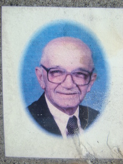
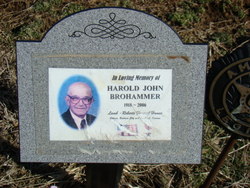
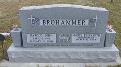
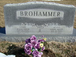
Harold J. Brohammer
| Birth | : | 7 Apr 1918 Douglas County, Kansas, USA |
| Death | : | 19 Jan 2006 Baldwin City, Douglas County, Kansas, USA |
| Burial | : | Crowland Abbey, Crowland, South Holland District, England |
| Coordinate | : | 52.6763800, -0.1654240 |
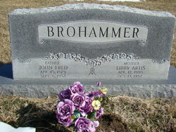
| Description | : | S/O John Fredrick and L. Artis (Metsker) Brohammer. He grew up and attended grade school in rural Willow Springs. He worked for his father from 1933-40. He planted, cultivated and harvested wheat, oats and small grains, raised cattle, hogs and poultry for market and home. He served our country during WWII. He entered into active duty Dec. 23, 1940. He attained the rank of Tech. Sgt. in the 137th Infantry, 35th Division of the US Army. He was Platoon Sergeant of the of a heavy mortar crew in France, Luxemborg, Belgium and Germany. He received the Bronze Star Medal, Good... Read More |
frequently asked questions (FAQ):
-
Where is Harold J. Brohammer's memorial?
Harold J. Brohammer's memorial is located at: Crowland Abbey, Crowland, South Holland District, England.
-
When did Harold J. Brohammer death?
Harold J. Brohammer death on 19 Jan 2006 in Baldwin City, Douglas County, Kansas, USA
-
Where are the coordinates of the Harold J. Brohammer's memorial?
Latitude: 52.6763800
Longitude: -0.1654240
Family Members:
Parent
Spouse
Siblings
Children
Flowers:
Nearby Cemetories:
1. Crowland Abbey
Crowland, South Holland District, England
Coordinate: 52.6763800, -0.1654240
2. St Bartholomew Churchyard
Newborough, Peterborough Unitary Authority, England
Coordinate: 52.6385360, -0.2223780
3. Thorney Abbey
Thorney, Peterborough Unitary Authority, England
Coordinate: 52.6204590, -0.1072060
4. St. Mary and St. Botolph Churchyard
Thorney, Peterborough Unitary Authority, England
Coordinate: 52.6204260, -0.1069770
5. Eye Cemetery
Eye, Peterborough Unitary Authority, England
Coordinate: 52.6110938, -0.1859580
6. Saint Matthew's Churchyard
Eye, Peterborough Unitary Authority, England
Coordinate: 52.6094813, -0.1866602
7. Thorney Cemetery
Thorney, Peterborough Unitary Authority, England
Coordinate: 52.6163700, -0.1044200
8. Saint Pegas Churchyard
Peakirk, Peterborough Unitary Authority, England
Coordinate: 52.6454940, -0.2744530
9. St. James Churchyard
Deeping St James, South Kesteven District, England
Coordinate: 52.6716980, -0.2896360
10. St. James Cemetery
Deeping St James, South Kesteven District, England
Coordinate: 52.6716340, -0.2899500
11. St. John the Baptist Churchyard
Whaplode Drove, South Holland District, England
Coordinate: 52.7034435, -0.0476688
12. St. Andrew's Churchyard
Northborough, Peterborough Unitary Authority, England
Coordinate: 52.6571000, -0.2974630
13. Saint Benedict Churchyard
Glinton, Peterborough Unitary Authority, England
Coordinate: 52.6392160, -0.2959420
14. Glinton Cemetery
Glinton, Peterborough Unitary Authority, England
Coordinate: 52.6374399, -0.2947420
15. Holy Trinity Churchyard
Gedney Hill, South Holland District, England
Coordinate: 52.6826080, -0.0211840
16. All Saints Churchyard
Paston, Peterborough Unitary Authority, England
Coordinate: 52.6053690, -0.2576130
17. Saint John the Baptist Churchyard
Werrington, Peterborough Unitary Authority, England
Coordinate: 52.6134500, -0.2734500
18. St Medard and St Gildard Churchyard
Little Bytham, South Kesteven District, England
Coordinate: 52.6786110, -0.3200000
19. Eastfield Cemetery
Peterborough, Peterborough Unitary Authority, England
Coordinate: 52.5890690, -0.2225360
20. Peterborough Crematorium
Bretton, Peterborough Unitary Authority, England
Coordinate: 52.6047280, -0.2915090
21. Broadway Cemetery
Peterborough, Peterborough Unitary Authority, England
Coordinate: 52.5796750, -0.2350260
22. St Michael and All Angels Churchyard
Langtoft, South Kesteven District, England
Coordinate: 52.6990300, -0.3389800
23. St. Peter's Churchyard
Maxey, Peterborough Unitary Authority, England
Coordinate: 52.6575500, -0.3455940
24. Peterborough Cathedral
Peterborough, Peterborough Unitary Authority, England
Coordinate: 52.5725280, -0.2392390

